
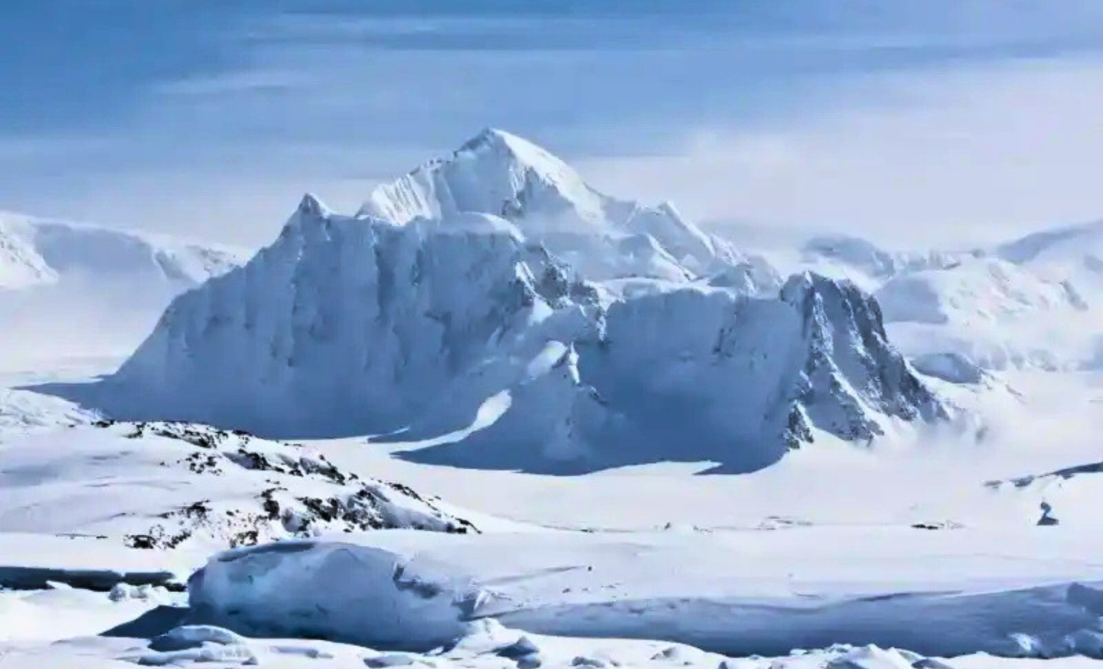
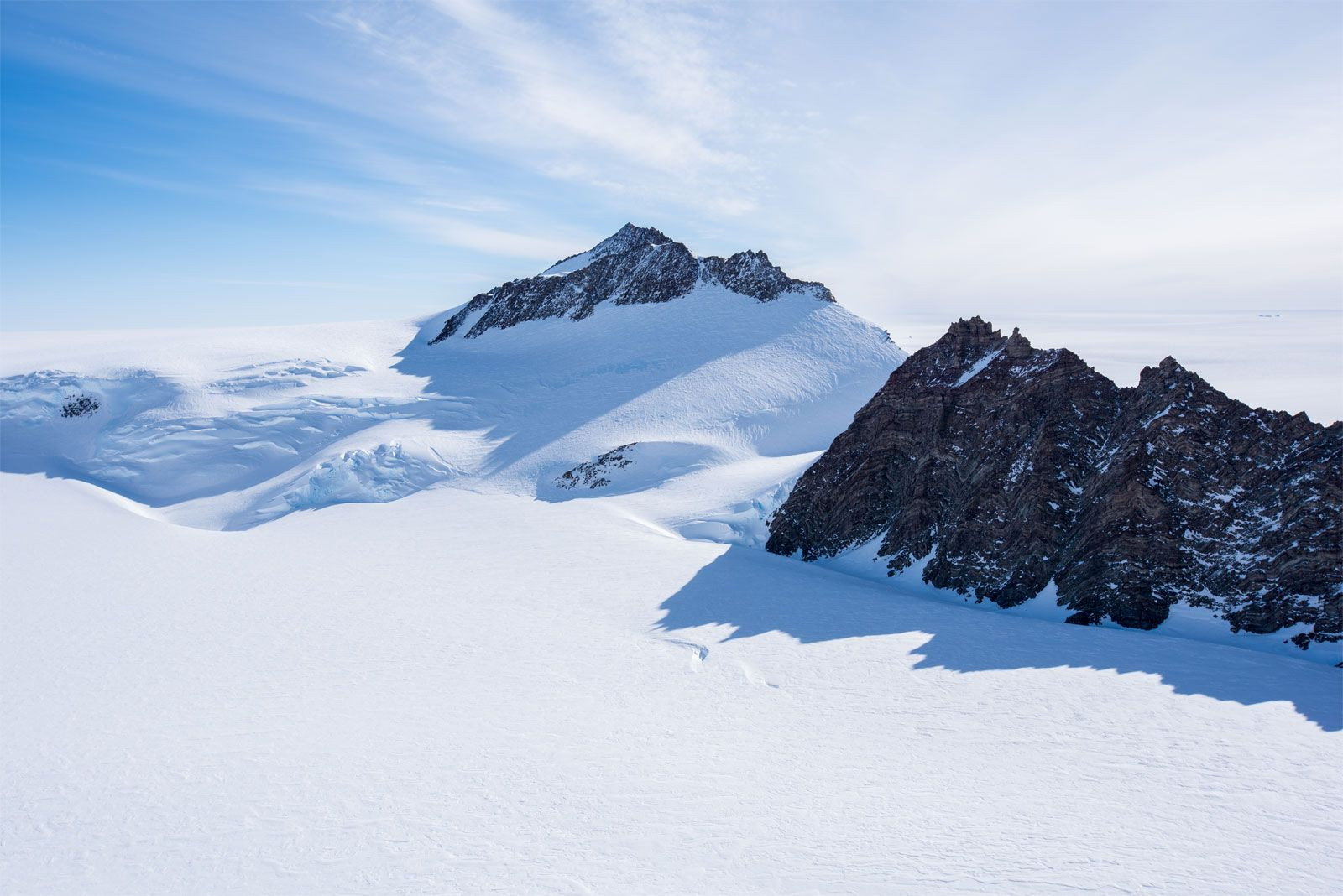
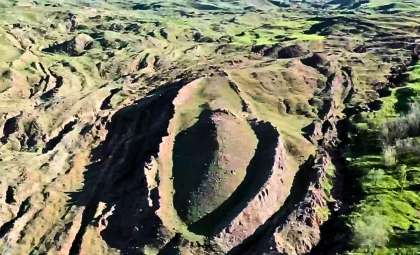
Located within Antarctica’s southern Ellsworth Mountains, this distinctive peak boasts a near-perfect pyramid shape, featuring four steep faces and a summit rising approximately 4,150 feet above the icy terrain. According to coordinates shared by Live Science, the formation sits at -79.9774614356392, -81.95892707235716 deep inside West Antarctica.
When discovered online in 2016, the mountain's sharp, geometric contour led to widespread speculation linking it to extraterrestrials, lost ancient civilizations, and hidden ice-encased ruins. While its striking pyramid resemblance is undeniable, no conclusive evidence supports these extraordinary claims.
Geologists explain the peak’s form as the result of natural processes. Experts cited by Live Science suggest that this Antarctic pyramid is a product of erosion, particularly from freezing and thawing cycles that crack and fracture rock. These forces sculpt the mountain’s steep faces without any hint of intentional construction.

Natural Forces Behind the Pyramid-Like Appearance
This peak gained attention because its symmetry and compact, sharply defined sides stand out in satellite imagery, compared to the more irregular forms of typical mountains. Its appearance evokes the monumentality of a man-made pyramid.
Mauri Pelto, environmental science professor at Nichols College, explained to Live Science that freeze-thaw erosion over hundreds of millions of years is likely responsible. Water seeping into cracks freezes, expands, and gradually breaks the rock apart.
Repeated freeze-thaw cycles enlarge these fractures, dislodge rock fragments, and sharpen the mountain’s faces. Pelto highlights that three sides of the peak seem to have eroded at comparable rates, while the eastern ridge evolved separately, accounting for the mountain’s balanced yet naturally formed shape.
Experts Agree: It’s a Natural Mountain, Not an Engineered Monument
Eric Rignot, also interviewed by Live Science, succinctly stated the formation is "simply a mountain that resembles a pyramid." While peaks with four pyramid-like faces are uncommon, their rarity does not imply human hands shaped them.
The specialists acknowledge the mountain’s unusual aesthetic but emphasize its formation arises from understandable geological phenomena. Rock fractures along natural weaknesses, ice erodes loose debris, and falling rock steepens slopes. When erosion affects several faces similarly, the result can appear artificially symmetrical.
This viral image demonstrates how a sharp outline can misleadingly suggest human craftsmanship, especially in an isolated, snow-covered location. However, Pelto’s scientific explanation clarifies the phenomenon without resorting to speculation.
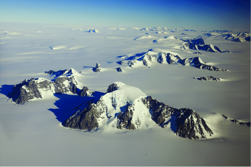
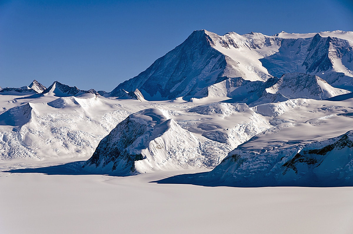
Extensive Mapping of the Ellsworth Mountains Dates Back Decades
The mountain belongs to the well-studied Ellsworth Mountains within West Antarctica. A U.S. Geological Survey study locates this range around 79° south and 85° west, dividing it into the Sentinel Range north of the Minnesota Glacier and the Heritage Range to the south.
American aviator Lincoln Ellsworth first spotted the mountains on November 23, 1935, during a trans-Antarctic flight from Dundee Island toward the Ross Ice Shelf. Initially, only part of the Sentinel Range was visible, and subsequently several features received names, including Mount Lymburner, Polarstar Peak, Mount Ulmer, and Mount Wyatt Earp.
Later aerial photography and field surveys, carried out by the U.S. Navy Squadron VX-6 in 1959 and 1962, employed trimetrogon imaging to map the terrain from multiple angles. These efforts were instrumental in producing detailed topographical maps of both the Sentinel and Heritage Ranges.
This comprehensive exploration history dispels notions of an undiscovered or uncharted territory. Though remote, the area is well-documented geologically and cartographically.
Rugged Peaks Naturally Define This Antarctic Landscape
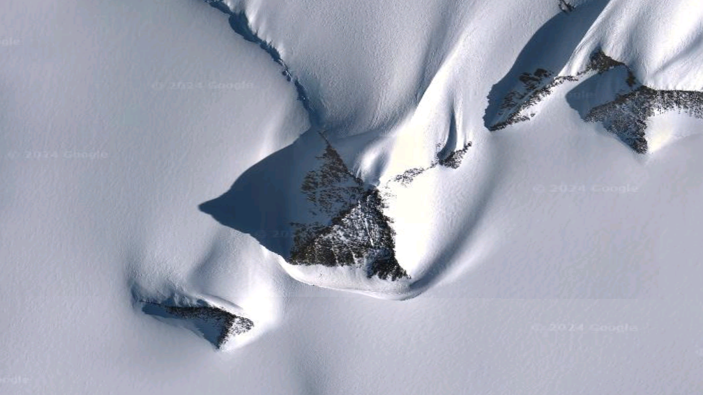
The same USGS report portrays the Sentinel Range as characterized by harsh, angular mountains, including Antarctica’s tallest, the Vinson Massif. Glacial sculpting and resilient quartzite bedrock have created pronounced arêtes, horns, cirques, and tors throughout the region.
These geological features paint a vivid picture: arêtes form sharp ridges, horns are pointed summits, cirques represent bowl-shaped depressions carved by glaciers, and tors are exposed rocky outcrops. Together, they demonstrate how natural forces shape dramatic Antarctic mountain landforms.
Live Science also highlights the region’s significance for containing fossils dating back 500 million years, such as trilobites from the Cambrian period. If there’s an ancient narrative here, it’s embedded in fossilized marine life and rock layers far predating any human history.
A USGS Professional Paper on Early and Middle Cambrian trilobites from Antarctica records fossil finds at Mount Spann in the Argentina Range, as well as in the Neptune Range and Harold Byrd Mountains.
According to this report, trilobite beds were first identified within the Heritage Range during the 1963–1964 field season, showcasing Antarctica’s unmatched preservation of ancient ecological and geological records rather than foundations of an unknown civilization.
- Categories:
- Science


0 comments
Sign in to Comment