
Muon Space is launching a groundbreaking satellite program designed to transform how wildfires are tracked internationally. The deployment of the FireSat Protoflight satellite heralds the beginning of a constellation that will capture a full Earth scan every 20 minutes. This innovative network aims to facilitate early wildfire detection and deliver critical information to emergency responders, policymakers, and communities at risk. For an in-depth look at this technology, Muon Space’s official press release highlights ongoing developments and future objectives in wildfire surveillance.
Transforming How Wildfires Are Detected
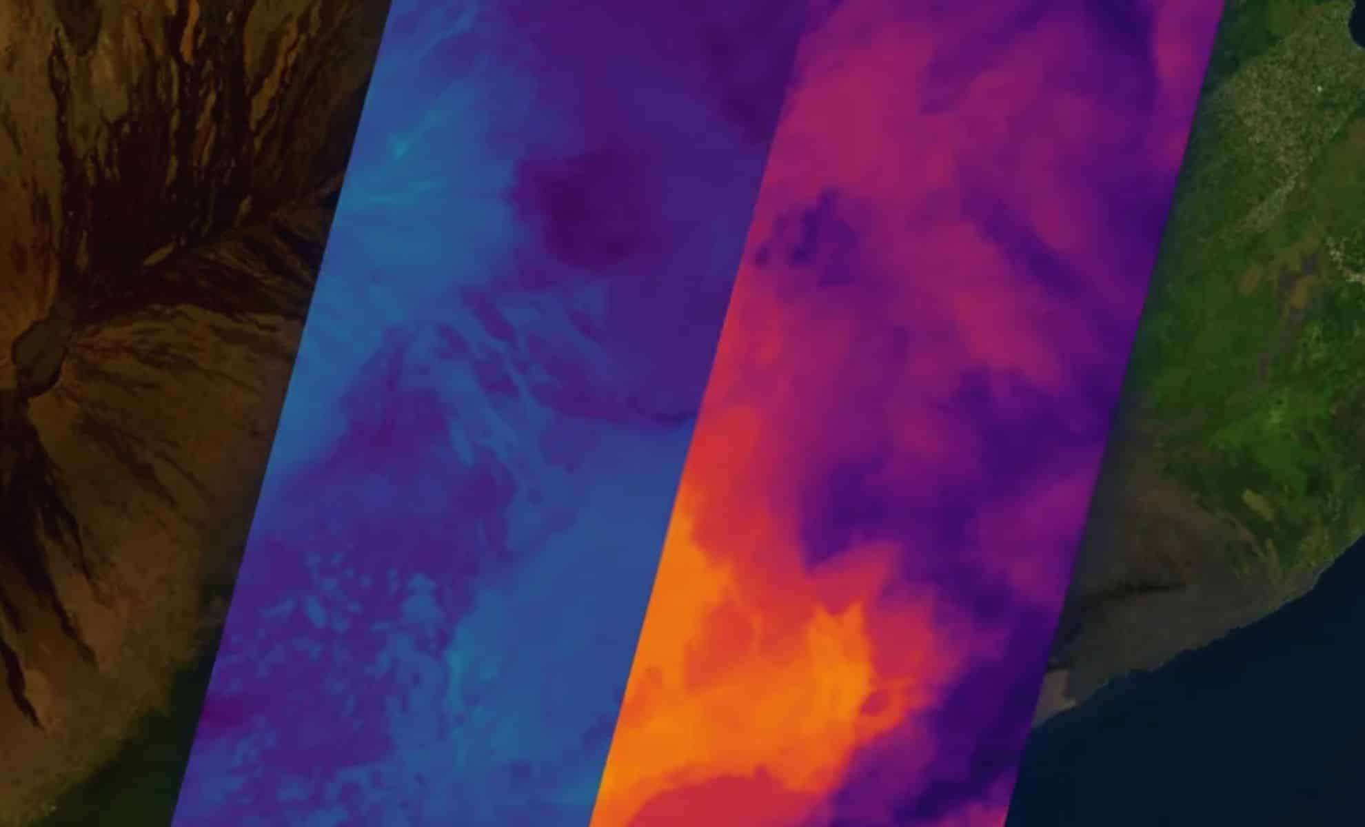
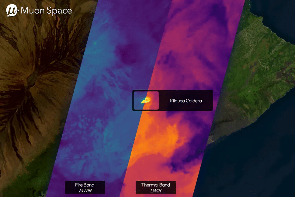
At the heart of this project, the FireSat satellite employs state-of-the-art infrared sensors that identify heat indicators linked to wildfires. Situated in low-Earth orbit, the satellite utilizes a multi-spectrum infrared device capable of scanning from visible light through long-wave IR wavelengths. This advanced detection technique captures lower-temperature heat sources more accurately than many conventional methods.
What sets this technology apart is its capacity for swift wildfire detection. Scanning the globe every 20 minutes, FireSat continuously provides up-to-date data to concerned parties. “These first light images confirm that our IR sensors are operating as designed and collecting high-quality data,” said Dan McCleese, Chief Scientist of Muon Space in a statement. “Infrared imaging with this quality is one of the most technically demanding domains in remote sensing, and we’re proud to be among the few commercial players advancing this capability in orbit.”

This satellite system will enable near-immediate wildfire identification, aiding in safeguarding lives and property worldwide.
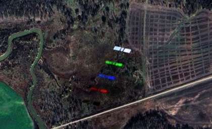
FireSat Protoflight: A Promising Debut
The March 14, 2025 launch of the FireSat Protoflight on SpaceX’s Transporter 13 mission marked a key milestone for the project. Its initial thermal images, covering diverse zones from Sydney’s urban regions to Hawaii’s volcanic terrain, validated the satellite’s ability to capture sharp thermal data in varying environments. With a scanning width of 932 miles (1,500 km), FireSat can detect fires as small as 15 feet (5 meters), setting a new standard in wildfire detection precision.
The successful launch and operation of the FireSat Protoflight highlight the potential of the planned constellation—not simply a technological feat but a significant step forward in delivering actionable wildfire data that can mitigate damage and save lives.
Building a Comprehensive Global Network for 2030
Muon Space intends to expand its fleet to over 50 satellites by 2030, with each unit capable of scanning Earth every 20 minutes. This rapid coverage will particularly benefit high-risk wildfire regions by detecting outbreaks in near real-time. Positioned in low-Earth orbit, these satellites will utilize sophisticated sensors to supply vital information to emergency personnel and government bodies. This ambitious system represents a leap forward not just in wildfire spotting but also as a vital resource addressing the growing global demand for reliable, real-time fire monitoring.
Jonny Dyer, CEO of Muon Space, stated, “The FireSat first light images demonstrate Muon’s approach to building mission-optimized satellites including purpose-built instruments.” Such innovative design strategies may prove crucial in combating wildfire threats, especially where firefighting resources are limited or stretched thin.
- Categories:
- News


0 comments
Sign in to Comment