
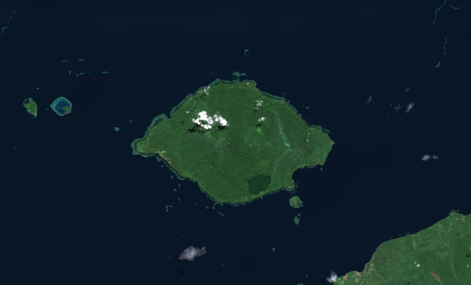
A submarine volcano located in the Bismarck Sea may soon give rise to a brand-new island. Satellite data collected since early May reveals a persistent volcanic eruption ascending closer to the ocean surface.
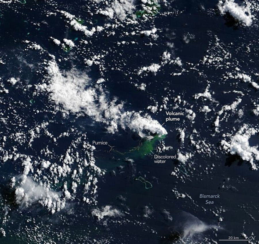
The initial indication of this eruption came after a series of earthquakes shook the central Bismarck Sea region, situated just north of Papua New Guinea. Multiple satellites have since been monitoring the eruption, capturing phenomena such as towering steam clouds, drifting pumice rafts, and significant thermal hotspots.
While this event excites scientists, it also challenges them due to the area's lack of detailed seafloor mapping. Despite this, the ongoing satellite observations are providing valuable insights into the underwater volcanic activity.

Tracking an Isolated Volcanic Event in the Ocean
The earliest clues appeared on May 8, when seismographs registered a cluster of earthquakes beneath the Bismarck Sea. According to NASA, subsequent satellite images confirmed that an underwater volcanic eruption was in progress.
This discovery highlights the limited knowledge about this section of the ocean floor. The area lacks comprehensive seafloor maps, complicating efforts to pinpoint the exact volcanic source. The geology is complex, marked by faults, volcanic ridges, rifts, scarps, and active tectonic boundaries.
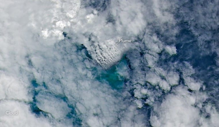
Current data suggests the activity is occurring at Titan Ridge, where two submarine tectonic plates intersect. Nevertheless, researchers have yet to determine which vent is erupting, its pre-eruption depth, or its eruption history.
Satellite Data Shows the Volcano Rising
Satellites have documented that the eruption is drawing nearer to the surface over time. On May 9, NASA’s Aqua and Terra satellites detected large white steam columns emerging from the ocean. Other satellites observed these plumes extending several kilometers into the sky, while NASA’s PACE satellite noted discolored water around the vent.
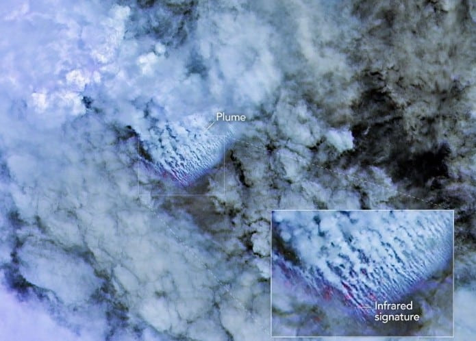
By May 10 and 11, sharper views from ESA’s Sentinel-2 and NASA/USGS Landsat 9 satellites indicated volcanic activity close to the ocean surface. A crucial signal emerged on May 12, as the Suomi NPP satellite identified thermal anomalies spanning roughly 7 square kilometers (2.7 square miles).
Michigan Technological University volcanologist Simon Carn explained that these heat patterns imply a sizable volume of hot volcanic material lies near the surface. He added that the active vent’s current depth appears significantly shallower than previously estimated.
Possibility of a Nascent Island
A particularly notable result from the eruption has been the emergence of extensive pumice rafts drifting across the sea. These lightweight volcanic rocks can remain afloat for extended periods and may travel vast distances carried by ocean currents.
Jim Garvin, the chief scientist at NASA’s Goddard Space Flight Center, noted that scientists are now watching closely to determine if this eruption will create a new island — an occurrence seldom witnessed from beginning to end with modern satellite technology.
Should new land emerge, it might form a tuff cone created when magma interacts explosively with seawater, though this land could also be transient, eroding away or collapsing swiftly.
The eruption’s mild intensity may be tied to its position at the junction of a transform fault and a back-arc spreading center volcanic ridge. As Carn describes:
“Spreading centers are associated with less explosive activity, while the most explosive eruptions are usually along subduction zones and involve large stratovolcanoes.”
The duration of this volcanic activity is uncertain. A 1972 event along the same ridge lasted only four days, whereas another nearby eruption near St. Andrew Strait, about 100 kilometers (62 miles) away, continued for nearly four years beginning in 1957.
“We’re now eagerly waiting to see if a new island is about to be born – something that we’ve only rarely been able to observe with satellites as it happens,” Garvin said.
If land does form, scientists plan to examine how ecosystems establish themselves, observing the arrival of plant and animal life while monitoring environmental factors like rainfall, erosion, and chemical breakdown that shape the island’s development.
- Categories:
- News

0 comments
Sign in to Comment