

Since its arrival on Mars in 2012, NASA’s Curiosity rover has been instrumental in revealing the Red Planet’s geological history. Its latest investigations have uncovered striking evidence of historic flood events that swept across Mount Sharp’s slopes, shedding light on Mars’ wetter and more active past.
Investigating the Gediz Vallis Water Channel
Curiosity has devoted much of 2024 to studying the Gediz Vallis channel, an ancient watercourse carved into the towering Mount Sharp. Data collected by the rover indicate that powerful floods once surged through this region, displacing and depositing numerous rocks and boulders along its path.
Becky Williams, a researcher with the Planetary Science Institute, remarked, “Mars experienced a highly active phase here. We observe evidence of multiple high-energy flood flows and boulder-laden currents traveling down the channel.”

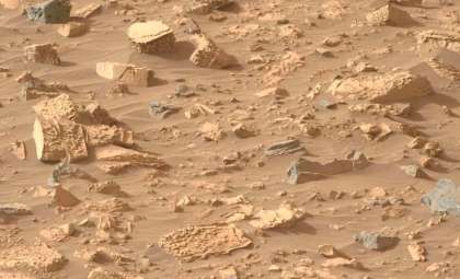
The remarkable geological features within the Gediz Vallis channel, characterized by large rock deposits and debris piles, point to a history marked by intense water movements and sediment transport. NASA highlights that these floodwaters sculpted hills and mounds extending nearly two miles downhill, with some formations possibly originating from landslides triggered by these flows.
Examining Water-Altered Rock Formations
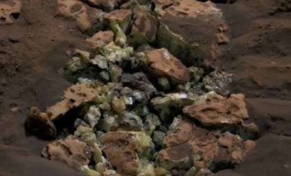
Curiosity’s detailed analysis of rocks situated in the channel revealed distinctive “halo” patterns, which are chemical signatures indicating long-past interactions with liquid water.
NASA elaborates, “Water permeated all the deposited material in this site. Chemical reactions induced by this water created bleached white ‘halo’ effects surrounding some rocks.” These distinct halos serve as vital indicators of an ancient wetter environment on Mars.

The discovery of these chemically modified rocks offers researchers critical insight into how water once interacted with Martian sediments, altering their makeup and revealing Mars’ climatic shifts over geological timescales.
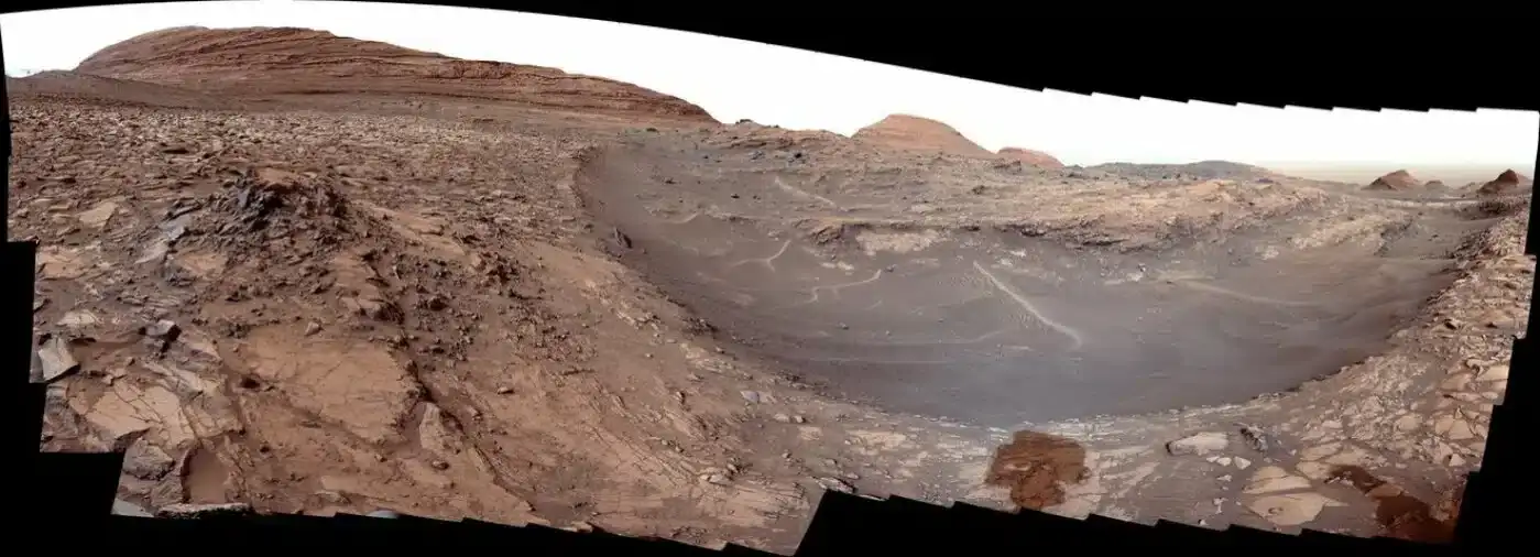
A Panoramic View of Gediz Vallis
On March 31, 2024, Curiosity employed its left Mast Camera to capture a sweeping 180-degree panorama of the Gediz Vallis channel. This composite image, stitched from 176 photos, showcases the geological complexity of this terrain. Notable landmarks include the “Fascination Turret” and “Hinman Col,” mounds that exemplify the natural forces that shaped the channel. The site’s abundance of sulfates, salty minerals, further supports the narrative of a water-rich past.
The panorama’s adjusted lighting mimics human vision on Earth, enhancing feature visibility and assisting scientists in reconstructing Mars’ environmental evolution, especially the impact of water on its landscape formation.
Consequences for Understanding Mars’ Environmental Past
Discoveries in the Gediz Vallis region reinforce the expanding evidence that Mars once harbored conditions suitable for sustained liquid water. Presently, Mars is a cold, barren planet with an atmosphere too thin to maintain surface water, yet these fossilized flood channels reveal a significantly different climate in its deeper past.
Decoding Mars’ climate history is essential for assessing its former habitability. While Curiosity primarily investigates signs of past environmental conditions, its findings complement those of NASA’s Perseverance rover, which searches for direct indicators of ancient microbial life. Although definitive proof of life remains elusive, the flooded channels and chemically altered rocks provide crucial clues toward understanding Mars’ potential to support life.
NASA’s Curiosity rover continues to provide invaluable data on the Red Planet’s evolving environment, with its recent work in the Gediz Vallis channel illuminating Mars as a planet that was once sculpted by water-driven forces and possibly capable of sustaining life.


0 comments
Sign in to Comment