
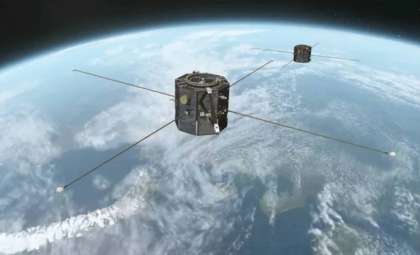
A collaborative satellite initiative between NASA and the European Space Agency (ESA) is set to enhance hurricane prediction by delivering more precise measurements of ocean temperatures and sea surface elevations. Scheduled to launch no earlier than November 16, 2025, the Sentinel-6B satellite will succeed its counterpart, Sentinel-6 Michael Freilich, which took to the skies in 2020. According to the Jet Propulsion Laboratory (JPL), this endeavor builds on years of transatlantic partnership and aims to fill crucial knowledge gaps in how ocean energy fuels powerful tropical cyclones.
Sentinel-6B: Advancing Storm Intensity Forecasting Capabilities
The Sentinel-6/Jason-CS project represents a global alliance involving NASA, ESA, EUMETSAT, and NOAA, supported financially by the European Commission and CNES in France. Serving as the second satellite in this series, Sentinel-6B aims to maintain continuous sea level observations that extend back to 1992. These measurements go beyond tracking climate shifts; they provide vital data for understanding hurricane dynamics, especially the mysterious process of rapid intensification, where wind speeds intensify swiftly within a single day.
Nadya Vinogradova Shiffer, a NASA program scientist, points out, “Sentinel-6 will monitor variations in Earth’s ocean height, heat, and currents globally and will enhance predictions of extreme weather such as floods and hurricanes, helping to connect global trends with the tangible risks faced by communities.” This enriched dataset adds a new layer of precision to hurricane forecasting, enabling meteorologists to better pinpoint areas of heightened danger. The ability to foresee when storms might rapidly strengthen days in advance could revolutionize how emergency responses are planned and executed.

Ocean Heat: The Hidden Fuel Behind Intensifying Hurricanes
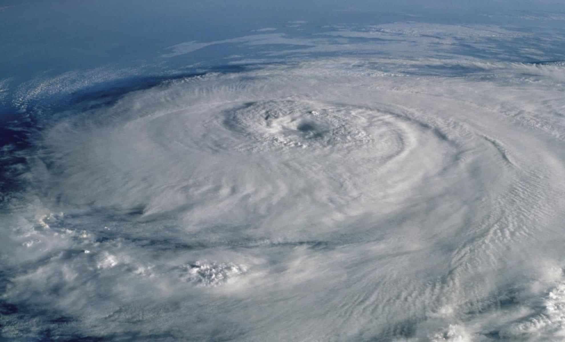
Recent research underscores a key link between subsurface ocean heat and the escalating strength of storms. Hurricanes draw energy from warm ocean waters, and warming that extends deep below the surface provides even more power to fuel explosive growth. Sentinel-6’s advanced instrumentation enhances the detection and measurement of this heat stored in the ocean’s depths.
Josh Willis, the Sentinel-6B project scientist at NASA’s Jet Propulsion Laboratory, explains, “A thick layer of warm water raises sea level more than a thin warm layer does. Thus, measuring sea surface height helps estimate the ocean’s heat content.” This subtle variation—just a few centimeters change in elevation—can uncover vast hidden energy reserves that may trigger rapid cyclone intensification. Unlike conventional instruments limited to surface measurements, satellite-derived sea level data offers a panoramic view of thermal energy distribution and how it affects developing storms.
Harnessing Machine Learning and Satellite Data to Refine Forecasts
The combination of satellite observations with advanced machine learning algorithms is ushering in an era of improved forecast accuracy. The National Hurricane Center integrates Sentinel-6 data into models designed to identify when hurricanes are likely to strengthen rapidly. Although such predictions are challenging, they are invaluable, providing communities crucial extra time to prepare.
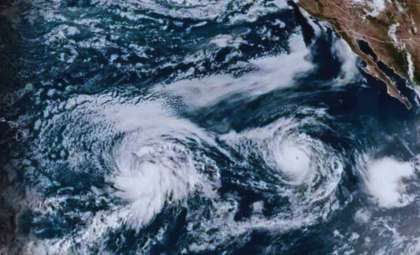
An illustrative case is Hurricane Milton from October 2024, which intensified dramatically from a Category 1 to a Category 5 in under 24 hours, peaking with 180 mph winds before weakening to a Category 3 prior to Florida landfall. Early data from Sentinel-6 Michael Freilich supported warnings about this sudden intensification, confirming the satellite’s operational forecasting impact. Models powered by machine learning and these datasets now better distinguish storms likely to undergo dangerous intensification.
Economic and Human Benefits of Enhanced Hurricane Forecasting
The financial toll and human displacement caused by hurricanes are staggering. Each year, these storms inflict billions of dollars in damages and uproot thousands. Economist Renato Molina from the University of Miami notes that even small gains in forecasting precision translate into substantial cost savings and saved lives. When early warnings are accurate, residents can safeguard belongings, relocate vulnerable individuals, and take lifesaving precautions.
Since the introduction of satellite data into hurricane models in the early 2000s, forecast reliability has advanced markedly. The Sentinel-6 mission not only signifies scientific achievement but also represents a vital element of global disaster preparedness—an orbiting shield of precise instruments monitoring Earth’s seas. Although surface temperature instruments remain indispensable, satellite sea surface height measurements offer unmatched insight into ocean conditions that drive storm activity.
International Cooperation Ensures Ongoing Ocean Monitoring
The Sentinel-6 endeavor also exemplifies decades-long scientific partnership. With efforts spanning continents and lasting over 30 years, the mission embodies the principle that climate and weather phenomena transcend geopolitical boundaries. Data from Sentinel-6B will continue to inform worldwide meteorological and research institutions, contributing to improved hurricane forecasts as well as studies on sea level rise, ocean circulation patterns, and climate change impacts.
Managed by Caltech and based at NASA’s JPL in Pasadena, the team has equipped both Sentinel satellites with cutting-edge technology, including the Advanced Microwave Radiometer, Global Navigation Satellite System – Radio Occultation, and the Laser Retroreflector Array. Maintaining consistency across this sensor suite ensures decades of sea level data remain compatible, allowing historical insights to enhance future storm preparedness.
- Categories:
- News


0 comments
Sign in to Comment