
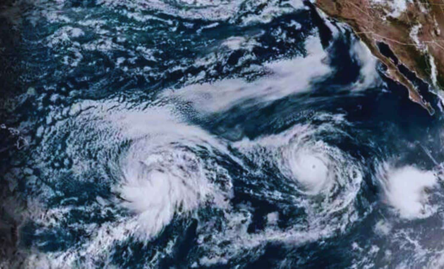
Hawaiian Islands are gearing up for an unusual weather challenge as two tropical systems, Tropical Storm Hone and Hurricane Gilma, approach in rapid succession, threatening severe conditions.
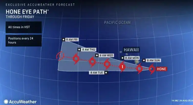
Tropical Storm Hone is forecasted to travel just south of the Big Island by the weekend’s end, while Hurricane Gilma, a formidable Category 3 hurricane, is expected to be near the islands by midweek.
Authorities including the National Weather Service (NWS) have issued advisories alerting residents of intense winds, heavy rainfall, and hazardous surf across various parts of Hawaii.

An Uncommon Dual Threat: Tropical Storm Hone and Hurricane Gilma
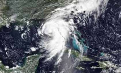
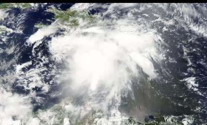
Although Hawaii occasionally encounters tropical storms, experiencing two severe storms so closely timed is quite rare. Tropical Storm Hone, positioned roughly 620 miles east-southeast of Hilo on Friday, is predicted to gain strength moving west, carrying sustained winds around 46 mph.
The NWS has put out a tropical storm warning for surrounding waters, issued a tropical storm watch for the Big Island, and announced a small craft advisory for the other islands. Hone may intensify into a hurricane by late Sunday or Monday as it passes south of Kauai and Oahu.
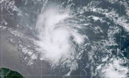
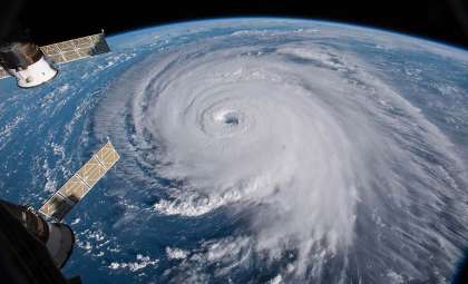
Meanwhile, Hurricane Gilma, currently a strong Category 3 hurricane with sustained winds reaching 120 mph, churns in the Pacific Ocean. Gilma is situated over 1,000 miles east of Hilo and more than 1,000 miles west-southwest of southern Baja California.
Gilma was designated a major hurricane on Thursday but is anticipated to weaken somewhat as it nears Hawaii midweek. The trajectory and strength of Gilma remain uncertain, warranting continuous observation by weather experts.
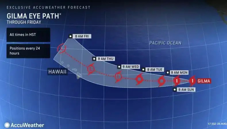
As explained by AccuWeather Lead Hurricane Specialist Alex DaSilva, “Wind intensities will largely depend on the storm’s exact path. Gusts between 40-60 mph are likely mostly over the southern islands, with gusts as strong as 60-80 mph possible on the far southern Big Island.”
Hawaii Takes Precautions Ahead of Approaching Storms
The back-to-back nature of Hone and Gilma creates a complex meteorological scenario for Hawaii. Dual storm threats so close together are rare; the last instance was in 1992 during the aftermath of Hurricane Iniki followed by Tropical Depression Orlene. Officials strongly encourage both residents and tourists to stay alert and prepare for challenging weather.
The NWS warns that Hone’s powerful winds might damage structures like porches, sheds, and carports, break large branches, and cause scattered power outages. Heavy rain is forecast, with the Big Island’s windward slopes possibly receiving between 8 and 16 inches, raising localized flood concerns.
Although storm surge flooding doesn’t appear to be a major risk at present, the combined effects of strong winds, heavy precipitation, and turbulent seas could complicate travel and disrupt daily life. The NWS also cautions that debris may block roadways, hindering emergency services.
Monitoring an Intense Hurricane Season
The current Pacific Hurricane Season has been notably busy, with seven named systems to date. Hone and Gilma are part of this elevated storm activity, contrasting with the Atlantic Hurricane Season, which typically impacts the U.S. mainland more frequently. Meteorologists urge ongoing vigilance as the storms develop.
The National Hurricane Center (NHC) advises, “People in Hawaii should monitor this weather system closely, but it remains too early to predict the exact locations or intensities of possible effects.” Residents are urged to safeguard their homes and ensure adequate emergency supplies, since both storms might bring extended periods of hazardous surf and rough ocean conditions.
With continued Pacific hurricane activity, Hawaii’s population is reminded to prioritize preparedness. Even as Gilma may weaken before its nearest approach and Hone is expected to pass just south as a hurricane, the upcoming days will undoubtedly test local resilience and emergency readiness.
- Categories:
- News ,
- Climate change


0 comments
Sign in to Comment