
Researchers have achieved a groundbreaking milestone in ocean exploration by developing one of the most comprehensive maps of the seabed ever created. Utilizing detailed measurements from the SWOT satellite, they uncovered close to 100,000 underwater mountain formations known as seamounts that lie hidden beneath the ocean's surface.
How the SWOT Satellite Transforms Ocean Floor Mapping
Mapping the ocean depths has long trailed behind efforts to chart other planetary surfaces, such as the Moon. To date, only approximately one-quarter of the seafloor has been directly surveyed using sonar technology from research vessels.
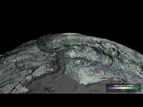
The SWOT (Surface Water and Ocean Topography) satellite, a joint initiative by NASA and the French space agency CNES, has significantly enhanced our ability to study ocean topography. Equipped with highly sensitive instruments, SWOT detects minute variations in sea surface height that reveal underwater geological structures.

These subtle changes, influenced by features like seamounts and abyssal hills, result from the gravitational effects of these formations. SWOT's exceptional precision enables scientists to discover previously uncharted seafloor characteristics.
Revealing the Ocean’s Concealed Mountain Ranges
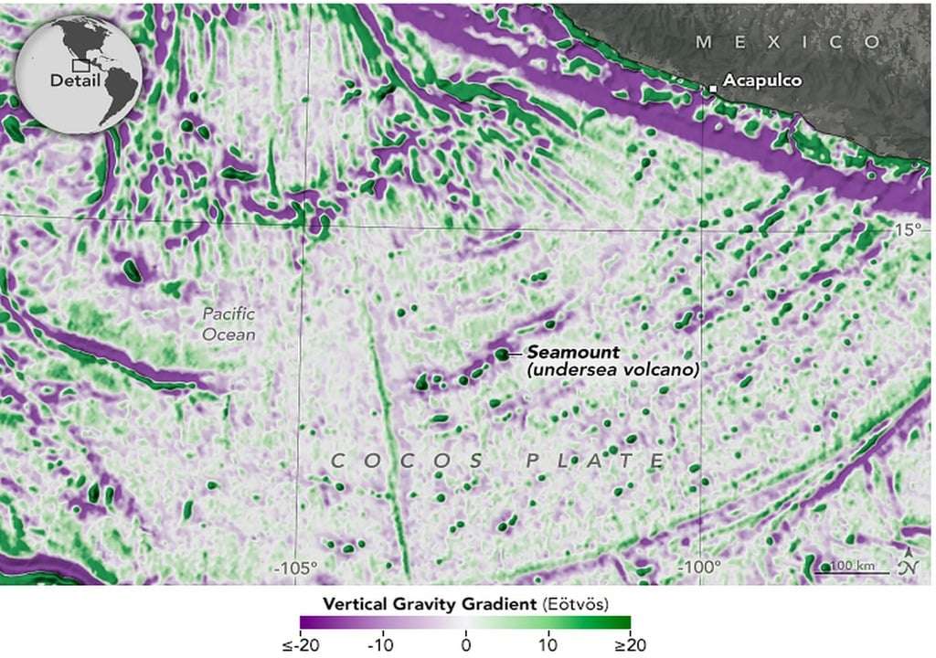
Data gathered by the SWOT satellite led to the astonishing identification of nearly 100,000 seamounts beneath the ocean’s surface. Many of these underwater peaks are much smaller than those previously detected, challenging conventional knowledge about ocean floor geography.
These seamounts significantly influence deep ocean currents and serve as essential habitats for marine ecosystems by concentrating vital nutrients along their slopes. David Sandwell, a geophysicist affiliated with the Scripps Institution of Oceanography, emphasizes that SWOT has revolutionized seabed mapping capabilities.
“The SWOT satellite represented a breakthrough in our ability to map the seabed,” Sandwell stated, underscoring the technological advances enabling these findings.
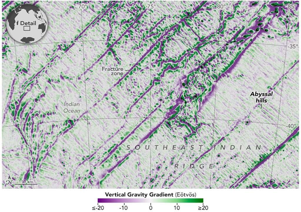
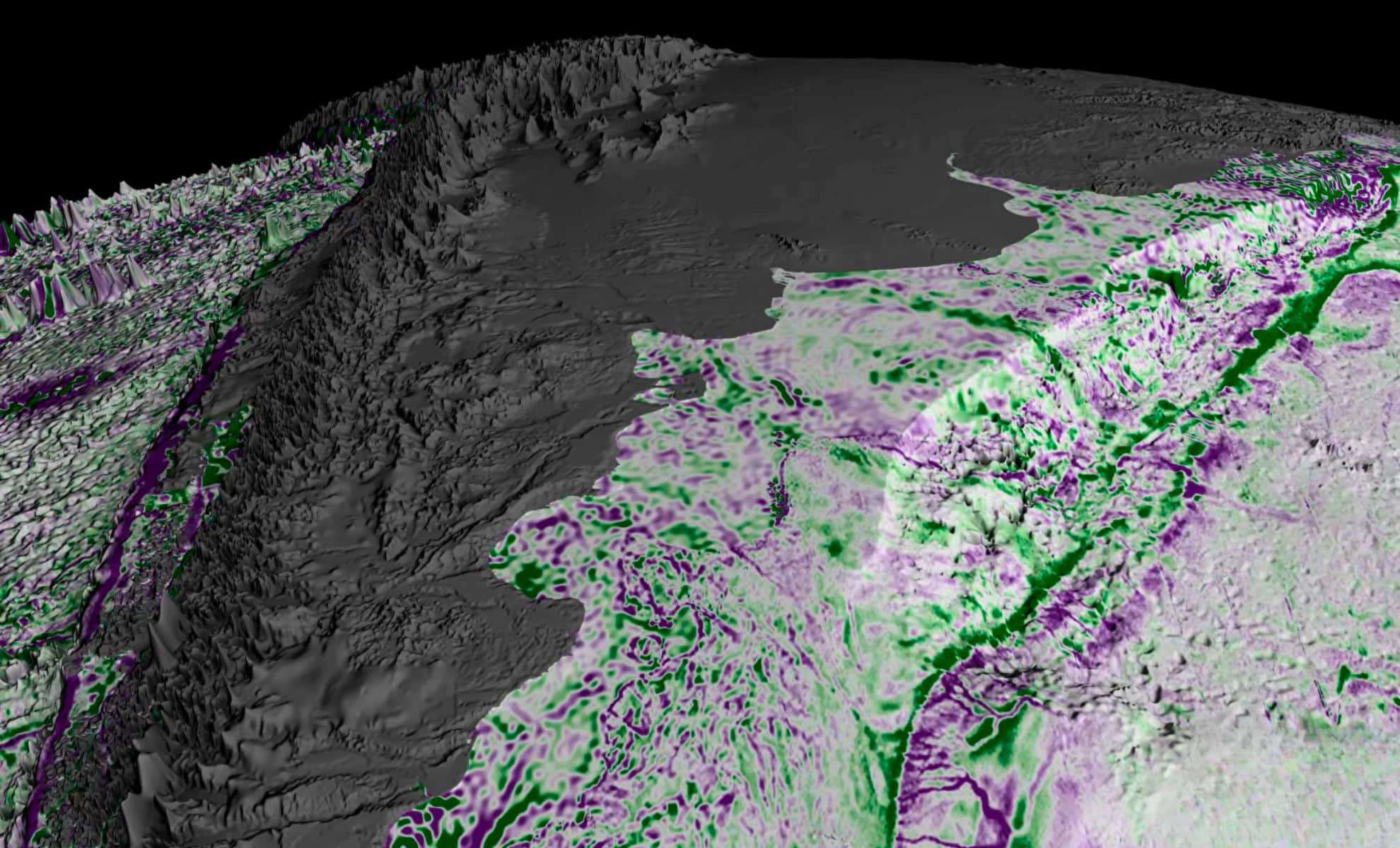
Insights into Abyssal Hills and Their Geological Impact
Beyond seamounts, SWOT has offered fresh perspectives on abyssal hills, which account for roughly 70% of the ocean floor. These hills emerge as parallel ridges formed by diverging tectonic plates but have eluded observation due to their diminutive size.
Thanks to SWOT’s enhanced measurement capabilities, these landforms can now be mapped with exceptional clarity. Oceanographer Yao Yu, who led the related research at the Scripps Institution of Oceanography, describes abyssal hills as “the most abundant landform on Earth.”
Despite their prevalence, their subtlety made them challenging to detect until now. These hills are significant not only geologically but also for their effects on oceanic tides and deep-sea currents, areas that remain under active study.
How These Discoveries Affect Marine Biology and Earth Sciences
The enhanced ocean floor map has considerable implications beyond geology, influencing our understanding of marine ecosystems.
Seamounts actively shape ocean current pathways, which in turn affect nutrient dispersion in deep waters. These nutrient-rich zones foster vibrant marine communities, creating biological hotspots in vast areas of the seabed.
Additionally, data from the SWOT satellite benefits navigation, supports the placement of underwater communication infrastructure, and provides critical insights into the behavior of tectonic plates, aiding broader scientific investigations.


0 comments
Sign in to Comment