
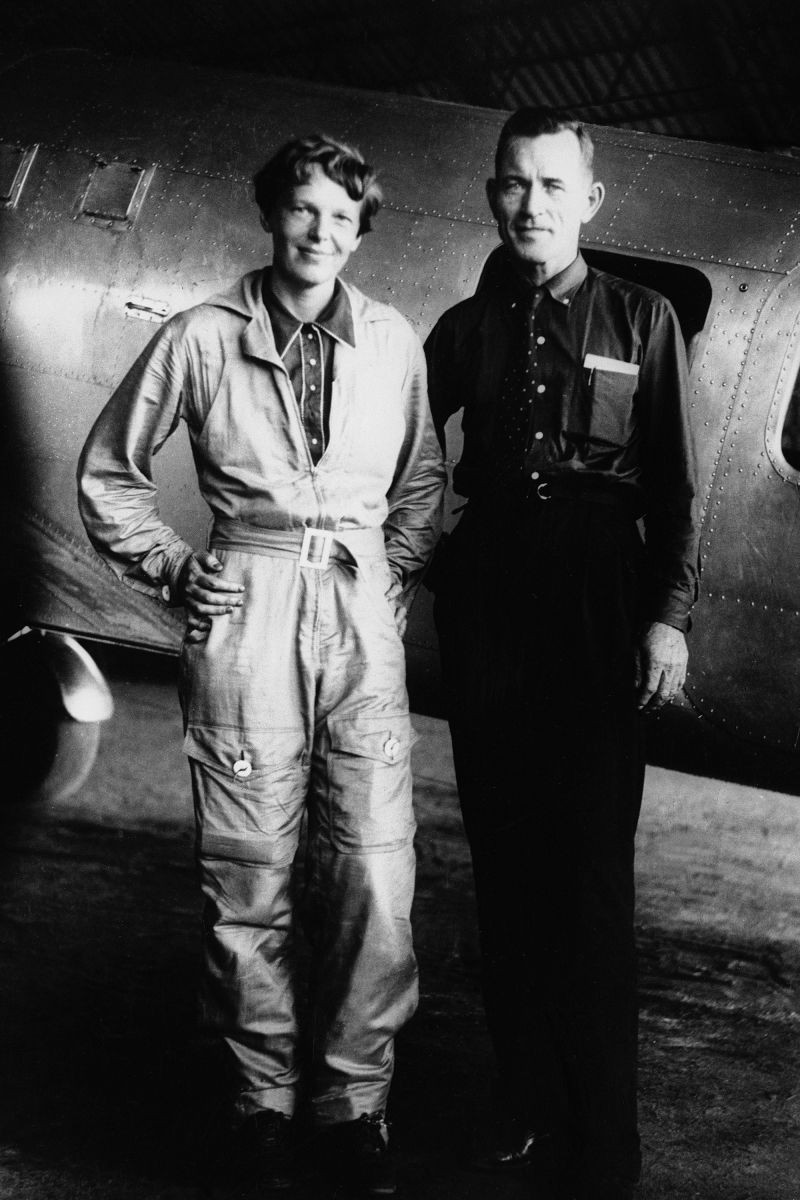
The mystery surrounding Amelia Earhart and her disappearance has persisted for nearly nine decades. In the coming months, two investigative teams plan to test two contrasting theories by examining the only conclusive evidence: debris from the crash site itself.
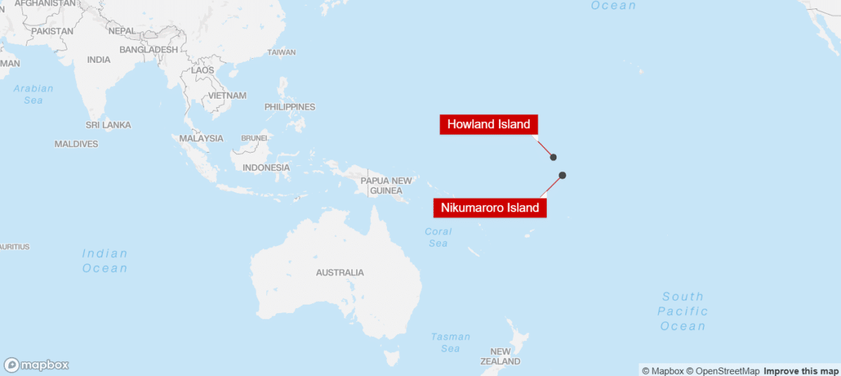
One team will journey 1,200 nautical miles to a lagoon where satellite images dating back to 1938 reveal an object that might be airplane fuselage. Meanwhile, another group intends to deploy autonomous submersibles near Howland Island, guided by a fresh interpretation of the radio transmissions Earhart sent during her final moments as fuel ran out.
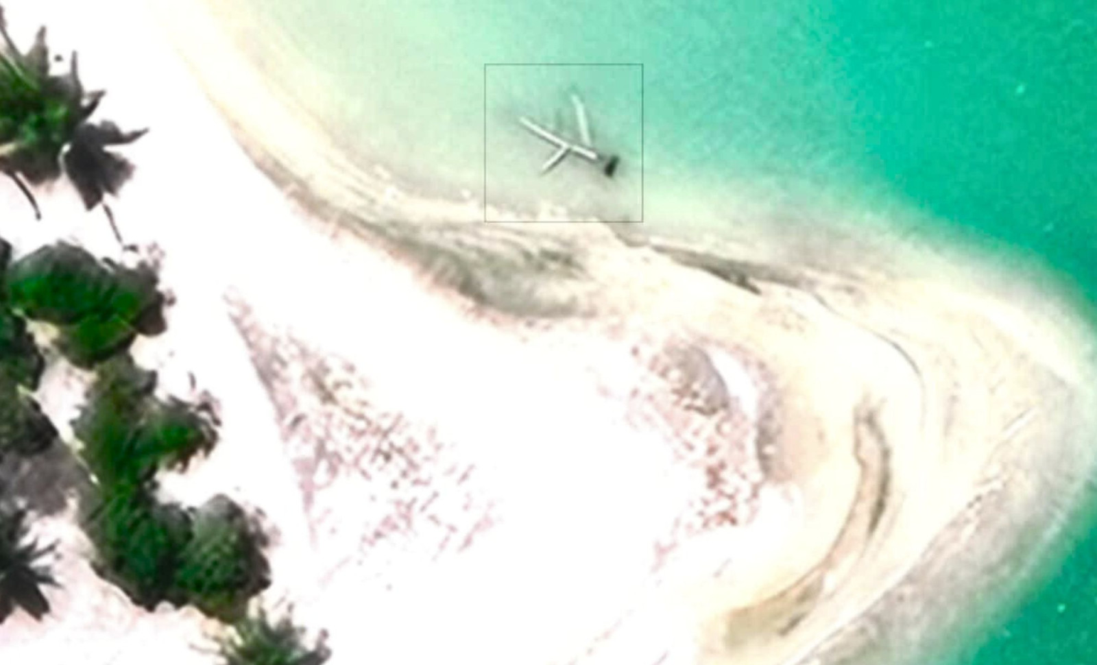
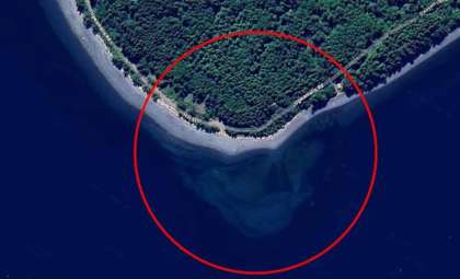
The Enigmatic Shape in the Lagoon
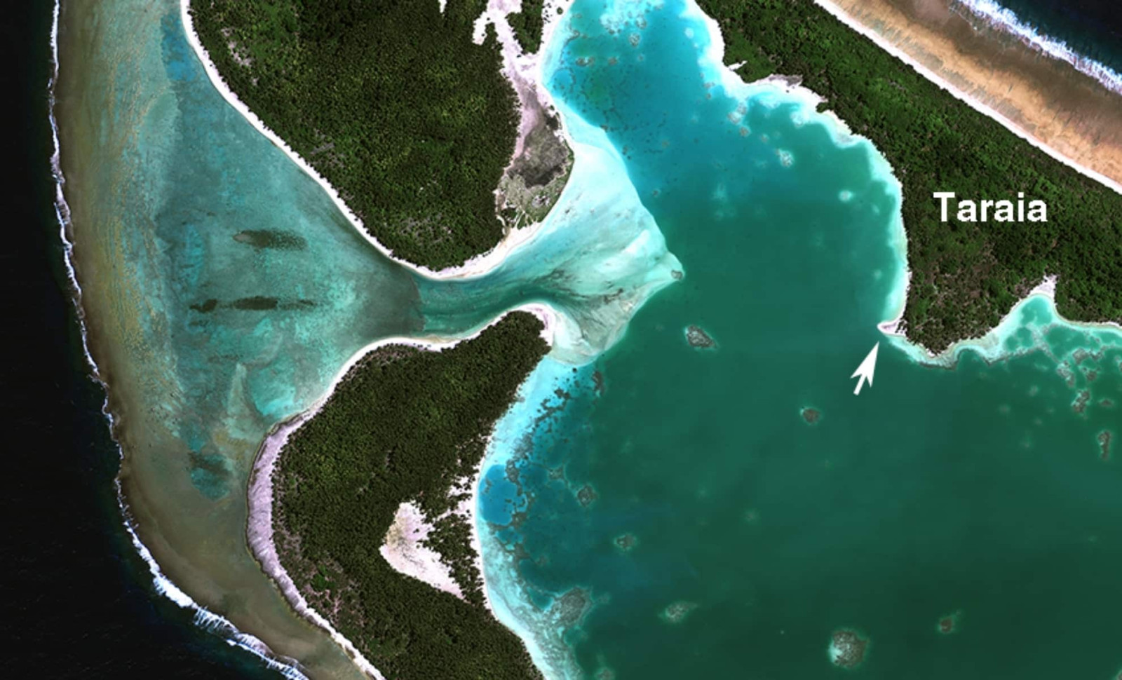
Known as the Taraia Object, this feature lies off the north shore of Nikumaroro Island’s lagoon. It was first noticed in 2020 by Mike Ashmore, a former US Navy member, while examining Apple Maps imagery from his residence in California. Ashmore shared screenshots on a forum managed by the International Group for Historic Aircraft Recovery (TIGHAR), sparking extensive discussion archived online.

Ric Gillespie, TIGHAR’s founder who has led eleven expeditions to Nikumaroro, quickly responded to Ashmore’s findings. On September 15, 2020, he wrote, “Michael Ashmore recently found something intriguing on Google Maps. People often believe they've discovered Earhart’s Electra on these platforms, but usually the sightings turn out to be shipwrecks or natural formations. This object, however, merits serious attention.”
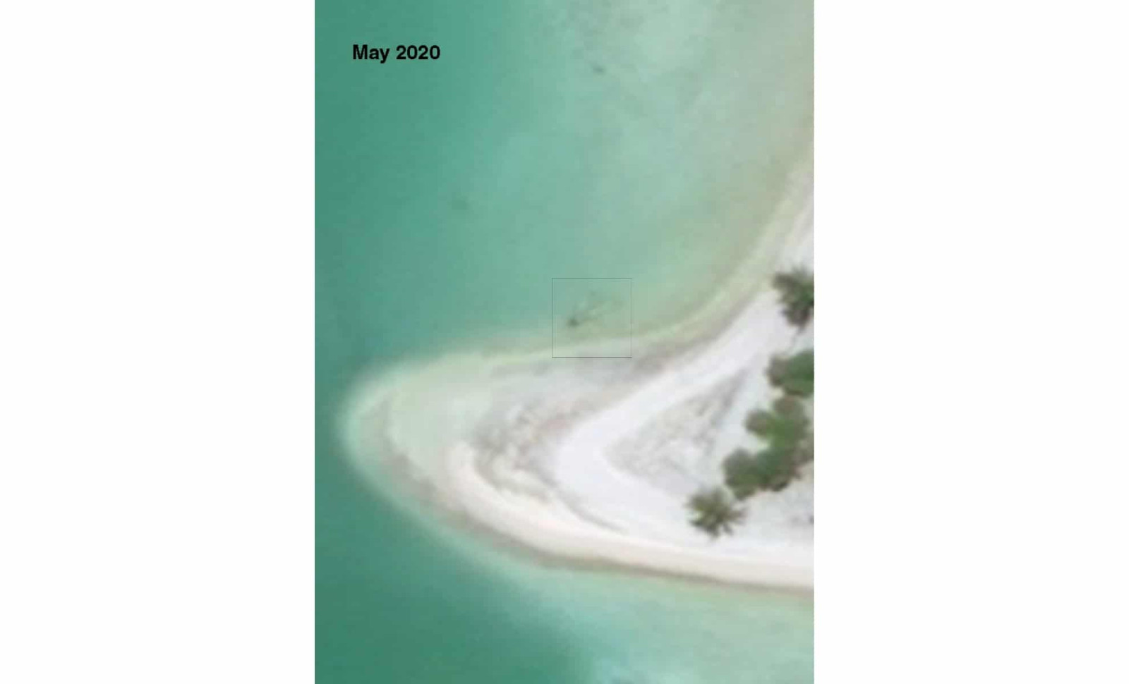
Gillespie noted the object appeared in satellite photos from 2016 through 2018 but vanished by mid-2020. He theorized it might have been “a log stranded after a storm, lingering for several years before being washed away.” Yet, he also highlighted conflicting evidence from a 1939 US Navy map that depicted a dark shape exactly where the object now lies.
Rick Pettigrew, an archaeologist and executive director of the Archaeological Legacy Institute, analyzed these images and reached a different verdict. Speaking to CNN, he stated that aerial photos from 1938 already show the object’s presence. Pettigrew emphasized, “With the available evidence, ignoring this site would be irresponsible.”
Leading the forthcoming mission along with Purdue University, where Earhart had studied aeronautics from 1935 to 1937, Pettigrew plans to initiate the expedition on July 28, 2026. The team will launch from Majuro in the Marshall Islands and spend around five days surveying the site using sonar, magnetometers, and hydraulic dredging equipment.
Gillespie, who previously visited the lagoon site, reported not witnessing any signs of airplane debris. “Recent satellite images reveal something, but it’s unmistakably a tree,” he told CNN, specifying it as a pandanus tree.
Insights from the Radio Records
The Nauticos team will focus their search near Howland Island, the scheduled refueling point that Earhart never reached. Company leader Dave Jourdan explained that their target area is based on a reevaluation of the radio signals exchanged between Earhart’s plane, identified as KHAQQ, and the Coast Guard cutter Itasca, which was stationed there to aid navigation.
The original radio log from the US National Archives details transmissions that began on the evening of July 1, 1937. The last recorded communication at roughly 8:43 a.m. on July 2 reads: “we are on the line 157 337 wl rept msg we wl rept.” Earhart stated she was flying at 1,000 feet and estimated her distance at about 200 miles from Howland.
Jourdan’s group reconstructed Earhart’s radio equipment and performed flight tests in 2020 using a similarly sized plane. These efforts yielded the most accurate estimation yet of Earhart’s location during her final transmissions.
Previous Nauticos explorations and a 2009 survey by the Waitt Institute for Discovery have examined an area of about 3,600 square miles of seabed without discovering the downed plane. The 2026 mission plans to deploy four autonomous underwater vehicles outfitted with side scan sonar technology.

“In our earlier searches, we focused on northern sectors of the island for various reasons yet found no evidence,” Jourdan told CNN. “That narrows down the options, and we believe one more expedition can cover all remaining areas.”
He does not see a rivalry with the Nikumaroro searchers. “They’re exploring a different theory,” he explained. “Our analysis of Coast Guard records and radio signals do not support their conclusions.”
Remaining Clues and Unsolved Questions
Supporters of the Nikumaroro theory highlight discoveries made during prior investigations on the island. Gillespie’s teams uncovered a compact mirror reminiscent of one Earhart reportedly carried, several cosmetic containers, a jackknife, and a wooden box possibly containing a sextant. Bones unearthed in 1940 were analyzed in Fiji and deemed male before going missing, though modern forensic assessment suggests the remains could match a woman of Earhart’s build.
Gillespie asserts that Earhart likely spent her final days on Nikumaroro, but doubts that the plane’s remains rest in the lagoon. “Everyone wants to find the plane, but we believe it was swept out to sea around July 7 and quickly destroyed by waves,” he said.
Originally planned for November 2025, the Nikumaroro expedition was delayed by permitting issues with Kiribati authorities. Meanwhile, Nauticos continues fundraising for its endeavor, estimating expenses between $8 million and $10 million, with plans to conduct the search in 2026 but no fixed launch date announced.
- Categories:
- News


0 comments
Sign in to Comment