
ESA’s Biomass satellite has delivered its initial captivating snapshots of our planet, unveiling an unprecedented look at Earth’s most untouched and ecologically vital areas. Introduced during the Living Planet Symposium 2025 in Vienna, these visuals highlight not only lush forests but also deserts and ice fields, demonstrating the satellite’s remarkable capabilities in environmental observation. Despite still being early in its commissioning stage, Biomass has already exceeded anticipated performance with its advanced radar technology, which promises pivotal insights into carbon reserves and climate change effects.
Revolutionizing Earth Monitoring
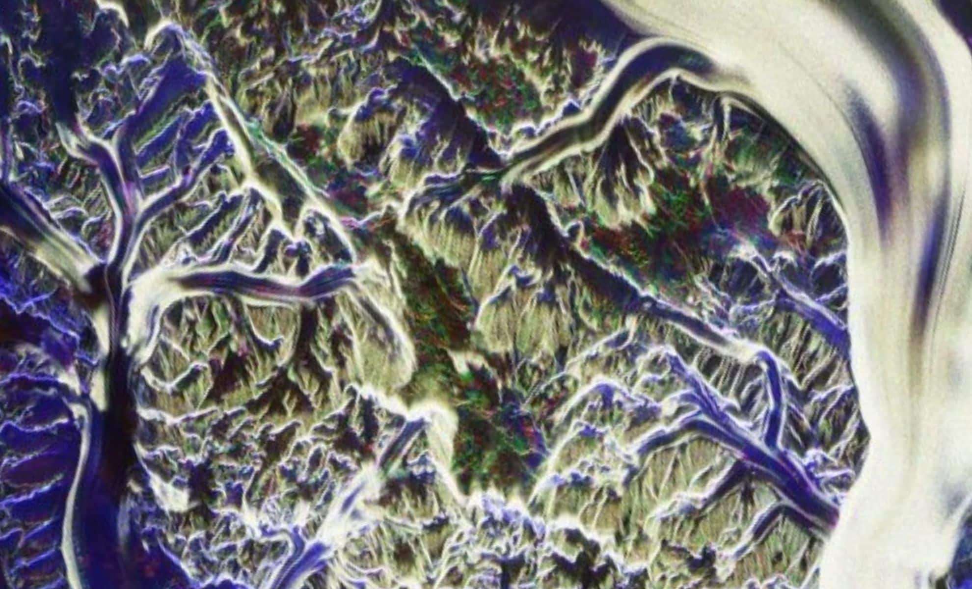
The Biomass satellite marks a breakthrough for environmental research through its cutting-edge P-band radar system that can penetrate dense forest layers, ice cover, and soil. Unlike traditional optical satellites that capture only surface images, Biomass’s radar technology provides three-dimensional data on forest biomass, granting scientists a comprehensive understanding of forest architecture. “These inaugural images are truly impressive — and they represent just the beginning of what lies ahead,” stated Michael Fehringer, ESA’s Biomass Project Manager. Early outputs showcase intricate details of tropical rainforests, the Amazon Basin, and the icy Antarctic zones, underscoring Biomass’s exceptional potential to track carbon stocks and climate dynamics.
Beyond assessing vertical forest layers, Biomass offers valuable information on arid and glaciated areas. This versatility unlocks new avenues for scientific exploration, allowing more accurate evaluations of the Earth’s evolving ecosystems. The promising initial results affirm a mission committed to delivering essential data on forest vitality, climate impacts, and carbon cycles over the next five years.

A Testament to Global Innovation and Teamwork
Releasing these initial images signifies a major achievement in both space science and international collaboration. “It was deeply moving because it represents the collective effort of hundreds of individuals,” remarked Simonetta Cheli, ESA’s Director of Earth Observation Programmes. “This milestone embodies the dedication behind the scenes and the vast possibilities this mission holds.” The unique insights provided by Biomass into Earth’s critical ecosystems are the fruit of years of diligent work by an international community of scientists, engineers, and experts devoted to understanding our planet’s environment.
This mission’s progress highlights how cooperation and cutting-edge technology can address urgent global issues such as climate change and environmental decline. By harnessing space-based innovations, ESA equips researchers with powerful tools poised to influence conservation and sustainability worldwide.
Radar Technology Unlocking Hidden Layers
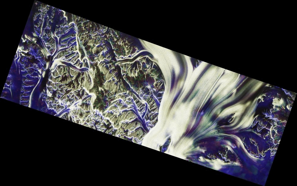
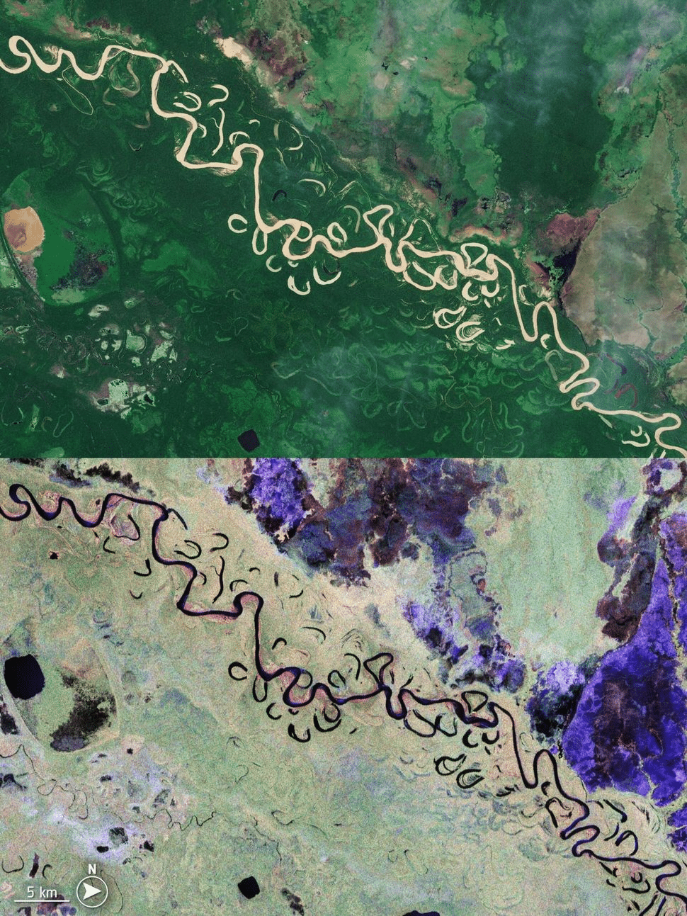
Biomass’s radar system excels at uncovering details beneath forest canopies, ice sheets, and soil layers—features invisible to standard optical satellites. The initial imagery captured the Amazon rainforest and the Beni River in Bolivia, revealing not only the treetops but the complex three-dimensional forest structure beneath. This capacity is essential for precisely quantifying the carbon stored within forests, a crucial factor for global climate models.
Bolivia’s tropical forests, recently affected by significant deforestation, were among the first areas observed by Biomass. Images depict the winding Beni River flowing through verdant rainforests and wetlands, highlighting the rich biodiversity and ecosystems dependent on this region. Biomass’s ability to distinguish forests from wetlands and grasslands provides vital data for studying deforestation’s impacts on biodiversity and carbon capture.
Venturing Into Earth’s Harshest Regions
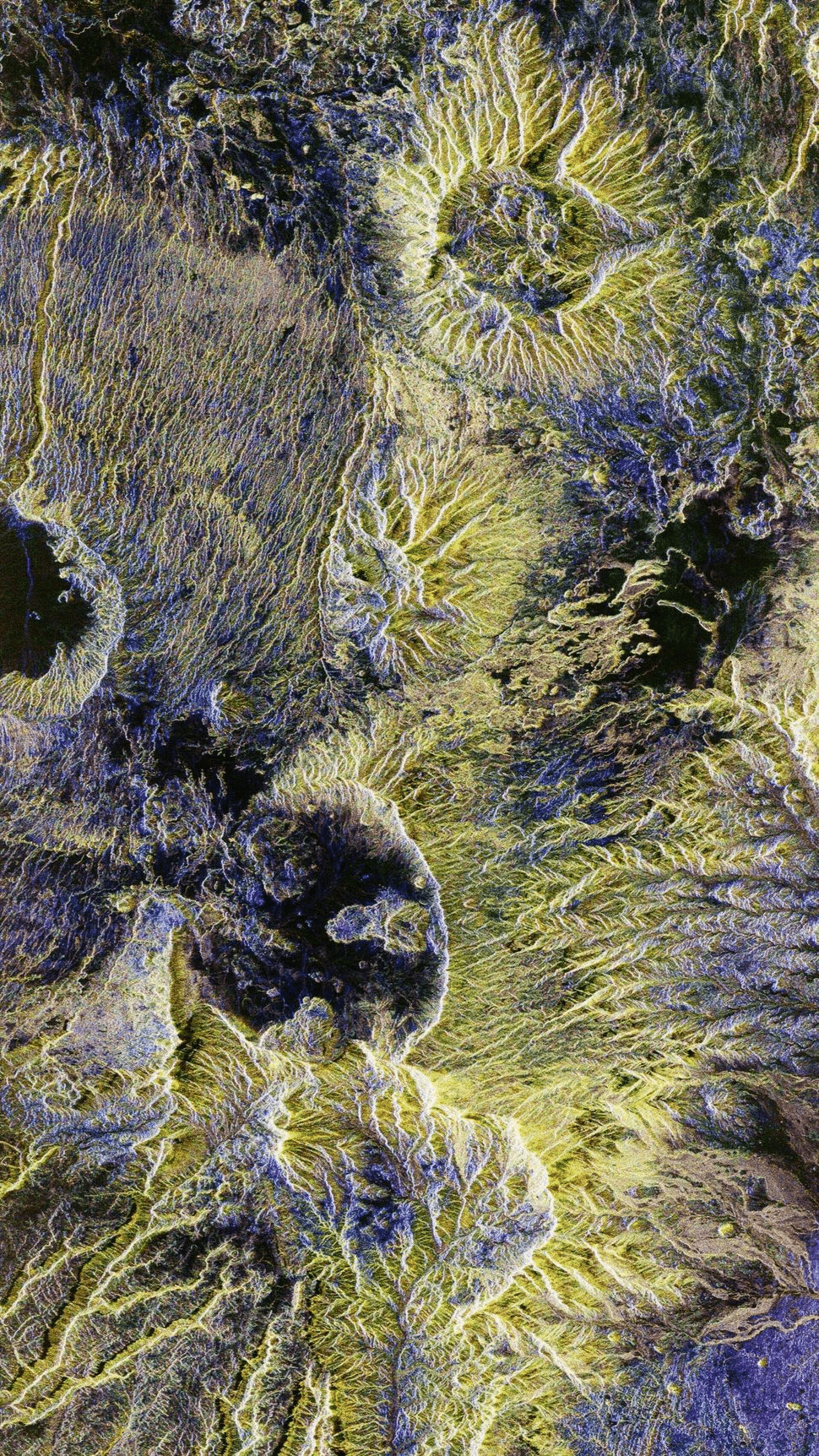
Biomass’s expertise extends far beyond tropical forests to encompass some of Earth’s most extreme and isolated environments. In the Sahara Desert, radar imaging has unveiled concealed geological formations hidden beneath vast sand dunes, including ancient channels and landforms. Such revelations could significantly enhance paleoclimate research and groundwater studies, advancing our understanding of desert evolution.
In Antarctica, Biomass’s radar penetrates thick ice to reveal internal layers, assisting researchers in tracking glacier stability and ice movement. These findings are critical for predicting sea-level rise and evaluating climate change’s effects on polar landscapes. Real-time ice dynamic monitoring positions Biomass as a vital asset for understanding and responding to global warming’s influence on Earth’s frozen regions.
- Categories:
- News


0 comments
Sign in to Comment