
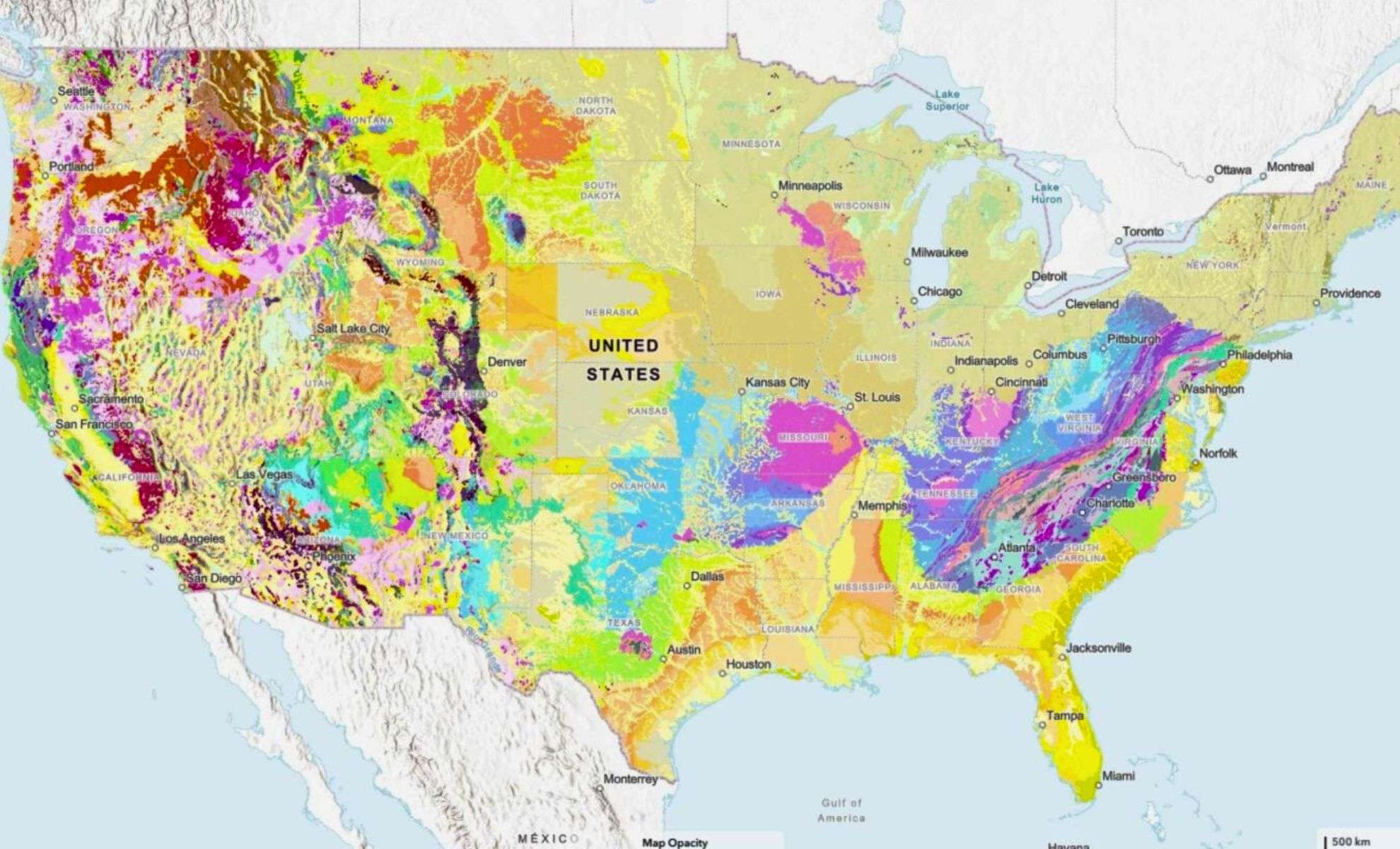
At the end of August, the U.S. Geological Survey introduced an innovative resource that presents a layered geological view of the United States. The Cooperative National Geologic Map, now accessible online, provides a detailed visualization of the nation’s underground landscape, revealing rock formations and sediment deposits from various geological periods down to the foundational bedrock.
This digital map breaks from tradition by consolidating over 100 regional and state geological maps into a unified, searchable platform covering the entire contiguous U.S., completed in just three years. Its vibrant, color-coded interface is designed for ease of use, enabling users ranging from city planners and engineers to students to investigate the composition and history of subsurface materials at any given location.
While it may appear to be primarily a scientific tool, its applications extend into crucial domains such as infrastructure design, natural resource allocation, and disaster preparedness. Whether to pinpoint earthquake hazard areas, plan transportation routes, or track mineral deposits, this map serves as an indispensable foundation for many essential decisions.

“This tool equips the nation with comprehensive geologic data ready for analysis,” explained Joseph Colgan, a USGS research geologist and the project’s chief designer. “It distills Earth’s complex history in a way that benefits everything from academic learning to commercial mineral searching.”
Practical Insights from Beneath the Surface
Few consider the importance of the earth beneath their feet, yet the characteristics of subsurface materials—from loose sediments to solid bedrock—significantly influence water movement, building stability, and vulnerability to natural threats. The USGS’s new interactive map organizes these geological elements, offering highly detailed and searchable layers.
Users can view geological periods or rock types such as Quaternary river sediments, Mesozoic basalt flows, or Precambrian granite formations, toggling layers to uncover patterns critical to researchers and planners. Clicking any location reveals fundamental details like formation age, name, and composition, all linked to original local and national data repositories.
Such granularity supports various industries. For instance, property developers can identify landslide-susceptible sites, water managers can evaluate aquifer recharge areas, and energy firms can locate resource-rich zones. According to a recent study by the American Association of State Geologists, investments in geological maps can yield returns ranging from $7 to $10 per dollar spent by minimizing costly errors and improving land use.
Supporting Critical Mineral Independence
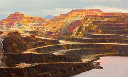
Reducing America’s reliance on imported critical minerals—such as titanium, lithium, and rare earth elements—is a pressing national goal. In 2024, over 95% of the titanium used in the country was sourced from abroad, according to the USGS Mineral Commodity Summaries.
To address this, the USGS has concentrated mapping efforts on promising geologic areas like the Atlantic Seaboard Fall Line, a geological boundary running from New Jersey to Georgia. This transition zone, where hard inland rocks give way to softer coastal sediments, holds deposits rich in titanium and other valuable minerals. By tracing upstream bedrock and downstream sediment pathways, researchers aim to uncover domestic mineral reserves.
A recent USGS report highlights that this southeastern mapping also improves public safety by refining earthquake hazard assessments through updated fieldwork, laboratory studies, and airborne scanning, revealing faults and unstable areas previously undetected in older maps.
“We are still uncovering the geologic origins of these resources,” stated Mark Carter, a USGS geologist leading field investigations in the Southeast. “Accurate maps help us focus efforts productively and avoid wasting resources.”
A User-Friendly Portal to Complex Earth Science
Despite the scientific complexity, the Cooperative National Geologic Map offers an intuitive interface accessible on mobiles, tablets, and desktops. This ensures that users, whether a Montana student or a Miami hydrologist, can explore Earth’s layers equally well.
Powered by the National Geologic Map Database, developed collaboratively with state surveys, this platform’s flexible structure enables frequent updates as new data arrives, marking a significant improvement over the static paper maps of the past.
“The real strength of this system lies in its ability to evolve,” noted Christopher Swezey, coordinator of USGS’s National Cooperative Geologic Mapping Program. “We can quickly incorporate new discoveries and meet public and scientific demands more effectively.”
Try the map yourself here: USGS Cooperative National Geologic Map
- Categories:
- News


0 comments
Sign in to Comment