
A mostly submerged landmass concealed beneath the South Pacific has been brought closer to scientific acknowledgment. Researchers have finalized the inaugural extensive geological map of North Zealandia, a massive sunken continent often dubbed Earth’s eighth continent. Their study, featured in the journal Tectonics, establishes firm geological evidence supporting Zealandia’s classification as a continent.
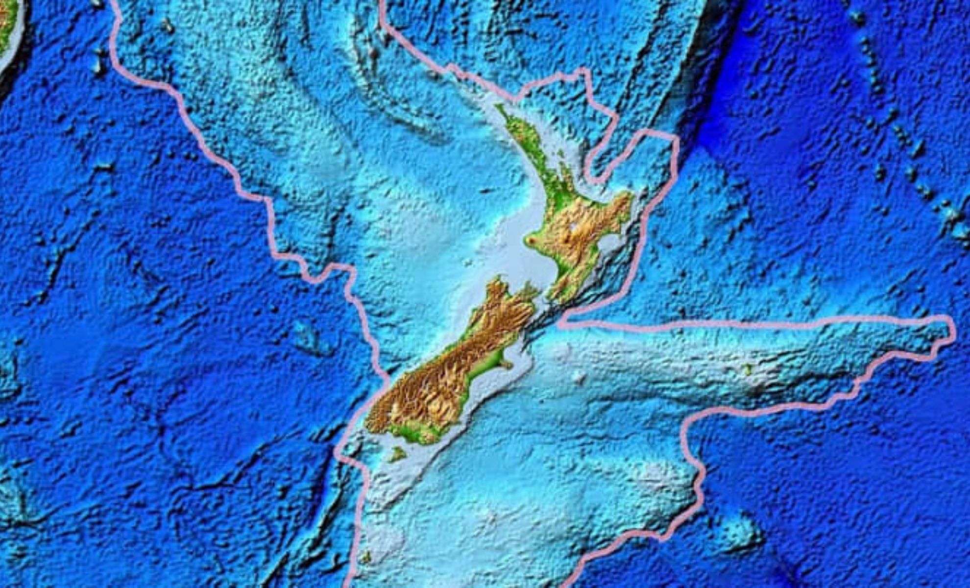
While nearly 95% of Zealandia remains submerged, the visible 5% forms parts of New Zealand and New Caledonia, offering tangible proof of this extensive landmass beneath the ocean. This latest research delivers the most compelling geological data yet confirming Zealandia’s continental status.
An Ancient Fragment of a Supercontinent
Zealandia’s history traces back over 100 million years when it was a segment of the supercontinent Gondwana, which included regions that would become Africa, South America, India, Antarctica, and Australia. It started to peel away roughly 85 million years ago, initially separating from West Antarctica before detaching from Australia approximately 25 million years afterward.

Unlike typical continental masses, Zealandia underwent extensive crustal thinning and cooling during the Paleogene period, causing the landmass to gradually sink below sea level. Today, it lies nearly submerged, bisected by a tectonic divide between the Pacific and Australian plates.
Revealing Buried Geological Secrets
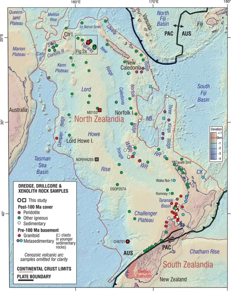
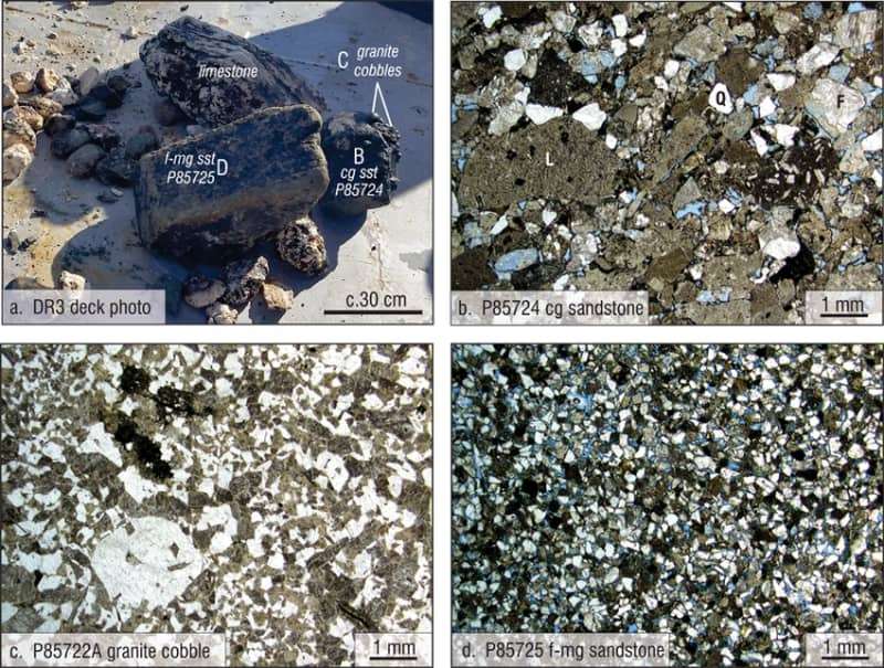
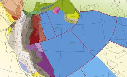
Under the leadership of geologist Nick Mortimer from GNS Science, the team carried out the first full offshore geological survey of North Zealandia, utilizing state-of-the-art dredging techniques in the Fairway Ridge and Coral Sea. The expedition collected diverse rock samples, including sandstone, mudstone, limestone, and basaltic lava, each contributing valuable clues about Zealandia’s geological past.
Sandstone specimens date back around 95 million years, while granite and volcanic pebbles extend the timeline to nearly 130 million years in the Early Cretaceous. Basalt samples tell a more recent story, originating in the Eocene epoch some 40 million years ago.
“By dating these rocks and studying the magnetic anomalies they presented, we were able to map the major geological units across North Zealandia,” the team explained.
This new geological map offers the most detailed reconstruction yet of Zealandia’s northern submerged area.
Transforming Understanding of Tectonic Activity
The fresh geological insights challenge earlier conceptions of Zealandia’s formation. Instead of separating along a traditional strike-slip fault where tectonic plates slide horizontally, the team proposes that the continent experienced plate stretching which led to fractures similar to subduction zones. This model suggests a more intricate tectonic development, tied to the creation of the Tasman Sea and additional crustal thinning that prompted Zealandia’s submersion.
The research indicates Zealandia’s crust thinned by as much as 65%, distinguishing it structurally from other continents. This thin crust is a key factor behind its underwater condition and positions Zealandia as a critical natural laboratory for studying less common tectonic mechanisms.
Strengthening Zealandia’s Continental Claim
Beyond its concealed location, Zealandia holds significant geological value. Its formation and unique structure reveal important lessons about continent evolution, especially in tectonically dynamic zones like the Pacific region.
“Zealandia’s underwater status in no way diminishes its geological significance,” said one GNS Science researcher.
Advances such as seismic surveys and deep-sea dredging continue to equip scientists with new methods to explore this submerged landmass. Each investigation contributes to a richer understanding of Zealandia and Earth’s tectonic development.
- Categories:
- News


0 comments
Sign in to Comment