
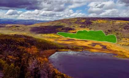
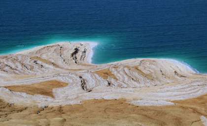
The Great Salt Lake in Utah is unveiling surprising new phenomena as its water recedes, exposing clusters of circular, reed-covered mounds — unusual “living islands” suddenly appearing on the drying lakebed. Recent research attributes these formations to a large, pressurized underground freshwater network. This groundbreaking discovery, highlighted at the 2025 Goldschmidt Conference and supported by extensive geophysical and hydrological analysis, provides fresh insight into the lake’s dynamics and potential ecological future.
Freshwater Surging Beneath the Salty Waters
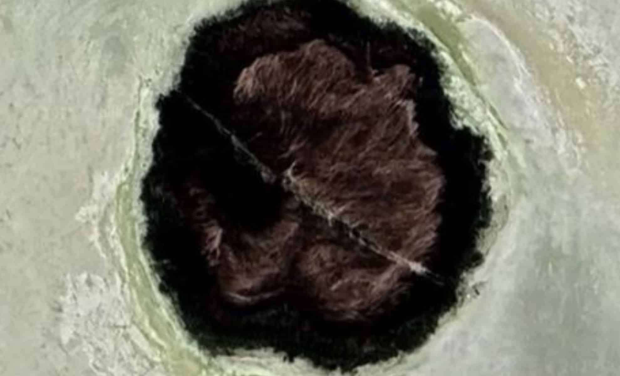
For some time, scientists at the University of Utah were intrigued by these strange vegetated mounds, which pop up in environments traditionally deemed unsuitable for plant growth. Dominated by invasive phragmites reeds, these mounds suggested the presence of subsurface water. Lead geologist Bill Johnson and his colleagues have now verified these mounds mark freshwater rising under pressure from deep below the lake floor.
Johnson explained, ”This water has traveled underground for a long period before reaching the lake, but exactly where remains a mystery.” Remarkably, freshwater was detected not only along the shoreline but even beneath Farmington Bay’s causeway — up to 30 feet down, in areas previously thought to contain only saline water.

Mapping the Hidden Underground Network
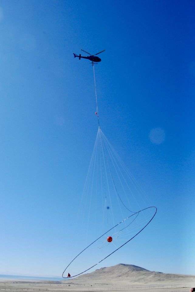
Early in 2025, the research team collaborated with the Canadian geophysics company Expert Geophysics. Using a helicopter-borne circular antenna array, they conducted electromagnetic surveys over Farmington Bay, sending signals into the earth that reflected off subsurface formations. This data helped generate detailed three-dimensional models of the subterranean structure beneath the lake.
The results reveal a complex layering of sediments with freshwater pockets potentially extending to depths near 10,000 feet. A fascinating finding shows fresher water concentrated at the center of the mounds, which suggests that water is driven upward through vertical channels where sediment is less compacted, facilitating this pressurized flow.
At one site known as Round Spot 9—one of at least 18 freshwater mound locations—arrays of piezometers recorded hydraulic pressures increasing with depth at 7, 11, 30, and 60 feet, confirming upward water movement.
Rethinking the Lake’s Water Budget
Previous estimates had groundwater contributing around 3% to the lake’s total water volume. However, recent chemical mass balance analyses suggest this input could be as high as 12%. This new perspective significantly shifts the scientific community’s understanding of the lake’s hydrology, especially amid persistent drought and water diversion challenges.
Despite this, Johnson warns against viewing this reservoir as a new water source. “I want to avoid hype around this as a water supply,” he stated. “The system is under pressure, and it might be more valuable for reducing dust storms on the exposed lakebed.” As the water recedes, dry sediments crack and release harmful dust into the environment.
Years of Exploration Lead to This Finding
Johnson’s curiosity began during an airboat survey of the lake’s North Arm, when he observed bubbling water and gas within a large circular area. The inability to gauge depth indicated strong groundwater upwelling.
Subsequent satellite imagery revealed numerous similar mounds throughout Farmington Bay, motivating further study. The team now believes that these “living islands” could number in the hundreds, each connected to an extensive underground aquifer. Current efforts focus on determining the water’s origin, age, and volume.
- Categories:
- News


0 comments
Sign in to Comment