
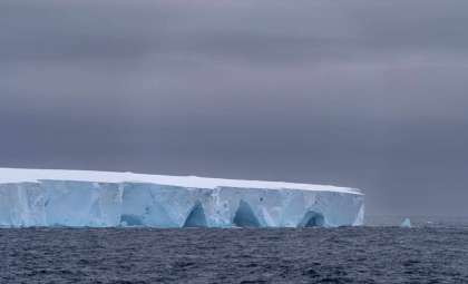
The immense ice sheet covering Greenland, a vital element of Earth’s climate balance, is melting faster than ever, raising significant concern among scientists and global leaders. The magnitude of ice loss in recent years highlights the pressing need to understand the implications of a warming planet. Now, an unprecedented real-time glimpse into this change is possible through the combined efforts of ESA’s CryoSat and NASA’s ICESat-2 satellite missions.
These state-of-the-art satellites, using advanced radar and laser sensing technology, offer the most detailed and accurate tracking of Greenland’s shrinking ice mass. By integrating their measurements, researchers are able to observe variations in ice thickness and volume with unmatched clarity. This innovative cooperation is yielding vital information about how the ice sheet is evolving and the broad global impacts on sea levels, climate patterns, and ecosystems.
Beyond the technical breakthrough, these revelations serve as a powerful reminder of the challenges posed by climate change. The story of Greenland’s melting ice resonates worldwide, with effects reaching far beyond the Arctic region.

Unrivaled Monitoring of Ice Sheet Changes
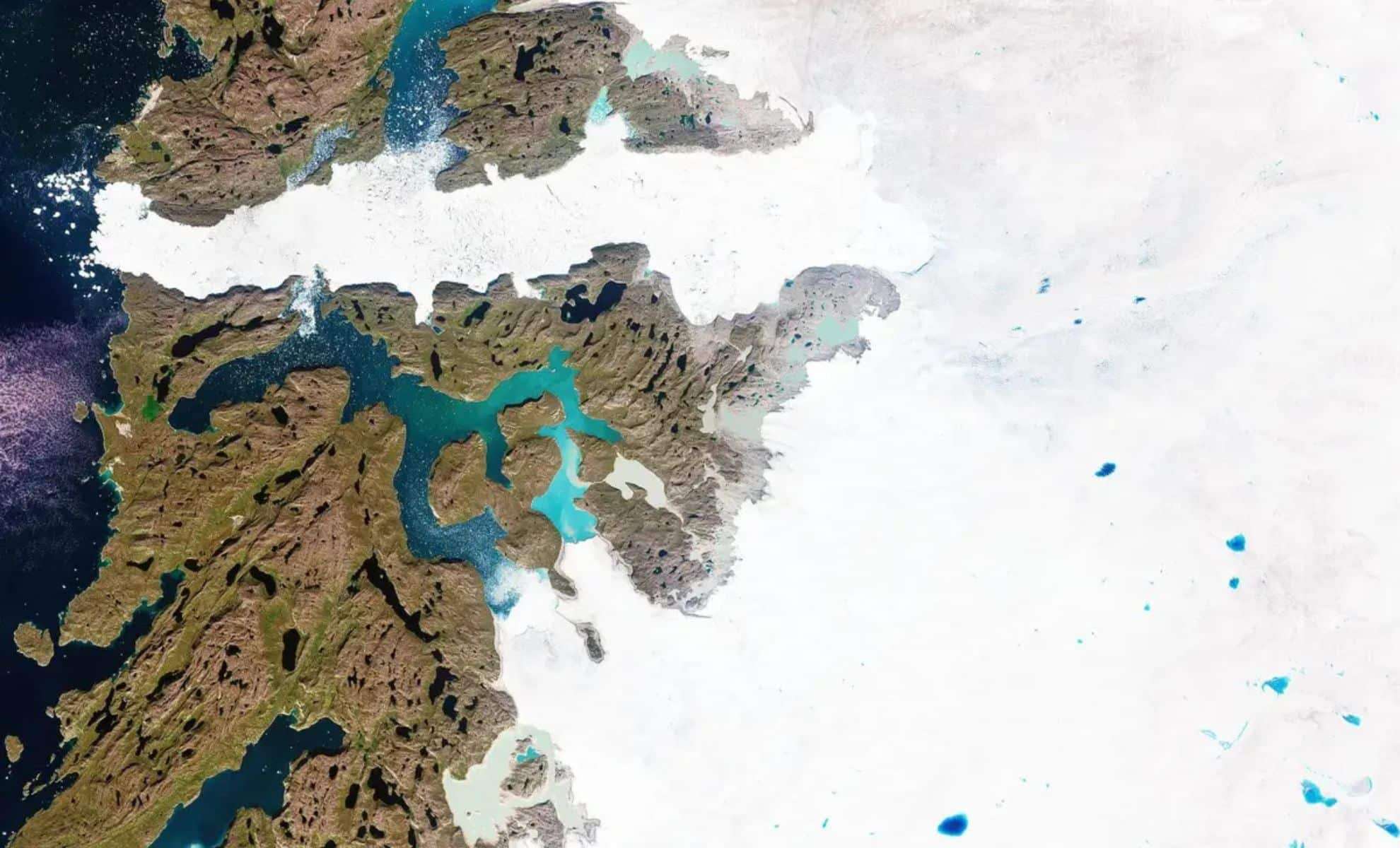
Studying Greenland’s melting ice has long been difficult due to its remote, inhospitable environment. The partnership of CryoSat and ICESat-2 transforms this landscape, delivering precise and complementary information that offers a fuller understanding of ice loss.
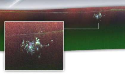
CryoSat uses radar waves to penetrate clouds and measure ice thickness but requires adjustments for surface properties. In contrast, ICESat-2 relies on laser pulses, delivering extremely accurate surface height data but is less effective under cloudy skies. Together, these ‘‘sister missions’’ produce a comprehensive and reliable dataset.
“Discovering such close alignment between CryoSat and ICESat-2 data is truly exciting,” states Nitin Ravinder, lead researcher at the UK Centre for Polar Observation and Modelling (CPOM). “Their complementary strengths motivate us to merge the datasets for improved estimates of ice volume and mass changes.”
Greenland’s Ice Sheet Shrinks at an Alarming Rate
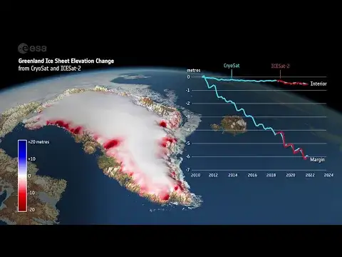
Current data paint a worrying picture. From 2010 to 2023, Greenland’s ice sheet thinned on average by 4 feet, with some locations experiencing dramatic ice loss.
- The Jakobshavn Glacier lost as much as 220 feet of ice thickness, ranking among the world’s fastest-retreating glaciers.
- The Zachariae Isstrøm Glacier in northeastern Greenland thinned by up to 250 feet in its most affected areas.
- The ablation zone, where melting exceeds snowfall, witnessed an average thinning of 20 feet.
Overall, more than 7,700 cubic feet of ice vanished within 13 years, peaking during exceptionally warm years like 2012 and 2019.
Ice Loss Highlights
Why Collaboration Between Satellites Matters
The partnership between CryoSat and ICESat-2 represents more than a technical feat; it’s a crucial advancement for studying and responding to climate effects.
“For 14 years, CryoSat has been essential in tracking Earth’s ice coverage. Now, by combining data with ICESat-2, we've increased the precision and depth of our insights,” explains Tommaso Parrinello, CryoSat Mission Manager at ESA.
“It’s encouraging to see our ‘sister missions’ paint a consistent picture of Greenland’s changes,” adds Thorsten Markus, ICESat-2 project scientist at NASA. “Comparing radar and lidar data helps us unlock the complementary value of these satellites.”
Broader Consequences Beyond Greenland
The melting of Greenland’s ice impacts more than just the local environment, triggering global repercussions:
- Rising sea levels threaten coastal populations worldwide as ice mass flows into the oceans.
- Altered weather patterns arise from freshwater influx disrupting oceanic currents far from the poles.
- Loss of habitat challenges species like polar bears, seals, and walruses as ice retreats.
- Local communities depending on stable ice for traditional activities face increasing uncertainty and need to adapt.
A Crucial Call to Climate Action
The detailed insights from CryoSat and ICESat-2 offer an essential resource for those seeking to understand and combat the effects of climate warming.
“This collaboration is a meaningful leap forward, not just technologically but in supporting scientists and policy makers confronting climate challenges,” Parrinello stresses.
The rapid loss of Greenland’s ice is a vivid warning that decisive climate action is critical. These real-time satellite observations not only reflect scientific progress but also emphasize the urgent need for global intervention.
- Categories:
- News ,
- Climate change


0 comments
Sign in to Comment