
Cutting-edge seismic research is advancing from beneath the waves, offering new ways to anticipate major natural disasters. Scientists equipped with a remotely operated vehicle (ROV) have charted the geological features of the Mona Rift, a submerged fault zone northwest of Puerto Rico, unveiling hidden earthquake risks that could threaten millions living along the island’s shores.
The study, featured in Geosphere, represents a significant leap in monitoring tectonic movements in remote subsea environments, underscoring that some of the gravest seismic dangers lie beneath the ocean surface rather than on land.
Exploring the Depths with Robotics
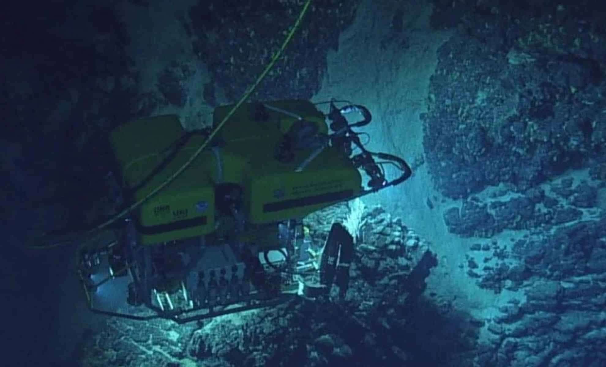
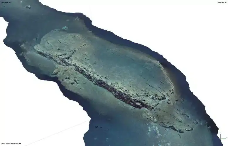
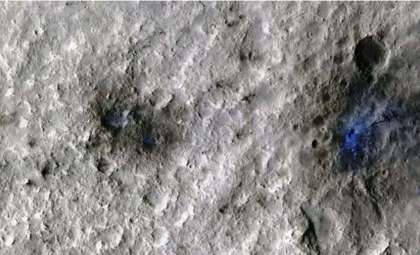
To investigate areas of the seafloor where conventional drilling poses challenges, lead researcher Dr. Uri S. ten Brink from the U.S. Geological Survey utilized ROVs to survey depths reaching nearly 13,000 feet. These advanced robots gathered detailed images and seven rock specimens from the Mona Rift’s seafloor.

Rather than relying on physical drilling, the team employed “virtual outcrop” modeling—constructing 3D geological models from visual data. This novel method extracted intricate geological insights from a previously unexplored underwater fault, with ten Brink likening it to "observing a rock face while driving by on land."
Seismic Secrets Hidden Below the Ocean
The Mona Rift, a geologically active fault line between Puerto Rico and the Dominican Republic, was long suspected as a factor in regional earthquakes but lacked comprehensive investigation until now.
A 1918 magnitude 7.2 quake generated a tsunami devastating parts of Puerto Rico. Although previous studies discounted the Mona Rift as the cause, new evidence indicates it remains a significant seismic hazard.
The research dated this underwater fault to approximately 3.3 million years old—younger than adjacent rock layers—suggesting the tectonic stretching in the area is progressing more rapidly than once assumed, marking the Mona Rift as an actively developing geological structure.
Missing Chapters in Geological History
By comparing rock layers on land and below the sea, scientists identified a 330-foot stratigraphic gap, signifying whole segments of the region’s geological past are absent from terrestrial records. This gap highlights our limited understanding of underwater fault dynamics and reinforces the importance of deep ocean exploration.
Variations in rock thickness further imply the Mona Rift follows its own unique tectonic evolution, distinct from nearby land formations.
Why Understanding This Fault Is Crucial Now
With Puerto Rico facing ongoing risks from earthquakes and tsunamis, early detection of fault activity in underwater regions like the Mona Rift is vital for safeguarding coastal communities and infrastructure.
Moreover, this research showcases the potential of ROV technology to examine other submarine fault lines worldwide, particularly in zones where traditional methods are impractical or prohibitively costly. As rising seas and climate change exacerbate coastal vulnerabilities, gaining a clearer picture of seafloor behavior is increasingly essential.
- Categories:
- News


0 comments
Sign in to Comment