
For many years, detailed maps of the Moon and Mars have surpassed our understanding of Earth's ocean bed. That is now changing with NASA’s Surface Water and Ocean Topography (SWOT) satellite, which is delivering an innovative, space-based view of the seafloor. This mission, conducted alongside the French space agency CNES, is reshaping how scientists identify underwater mountains, deep ocean currents, and seismic events from space.
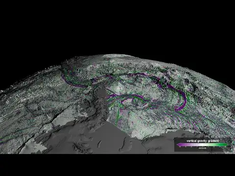
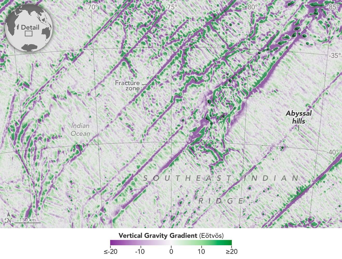
According to NASA’s Jet Propulsion Laboratory (JPL), SWOT’s detailed ocean surface height data enables researchers to map features like seamounts and abyssal hills hidden beneath the waves. Since sonar mapping has covered only about a quarter of the ocean floor, SWOT’s measurements are filling in vast unknown regions — potentially doubling the number of known underwater elevations and shedding light on deep ocean heat distribution, ecosystems, and geological activity.
This advancement promises to revolutionize maritime navigation, deepen climate change studies, and aid the search for valuable mineral resources beneath the ocean floor.

The Importance of Detailed Seafloor Mapping
Although oceans cover roughly 70% of the planet, much of their deepest terrain remains unexplored. Traditional seafloor mapping techniques rely heavily on sonar from ships, which, despite providing accurate images, is costly and time-consuming. With only a small portion of the ocean floor mapped thoroughly, scientists have long looked for methods that could deliver global insights more efficiently.
Having precise maps of the seafloor is essential for:
- Enhancing maritime safety and streamlining shipping lanes
- Supporting the installation and upkeep of underwater communication infrastructure
- Detecting potential tsunami dangers by monitoring fault lines beneath the ocean
- Locating rare mineral deposits for future deep-sea extraction
- Understanding shifts in ocean currents and marine life caused by climate change
Dr. Nadya Vinogradova Shiffer, who leads physical oceanography programs at NASA Headquarters, emphasized the wide-ranging benefits:
“Seafloor mapping is key in both established and emerging economic opportunities, including rare-mineral seabed mining, optimizing shipping routes, hazard detection, and seabed warfare operations.”
Gaining more insight into the ocean's depths enhances our ability to anticipate and address shifts in Earth's climate, ecosystems, and geological processes.
SWOT’s Breakthrough Approach to Ocean Floor Mapping
Since its launch in December 2022, SWOT’s core mission has been to measure water heights across nearly all of Earth’s aquatic surfaces, including oceans, lakes, and rivers. By capturing tiny variations in sea surface elevation, SWOT can reveal the contours of the seafloor more effectively than any previous satellite.
This method leverages the gravitational pull of underwater structures—which subtly alters sea surface shape—allowing SWOT’s sophisticated instruments to detect these minute changes and outline the hidden underwater landscape.
SWOT offers several advantages over conventional mapping methods, such as:
- Near-global ocean coverage, surveying around 90% of the seas every three weeks
- Enhanced sensitivity capable of detecting underwater features as small as 500 meters tall, compared to previous satellites that only identified features over 1 kilometer high
- Ongoing, repeated observations enabling tracking of how seabed formations affect ocean currents and climate over time
With these capabilities, scientists expect to nearly double known seamounts from 44,000 to close to 100,000, dramatically expanding knowledge of Earth’s submerged topography.
Discoveries Made by SWOT So Far
Early data from SWOT has already revealed thousands of unknown seafloor formations, including:
- Previously uncharted seamounts that impact marine ecosystems and ocean circulation
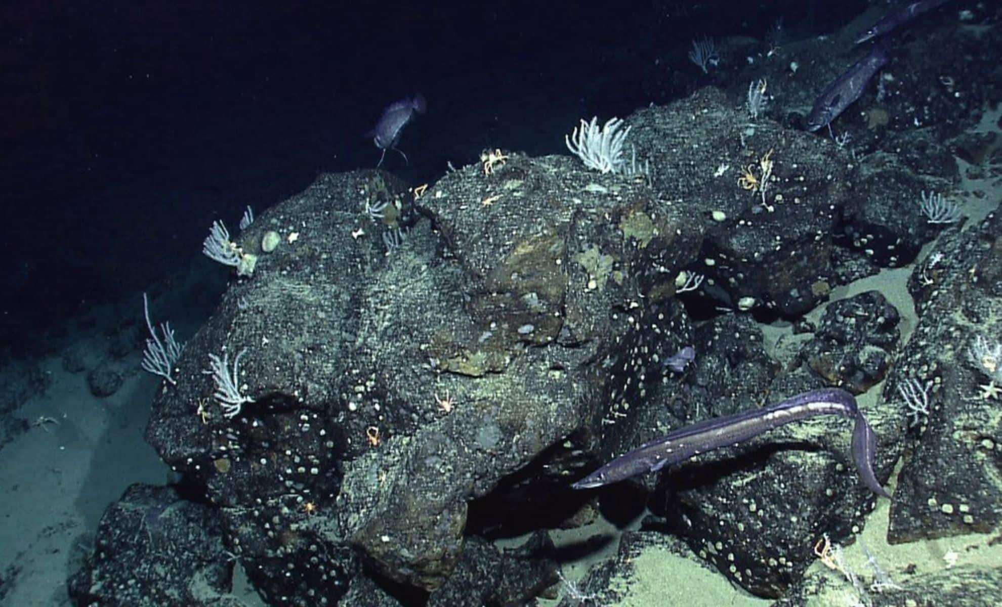
- Abyssal hills, which constitute the most widespread underwater landform, covering about 70% of the ocean floor
- Tectonic features that could deepen our understanding of the Earth’s crust evolution over millions of years
Dr. Yao Yu, an oceanographer at the Scripps Institution of Oceanography and lead author of a recent Science study, praised the detail in SWOT’s observations:
“Abyssal hills are the most abundant landform on Earth, but they’re incredibly difficult to observe. We were surprised that SWOT could see them so well.”
By analyzing these hill formations, researchers can infer historical movements of tectonic plates, enhancing predictions of seismic events, volcanic eruptions, and patterns of seafloor spreading.
- Categories:
- News


0 comments
Sign in to Comment