
Approximately five million years ago, a colossal flood may have reshaped Earth’s landscape like no other event in history. Recent geological findings reveal that a massive influx of water transformed a dry, saline basin into the vibrant Mediterranean Sea we recognize today. This dramatic flood likely surged swiftly from the Atlantic Ocean through the Strait of Gibraltar, reshaping the region in just months or years.
The Rapid Emergence of the Mediterranean Sea
Prior to flooding, the area that is now the Mediterranean was predominantly a parched, salty depression disconnected from the Atlantic Ocean. Scientists propose that a sudden, immense surge of Atlantic water forcefully entered through the Strait of Gibraltar. This powerful torrent is believed to have carved a deep channel, which became the cradle of the Mediterranean Sea. It is estimated that this flood unleashed water volumes about 1,000 times greater than the current Amazon River flow, radically altering the area's topography.
This transformative concept, known as the Zanclean megaflood, was introduced in a seminal 2009 publication. It draws heavily on discoveries of submerged canyons within the Strait of Gibraltar, believed to be carved by this sudden cataclysm. Although some scientists continue to debate this hypothesis, it remains a focal point of ongoing exploration.

Latest Research Reinforces the Megaflood Theory
New geological analyses bolster support for this megaflood hypothesis. Researchers have been studying sedimentary rock layers dating back to the Zanclean age to uncover traces of the flood’s effects. These strata reveal a narrative of the Mediterranean’s dramatic evolution. Beneath the seabed lies a thick salt deposit confirming a past where tectonic movements isolated the Mediterranean from the Atlantic. Above this, sediment layers containing fossils from low-salinity lakes indicate a prolonged arid environment before the flood.
The transition in sediment layers provides crucial clues: deep-sea sediments resting above the salt point to the sudden creation of a much deeper, salt-rich Mediterranean Sea after the flood. This evidence further confirms the notion that a gigantic offshore flood reshaped the region.
Geological Evidence of the Flood’s Power
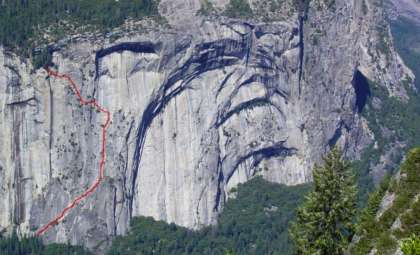
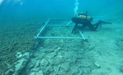
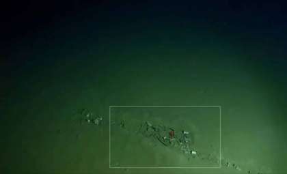
Among the strongest proofs for the Zanclean megaflood are distinctive rock formations showcasing unusual depressions. A seasearch led by Maltese geologist Aaron Micallef uncovered these features, comparable to those left by other known megafloods. The rock faces exposed to floodwaters closely resemble formations in Washington state, where an ancient megaflood also sculpted the landscape.
The team inferred these depressions resulted directly from the colossal floodwaters. Further examination revealed scattered rock fragments, including large boulders, across Mediterranean hills. These fragments match those found within the depressions, strengthening the argument that the flood was responsible for major geological reshaping.
Simulating the Mega Inundation
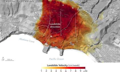
To support their findings, scientists Daniel García-Castellanos and Paul Carling created a computer model simulating the flood pathway across the Sicily Sill.
The simulation demonstrated that floodwaters would have flowed along the streamline patterns of the terrain, perfectly aligning with the orientation of the hills, thus validating the hypothesized flood route. These results emphasize how rapidly the Mediterranean Sea could have formed as waters cut through the landscape at incredible speed. Ongoing research continues to shed light on this ancient natural event’s extraordinary impact.
- Categories:
- News


0 comments
Sign in to Comment