
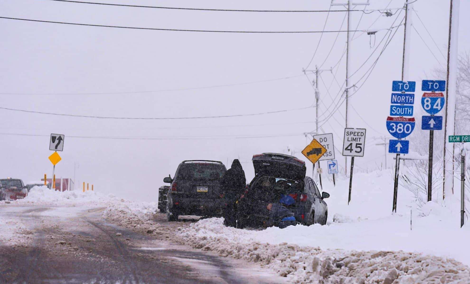
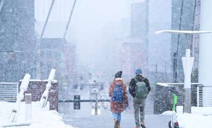
A severe lake-effect snow event is currently causing widespread travel disruptions throughout the Great Lakes area, impacting New York, Pennsylvania, Ohio, and Michigan with heavy snowfall and hazardous cold conditions. This storm, which started over the Thanksgiving holiday, has already deposited close to 4 feet of snow in certain locations and is anticipated to continue causing difficulties in transportation all week. Interstate 90 (I-90), a crucial corridor running east to west, remains heavily affected, with closures and dangerous driving conditions persisting in both New York and Pennsylvania.
Lake-Effect Snowfall Intensifies in the Area
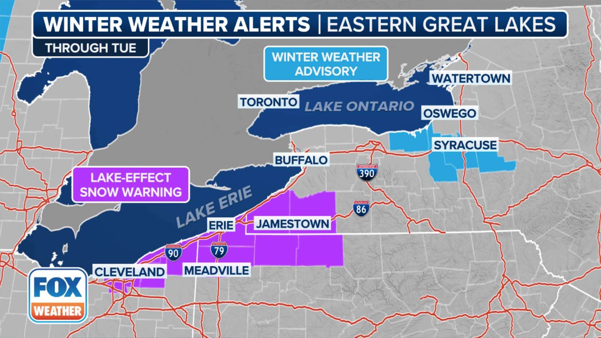
Heavy snow showers began overnight in western Michigan, with forecasts predicting up to one foot (30 cm) of accumulation on Monday. The National Weather Service has issued warnings for more snow expected on Wednesday and Thursday, accompanied by strong winds and very low temperatures.
“Bands of lake-effect snow will mainly impact shore areas during the morning commute,” explained the Grand Rapids weather office. These snow bands are leading to rapid drops in visibility, creating hazardous driving conditions.

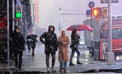
Lake-effect snow alerts remain active in parts of Ohio, New York, and Pennsylvania until Tuesday night, primarily affecting lakeshore regions. The National Weather Service cautioned, “Lake-effect snow will cause sudden visibility changes and slick, snow-covered roads.”
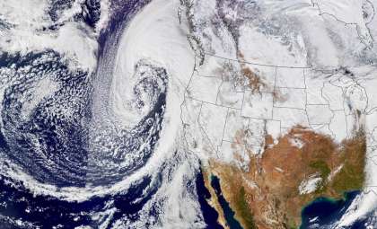
This storm originates from warm, moist air crossing the Great Lakes, resulting in nearly four feet (1.2 meters) of accumulated snow over the weekend in upstate New York, sections of Michigan, and Pennsylvania, leading to significant travel setbacks.
Thanksgiving Weekend Snowstorm Delays NFL Match
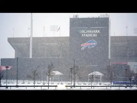
The storm’s impact extended beyond roadways, disrupting the NFL game between the Buffalo Bills and the San Francisco 49ers at Highmark Stadium in Orchard Park, New York. Beginning Saturday and persisting into Sunday, heavy snow fell just before kickoff, intensifying throughout the contest.
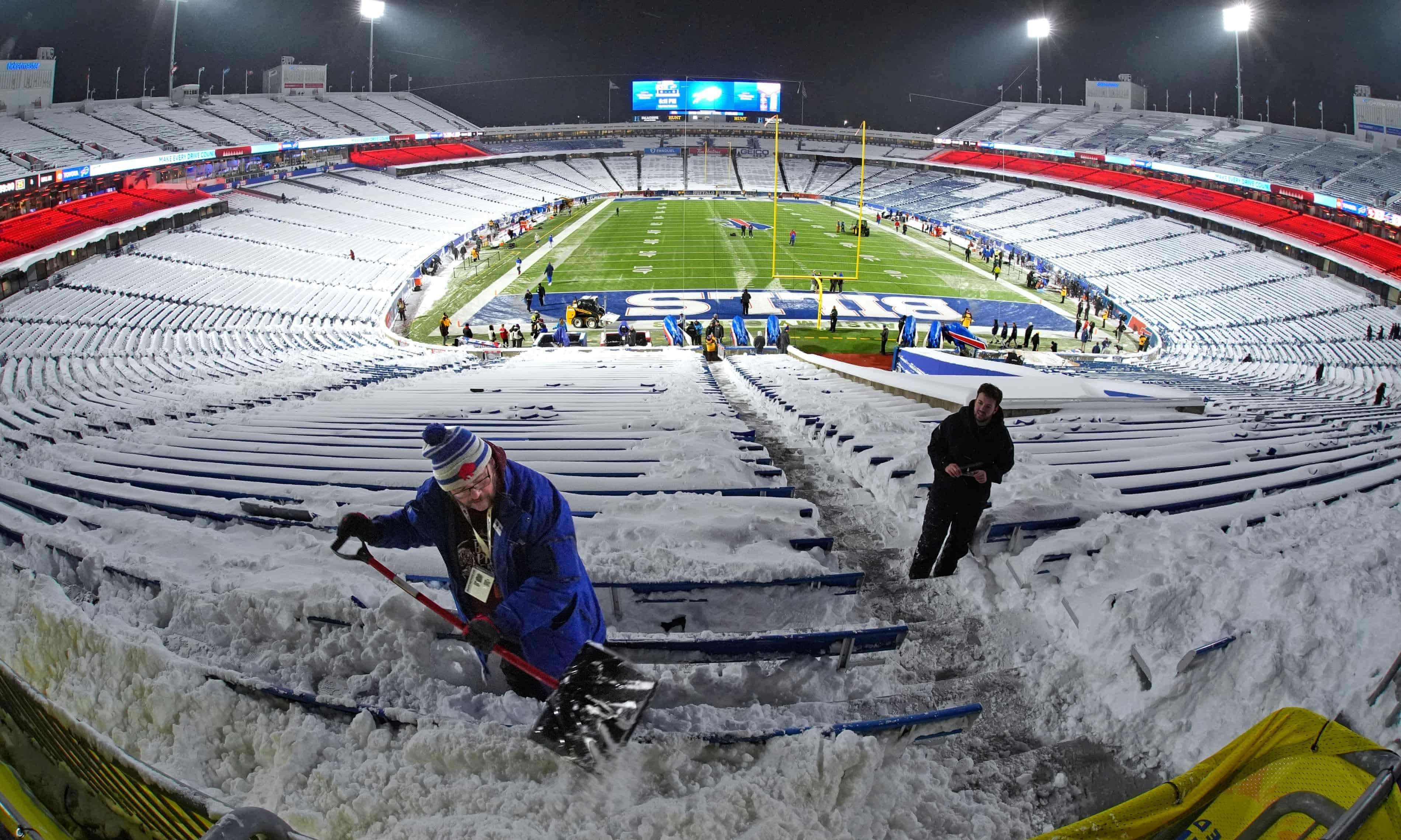
Although temperatures hovered around 27°F (-3°C) with wind chills dropping to 17°F (-8°C), Bills fans enthusiastically embraced the cold weather. Tim LoTemple, a passionate season-ticket holder, noted, “We love snow over here. You know how Bills Mafia is, we love the cold.”
In contrast, Jake Dyer, an Indianapolis Colts fan visiting from Southern California, found the cold challenging. “The only thing I didn’t prepare for was shoes,” he said. Regardless, the Buffalo Bills’ home field remained a fierce playing ground for both supporters and players.
Emergency Declarations in New York and Pennsylvania
Amid the growing severity of the snowstorm, affected areas in New York and Pennsylvania have announced states of emergency. Erie County in Pennsylvania experienced nearly 2 feet (61 cm) of snowfall, leading to the shutdown of municipal buildings and public services. Pennsylvania Governor Josh Shapiro declared a disaster emergency in response to the substantial snow accumulation in the northwest parts of the state.
Meanwhile, Michigan’s Upper Peninsula has faced lake-effect snow accumulations exceeding 2 feet (61 cm), complicating recovery and rescue efforts. According to meteorologist Lily Chapman of the National Weather Service, an estimated 27 inches (69 cm) fell north-east of Ironwood, Michigan, with the eastern Upper Peninsula expecting up to another foot (30.5 cm) by Monday morning.
Snow totals reported in the region include:
- Close to 2 feet (61 cm) in Erie County, Pennsylvania.
- 27 inches (69 cm) recorded northeast of Ironwood, Michigan.
- Up to 4 feet (1.2 meters) in certain areas of upstate New York.
Freezing Temperatures Persist as Snowfall Continues
As Arctic air masses linger, temperatures are forecast to remain 10 to 20°F (-12°C to -6°C) below normal, increasing the risk of hazardous conditions. The cold air is expected to extend across the eastern United States by Monday, with the Great Lakes and surrounding zones facing particularly frigid weather. The National Weather Service warns travelers to remain vigilant due to ongoing heavy snowfall and freezing temperatures.
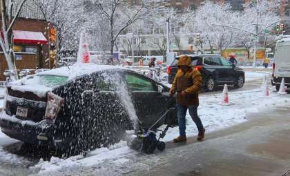
Emergency crews are actively working to clear roads and carry out rescues, but persistent snow and gusty winds continue to hinder recovery efforts. Local leaders emphasize, “The National Guard has been essential in managing this ongoing disaster,” highlighting the crisis’ seriousness. The lake-effect snowstorm is projected to last through the week, with snow bands reaching further southward.
- Categories:
- News ,
- Climate change


0 comments
Sign in to Comment