
Deep within Canada’s Yukon Territory, geologists have uncovered evidence of a potentially active seismic threat. The Tintina fault, which was long believed to be dormant for millions of years, now shows signs of ongoing tectonic movement. This revelation raises alarms for the safety of regional infrastructure, including key roadways and mining sites.
The Tintina Fault: A Crucial Geological Structure
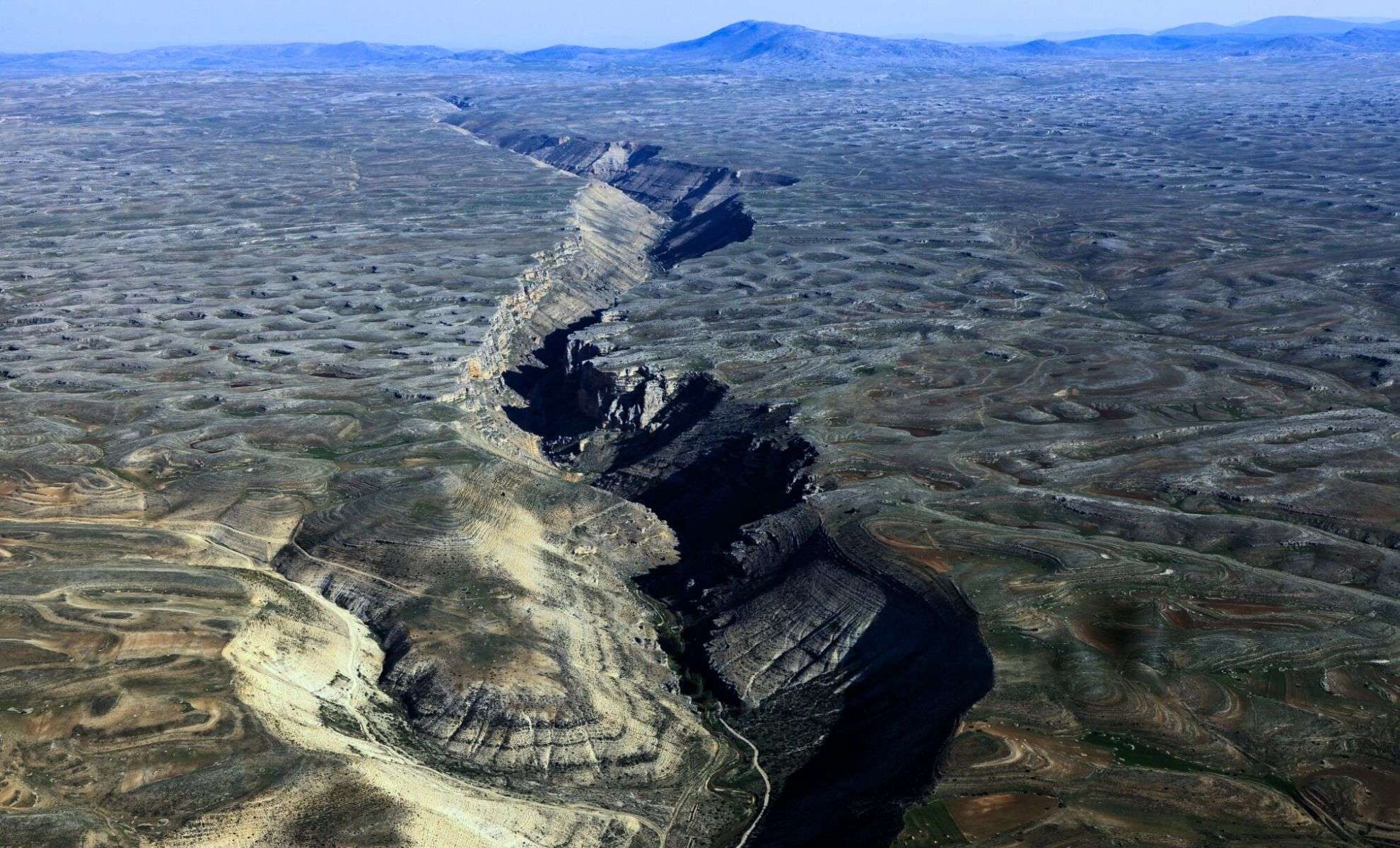
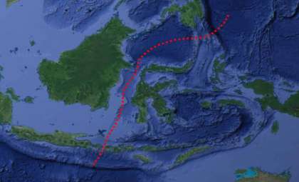
Extending more than 1,000 kilometers (621 miles) from the Yukon into Alaska, the Tintina fault stands as a prominent feature of western North America’s geology. It parallels the Yukon River and represents a major boundary where two tectonic plates converge. Over millions of years, this fault has shifted laterally by approximately 450 kilometers (280 miles), making it vital for interpreting the region's seismic framework.
Historically, researchers assumed the fault had been inactive for about 40 million years, due to an absence of recorded quakes. However, new investigations suggest the potential for major slips, indicating that the fault may still pose a significant earthquake hazard.

Cutting-Edge Techniques Reveal Fault Activity
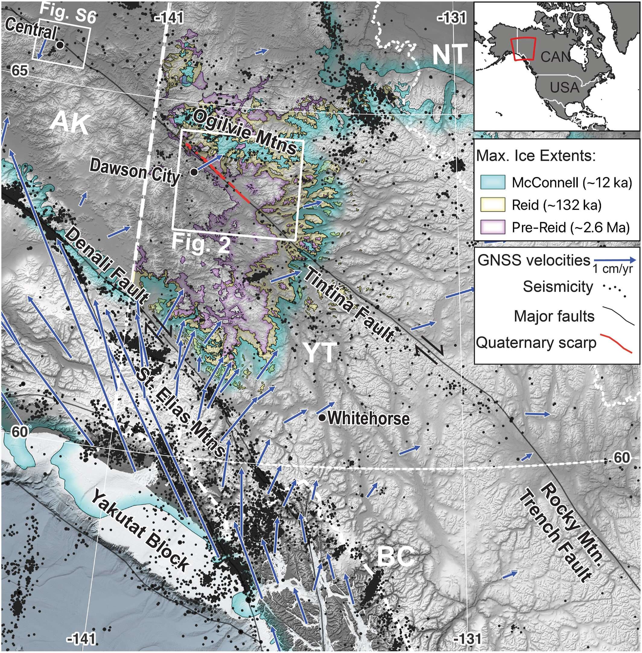
Scientists from the University of Victoria, the Geological Survey of Canada, and the University of Alberta utilized advanced technology to reassess the Tintina fault’s status. They analyzed high-resolution satellite topography alongside LIDAR data collected via drones and aircraft, revealing precise landform variations linked to fault movements.
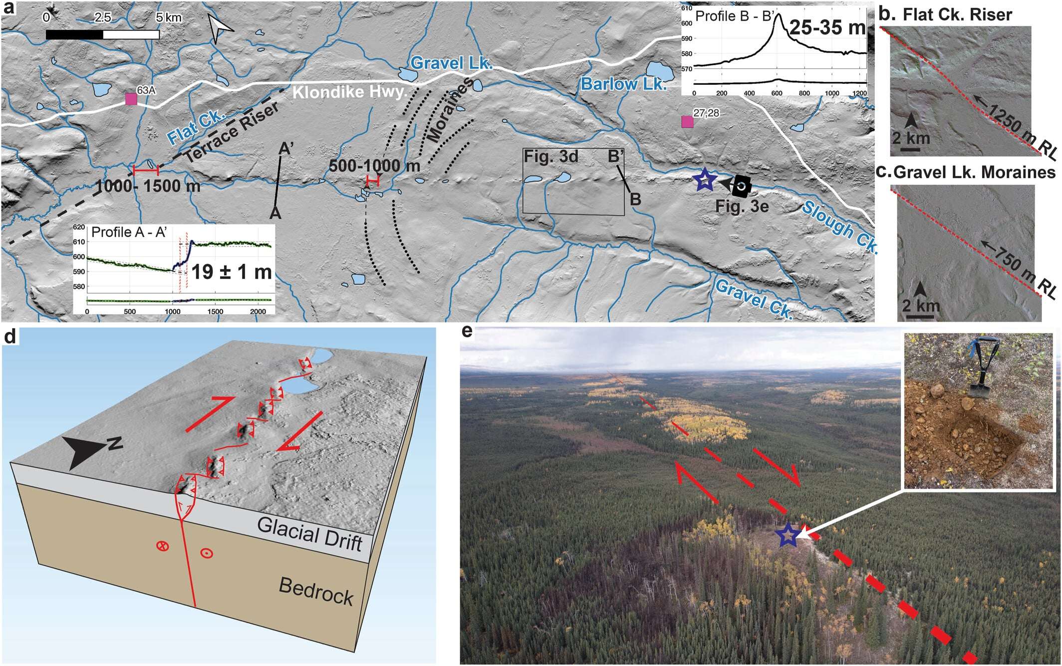
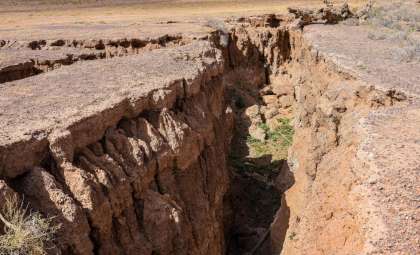
A critical discovery involved fault scarps, which are steep slopes formed by vertical displacement along the fault. Published in Geophysical Research Letters, the study shows some scarps correspond to landforms dating back up to 2.6 million years with vertical offsets reaching 1,000 meters. Other, younger landforms demonstrated smaller but notable displacements, establishing ongoing seismic activity throughout the Quaternary Period.
These insights indicate that the Tintina fault has experienced numerous significant earthquakes in the past and continues to hold the potential for major seismic events.
What This Means for Future Earthquake Risks
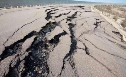
Though no major earthquakes have struck the fault region in the last 12,000 years, the fault is still accumulating geological strain at a rate between 0.2 and 0.8 millimeters per year. This gradual build-up raises the possibility that accumulated energy might one day be released suddenly, causing a powerful earthquake.
The report highlights a “slip deficit” potentially reaching six meters, suggesting the fault could be nearing a rupture threshold. If this energy were unleashed, it could trigger a quake with a magnitude exceeding 7.5.
Such an event could severely impact Dawson City and neighboring communities, disrupting critical transportation networks and mining infrastructure. Additionally, the area’s vulnerability to landslides may intensify the consequences of a significant seismic event.
- Categories:
- News


0 comments
Sign in to Comment