
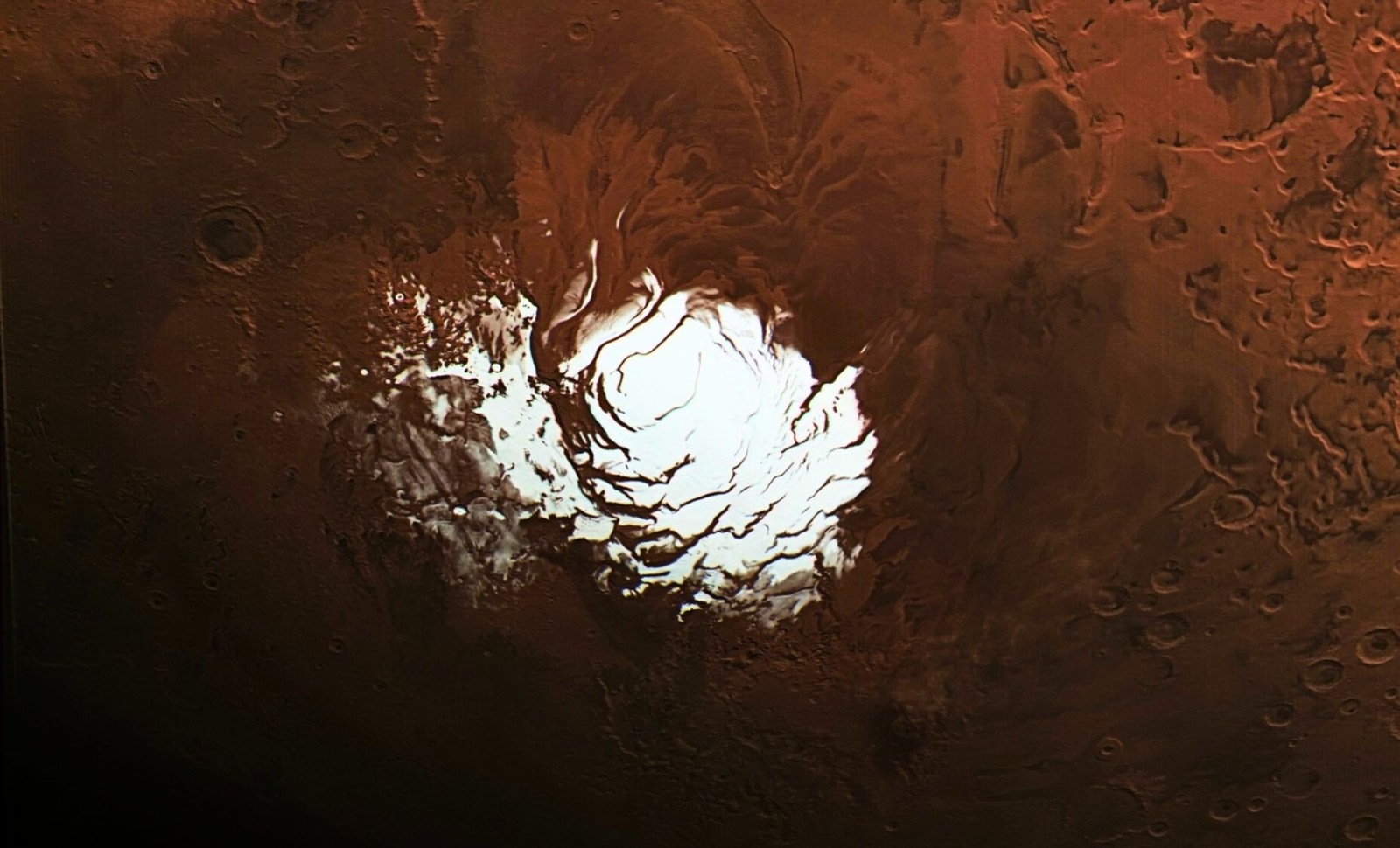
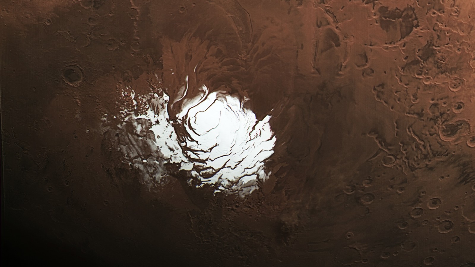
One of the most exciting planetary discoveries in recent years was the suggestion of an underground liquid water lake beneath Mars’ southern ice cap. Initially detected in 2018 by researchers using the European Space Agency’s Mars Express orbiter, the unusual radar echo ignited speculation about potential habitats for microbial life and promising water sources for human exploration.
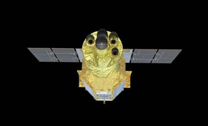
However, new radar analyses conducted with NASA’s Mars Reconnaissance Orbiter (MRO) are now calling that conclusion into question. This advanced radar technique offers a clearer and deeper view below Mars’ surface and suggests the signal may not indicate liquid water after all. Rather, it could be caused by reflections from subsurface rock or sediment formations.
Even as the hypothesis of a polar lake diminishes, the enhanced radar method is gaining attention for its ability to examine other potentially ice-rich areas on Mars. This is crucial for robotic and human missions targeting the 2030s, where reliable water sources will be vital.

Sharper Radar Technology Sheds New Light Beneath Mars’ Ice
The first intriguing radar signal came from the Mars Advanced Radar for Subsurface and Ionospheric Sounding (MARSIS) instrument aboard the ESA spacecraft. This intense radar reflection was interpreted as a possible briny subsurface lake beneath the southern polar ice. However, MARSIS’s capability for deep ice penetration was limited, and no confirming data was available at the time.
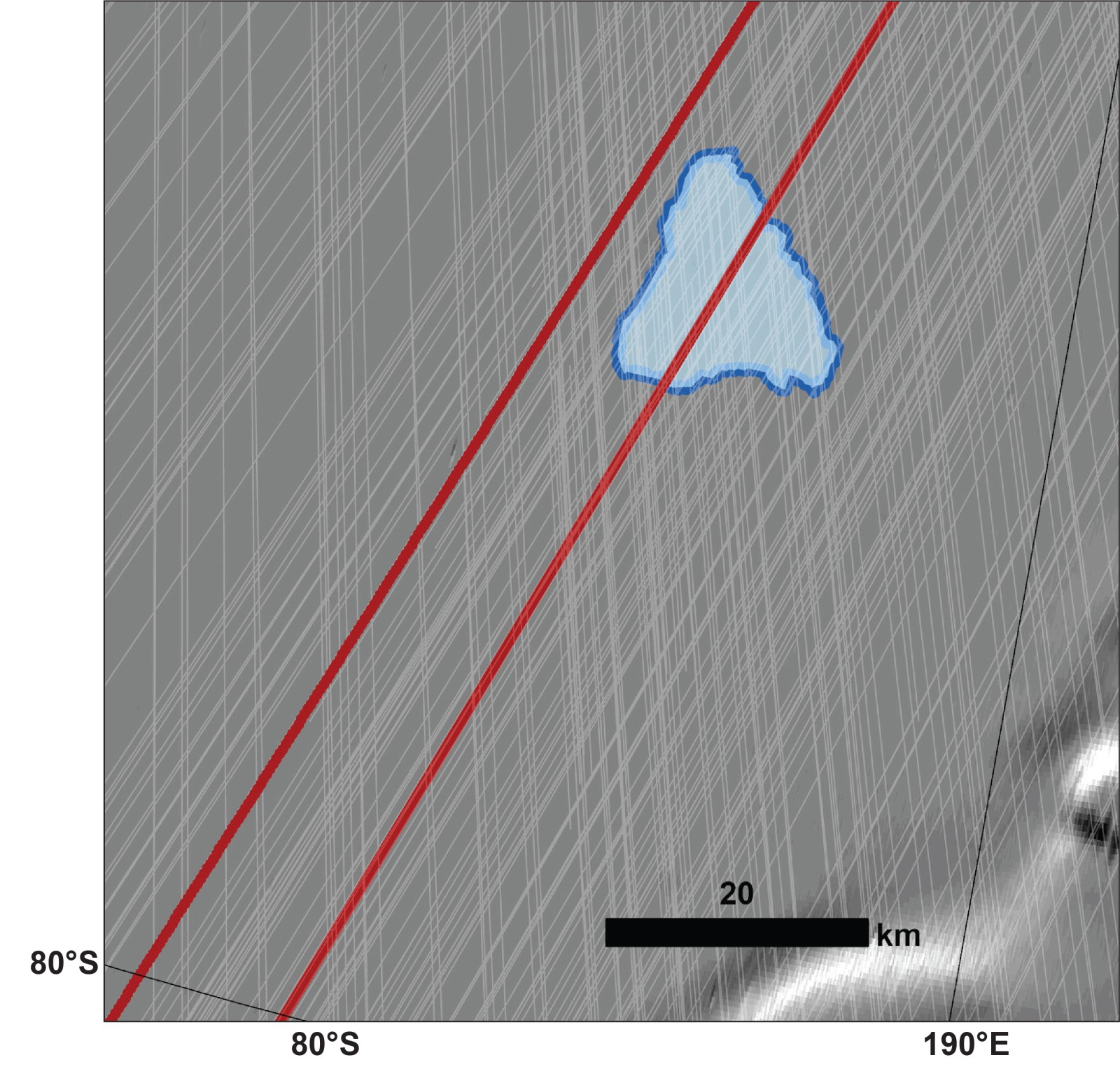
NASA’s SHARAD (Shallow Radar) instrument on MRO had scanned the same region but found no similar reflections—until a recent experiment. By rotating the orbiter 120 degrees in a maneuver called a “very large roll,” the SHARAD team enhanced the radar’s sensitivity and depth reach below the ice.
“We’ve been observing this area with SHARAD for almost 20 years without seeing anything from those depths,” said Than Putzig, SHARAD co-investigator at the Planetary Science Institute, according to NASA.
The findings were revealing: the enhanced SHARAD scans detected only a weak echo from the region, much less than MARSIS had reported. Adjacent areas showed no comparable signals. This inconsistency implies that the strong reflection detected earlier might stem from a different source.
Rather than liquid water, the SHARAD data suggest the radar signal may originate from a relatively smooth underground area—perhaps composed of volcanic rock—that could generate a similar reflective signature. As lead scientist Gareth Morgan stated, “this new data doesn’t close the case, but it strongly challenges the liquid water lake interpretation.”
Refocusing on More Accessible Ice Reserves
With the idea of a Martian lake at the south pole becoming less likely, researchers are now concentrating on other sites where buried ice might be easier to reach and more practical for astronauts. NASA’s Subsurface Water Ice Mapping (SWIM) initiative combines twenty years of observations from MRO, Mars Odyssey, and Mars Global Surveyor to locate ice just below the Martian surface in the planet’s northern mid-latitudes.
The SWIM program focuses on areas such as Arcadia Planitia and Deuteronilus Mensae which balance ideal conditions for spacecraft landing, temperature stability, and sunlight. These zones lie between the frigid poles and warmer equator, offering promising sites for future missions.
“This data allows us to draw that line with a finer pen instead of a thick marker,” said Sydney Do, SWIM project leader at NASA’s Jet Propulsion Laboratory, in NASA’s JPL feature.
By analyzing where five independent sets of data—thermal imaging, radar scans, hydrogen measurements, high-resolution surface photographs, and neutron detection—overlap, scientists identify prime locations for ice deposits. These become top candidates for landing and exploration.
Accessing subsurface ice on Mars is not just vital for drinking water but also for creating fuel, cultivating food, and sustaining life-support systems, which could drastically reduce the massive supply loads missions now require from Earth.
Delivering Deeper Insights with Tactical Maneuvers
The innovative SHARAD roll maneuver has become crucial for these discoveries. Though initially a risky operation due to the instrument and spacecraft design, the 120-degree rotation has enabled radar beams to bypass structural obstacles and probe deeper into Mars’ subsurface layers. This technique, developed by teams at JPL and Lockheed Martin, balances improved detection capabilities with spacecraft stability.
NASA is applying this maneuver at other significant locations like Medusae Fossae, a large equatorial formation that yields minimal radar reflection. Scientists speculate this might indicate deeply buried ice or thick volcanic ash layers—both of great interest for future exploration.
In addition, NASA’s Mars Exploration Program collaborates internationally on the prospective Mars Ice Mapper mission with agencies from Italy, Canada, and Japan, aiming to launch a dedicated orbiter to map shallow water ice worldwide. This would refine landing site assessments and resource planning for upcoming missions.
- Categories:
- Science


0 comments
Sign in to Comment