

The National Oceanic and Atmospheric Administration (NOAA) has released an update indicating the likely onset of La Niña this autumn, with strong chances it will persist through the winter season.
La Niña is defined by below-average sea surface temperatures in the central and eastern parts of the Pacific Ocean and plays a crucial role in influencing worldwide climate patterns.
This emerging climate condition is expected to influence the remainder of the Atlantic hurricane season and significantly affect winter weather across North America.

Observations and Outlook
As of early August, ocean conditions along the equatorial Pacific Ocean are neutral, with sea-surface temperatures near their long-term averages. This neutral status, where neither El Niño nor La Niña predominates, has been stable during summer, supporting balanced weather patterns globally.
Recent observations point toward a changing trend. NOAA reports a 66% likelihood that La Niña will start developing between September and November, which rises to a 74% probability of it continuing through winter, spanning November to January. These projections underscore an increasing chance that La Niña will drive important climatic events in the near future.
The prediction depends heavily on the cooling trend of the sea surface in the central and eastern Pacific. Although this cooling has been slower than forecasts suggested, conditions both in the ocean and atmosphere still favor the development of La Niña.
As temperatures in the key Pacific regions steadily decrease, the shift from neutral conditions to a full La Niña phase is anticipated, triggering cascading effects in global weather. The timing of this change will have important consequences for the concluding weeks of the Atlantic hurricane season and winter onset across various areas.
Weather Consequences Linked to La Niña
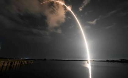
The arrival of La Niña tends to disrupt weather significantly, especially throughout the United States. It is commonly linked with a more active hurricane season in the Atlantic. This year already features four named storms, including Beryl and Debby, both of which made landfall in the U.S.
The atmosphere during La Niña episodes generally experiences reduced wind shear, a factor that encourages the strengthening and formation of tropical storms and hurricanes. Lower wind shear fosters a conducive environment for storms to grow, potentially prolonging the hurricane season and intensifying storm activity.
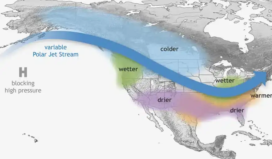
Beyond hurricanes, La Niña tends to generate notable alterations in winter weather across North America. The southern states are likely to face warmer and drier conditions, which could worsen drought situations and heighten wildfire danger.
These climatic shifts may impact agriculture, water supplies, and energy usage substantially. Conversely, the Northern Plains are expected to endure colder-than-normal winters with a higher chance of frequent and severe snowstorms.
Meanwhile, the Pacific Northwest could experience increased precipitation during winter, resulting in more rainfall and snow accumulation that may influence water resources and crop yields locally. These varied outcomes highlight the broad and intricate effects La Niña exerts on weather and climate patterns.
Delayed but Ongoing Development
While La Niña is projected to emerge this fall, the sea surface cooling signaling its start has proceeded more slowly than forecasted. Despite this slower pace, favorable oceanic and atmospheric elements persist, promoting the phenomenon’s formation.
The gradual drop in Pacific sea surface temperatures continues toward the thresholds required for La Niña, though later than expected. This delayed progression might affect the timing and potency of the weather impacts associated with La Niña.
The prolonged neutral phase has extended the time before La Niña takes hold, but a swift transition remains possible. Forecasters will closely track the Pacific’s cooling rate to assess how and when this shift influences global climate dynamics.
Once La Niña establishes itself, it could usher in substantial weather modifications, particularly as it coincides with peak hurricane activity and the arrival of winter. This delicate interplay between ocean and atmospheric conditions demonstrates how complex weather forecasting can be and underscores the need for ongoing scrutiny as the seasons change.
- Categories:
- News ,
- Climate change


0 comments
Sign in to Comment