

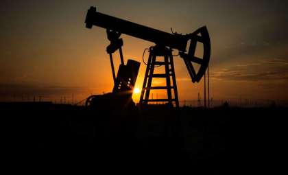
Tracking methane emissions from industrial sources has long posed significant hurdles in climate change mitigation efforts. However, the emergence of an innovative fleet of private satellites is changing the landscape. Scientists at GHGSat Inc. have engineered a technique to accurately detect methane leaks emanating from oil, gas, and coal operations worldwide, providing a vital resource for oversight and reduction strategies. This advancement represents a key development in tackling one of the most potent greenhouse gases accelerating global warming.
Creating a Comprehensive Methane Emission Map Using Satellite Technology
Tackling climate change demands a thorough understanding of methane emissions, a complex task traditionally reliant on inexact ground and atmospheric measurements. Enter the latest satellite-based technology pioneered by Canadian firm GHGSat Inc., which deploys a coordinated cluster of satellites designed to continuously monitor methane releases from industrial facilities around the globe with remarkable accuracy.
Lead researcher Dylan Jervis explained in their Science paper that this satellite system delivers “the first global gridded estimate of annual methane emissions from facility-scale measurements.” Such precision allows for identifying emission sources down to specific facilities, surpassing earlier methods that only provided broad national-level data.

Detecting Emissions from Concentrated Oil, Gas, and Coal Sources
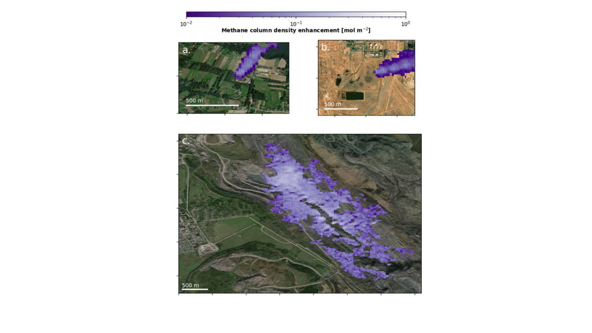
GHGSat’s breakthrough hinges on isolating high-output “point sources” such as flare stacks, coal vents, and surface mines, which emit concentrated methane volumes with significant environmental impact. Using high-resolution imagery, the system pinpoints methane plumes and quantifies emission levels accurately.
The 2023 study estimates emissions exceeding 9 million tons annually from over 3,000 facilities worldwide associated with oil, gas, and coal industries. These methane releases contribute profoundly to global warming due to methane’s high heat-trapping capability despite its relatively short atmospheric lifespan.
The research also identified notable emission trends.
“The countries where we measure the largest oil and gas methane emissions are Turkmenistan, the U.S., Russia, Mexico and Kazakhstan,” Jervis said. “For coal emissions, China and Russia are the major contributors.”
Such insights pinpoint the highest-emitting regions, guiding targeted mitigation efforts for maximal climate benefit.
Addressing the Complexity of Intermittent Methane Releases
Despite the system’s accuracy, emissions from oil and gas operations pose a measurement challenge due to their irregular nature, fluctuating with plant activities. Traditional monitoring often fails to capture these episodic leaks because of infrequent observation intervals.
GHGSat’s satellites, by contrast, offer regular methane plume surveillance, enabling detection of emissions previously missed. The investigation showed oil and gas facilities emit detectable methane roughly 16% of the time, while coal sites demonstrate steadier emission rates. This variability highlights the need for persistent observation to capture a true emission profile.
“These data help deepen our understanding and improve predictions of methane output, providing critical information to steer reduction measures,” Jervis emphasized, underscoring the satellites’ role in advancing climate action planning.
Significance of Monitoring Emissions at the Facility Level
A pivotal conclusion of the study is that addressing emissions requires monitoring with granularity down to individual sites. While national or regional inventories offer broad insights, they cannot accurately identify specific emission sources. GHGSat’s approach fills this gap by delivering detailed, site-specific emission data that can directly inform mitigation strategies.
“We found moderate agreement between GHGSat-measured emission estimates and bottom-up inventory predictions at the country level, but very little agreement at 0.2 degree x 0.2 degree spatial resolution,” Jervis explained.
This gap reflects limitations in bottom-up inventories that are based on general industry activity rather than actual emissions at fine spatial scales.
By concentrating efforts on individual facilities, emission reduction initiatives can be more effectively prioritized, ensuring strategic use of resources and enhanced environmental impact.
Growing the Satellite Fleet to Enhance Monitoring Capabilities
GHGSat’s current satellite lineup already offers unmatched global methane surveillance, but expansion remains underway. The company introduced four additional satellites in 2023—two launched in June and two more in November—bringing the total constellation to 14 orbiters. These enhancements allow for increased revisit rates and finer monitoring resolution over time and space.
“With more satellites in orbit, we’ll be able to detect more emissions and monitor them more frequently,” Jervis said.
This development is particularly vital for capturing intermittent methane leaks that are otherwise difficult to observe, enabling rapid detection and mitigation responses to reduce their climate impact.
- Categories:
- Science


0 comments
Sign in to Comment