
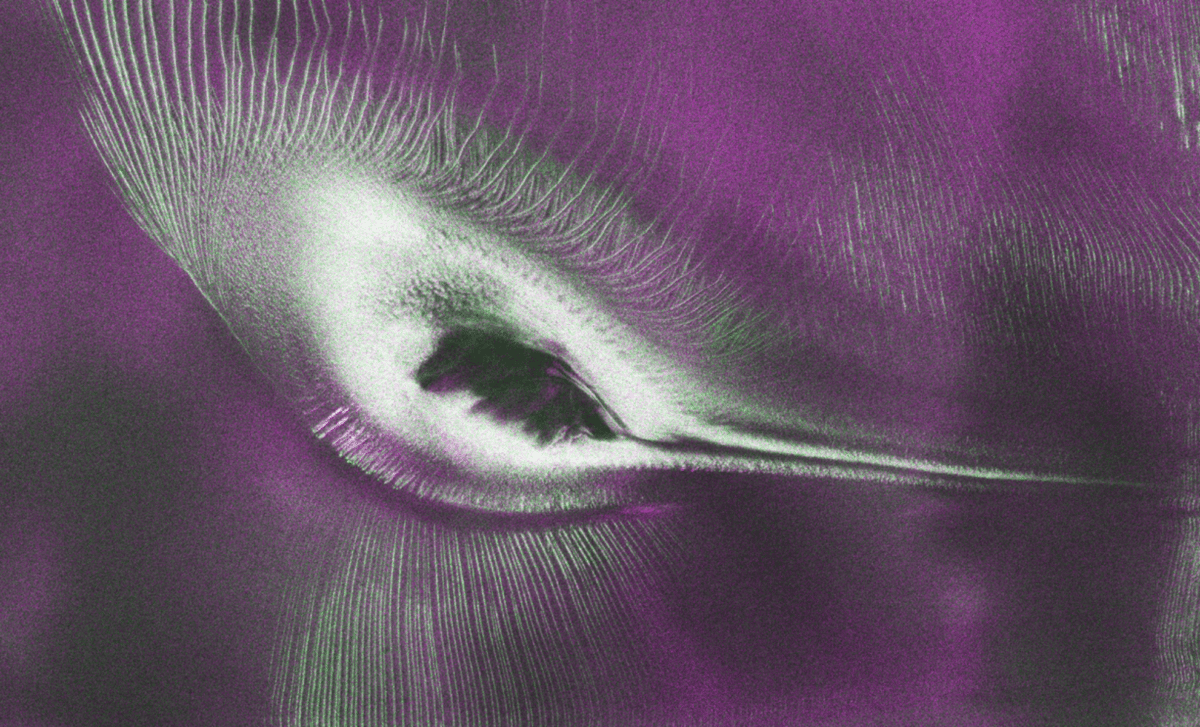
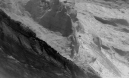
The NISAR satellite has captured a groundbreaking radar image exposing concealed formations beneath an Antarctic glacier, enabling researchers to study ice dynamics in one of Earth’s most isolated regions, according to NASA.
This latest image centers on Antarctica’s Thwaites Glacier, where enhanced radar sensing techniques help scientists track changes that remain undetectable by conventional optical satellites. The findings underscore the power of spaceborne instruments in unveiling phenomena beneath layers of ice and snow.
Innovative Spaceborne Technology Reveals Antarctica’s Subsurface Ice
The joint NASA and Indian Space Research Organisation (ISRO) initiative, NISAR, offers observations surpassing the capabilities of standard satellite imagery. Utilizing synthetic aperture radar, the satellite gathers data regardless of weather, lighting conditions, or polar weather challenges.

The Antarctic ice sheet is characterized by intricate glacier movements interacting with the terrain beneath. Tracking these shifts is critical to assessing potential impacts on future sea level changes.
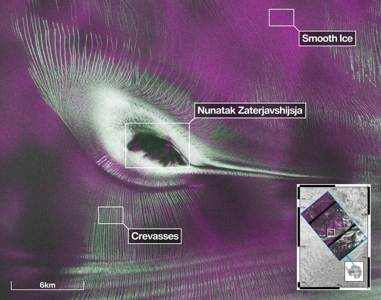
The released radar image displays intricate details within the glacier, highlighting features tied to ice flow and deformation. Unlike optical imaging, radar signals penetrate snow layers to reveal underlying structures.
NASA notes that this image exemplifies NISAR’s ability to detect aspects of Antarctic ice unseen by traditional space-based cameras. This capability provides scientists an invaluable method for investigating glacier transformations both on and beneath the surface.
Radar Systems Illuminate New Perspectives on Glacier Behavior
The NISAR mission contributes additional insights by detecting minute ice movements over time. Its radar instruments precisely track surface displacements, aiding scientists in monitoring glacier acceleration or shifts in flow patterns.
As reported by NASA, data from the mission bolsters research on natural disasters, climate change mechanisms, and environmental transformations in vulnerable regions. Antarctica’s extensive ice reserves remain vital due to their potential to significantly alter global sea levels if they undergo major changes.
“First, it’s a beautiful image, with rich details of features that provide insights to how the glacier is moving. Then, because radar can often see through snow and deep into the ice, NISAR can observe fundamentally different properties of Antarctic ice than can be seen in optical imagery,” said Seongsu Jeong, the signal analysis engineer who produced the image at NASA’s Jet Propulsion Laboratory in Southern California. “With NISAR we’re seeing what’s hidden beneath the surface.”
This statement highlights radar’s crucial role in contemporary polar exploration. Traditionally, glacier dynamics have been studied using various satellite platforms, fieldwork, and aerial surveys.
The Significance of Antarctic Radar Mapping for Future Studies
The Thwaites Glacier is intensely scrutinized worldwide for its vast scale and impact on rising sea levels. Efforts continue to decipher the factors governing its motion and long-term stability.
While the new radar data does not yet predict the glacier’s future, it enhances understanding of subsurface processes. Hidden cavities, subglacial channels, and internal ice layers critically influence the glacier’s reaction to environmental variations.
NISAR is designed to repeatedly gather surface data over time, creating an essential archive of Earth’s evolving dynamics. For Antarctica, continuous monitoring enables scientists to detect subtle trends that single observations might miss.
By integrating radar observations with complementary datasets, researchers are building more accurate models of glacier mechanics. These improved forecasts assist in anticipating how polar ice sheets could respond to climatic shifts in the decades ahead.
- Categories:
- Nasa





0 comments
Sign in to Comment