
A striking natural occurrence has come to light on the Nullarbor Plain of southern Australia: a visible tornado scar revealed through satellite images. This remarkable find highlights both the unexpected power of weather phenomena in seemingly tranquil landscapes and the vital role of modern technology in detecting such phenomena. Tornadoes are infamous for their intense energy and damage, and this event has left a clear impression.
What was the intensity of this tornado?
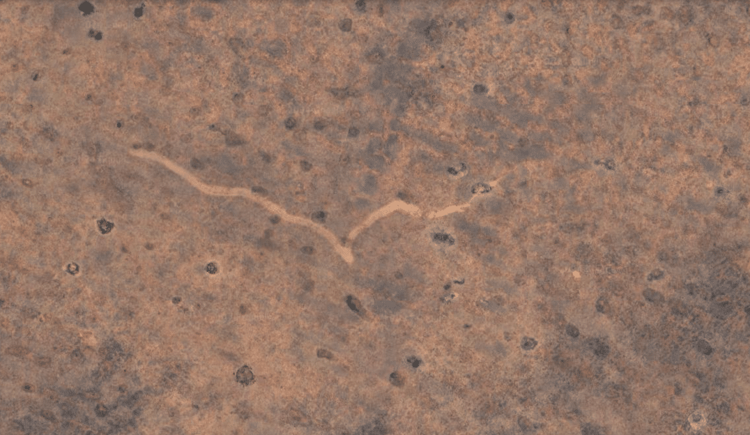
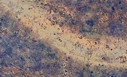
This tornado carved an unmistakable trail stretching about 6.8 miles long, with widths fluctuating between 525 and 820 feet. Wind speeds likely exceeded 124 miles per hour, underlining the strength of this atmospheric event. Though impactful, the tornado lasted only roughly 7 to 13 minutes. Interestingly, it rotated clockwise as it moved eastward, distributing debris along its path.
Who made this intriguing observation?
The anomaly was spotted by an observer exploring satellite views on Google Earth. The Nullarbor Plain is a broad, flat, and largely barren expanse spanning South Australia and Western Australia. On satellite maps, the tornado scar appeared as a narrow, elongated line with a pronounced V-shaped indentation, characteristic of a tornado’s passage.

Insights from scientific experts
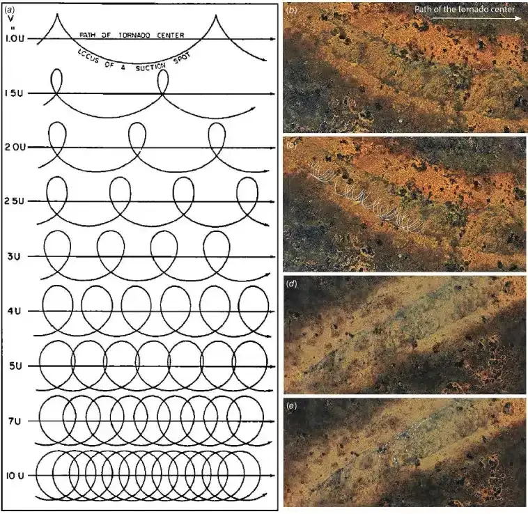
The discovery attracted the attention of Curtin University scientists in Perth. Lead geoscientist Matej Lipar extensively analyzed satellite imagery and meteorological data in a study published in the Journal of Southern Hemisphere Earth Systems Science. The research identified that between November 16 and 18, 2022, a low-pressure system and a cold front created ideal conditions for this tornado. The damage pattern exhibited “cycloidal marks,” which are definitive indicators of tornado suction vortices.
Assessing tornado strength
Based on the damage signature and atmospheric conditions, the tornado is estimated to have been an F2 or F3 on the Fujita Scale, indicating a moderate to severe destructive capacity. Tornadoes of this magnitude are uncommon in Australia but tend to occur during prolonged, intense thunderstorm activity.
Meteorologist John Allen from Central Michigan University also noted the rarity of such F2-F3 tornadoes in Australia compared to other regions worldwide.
Importance for meteorological research
The use of satellite imagery proved crucial in identifying this tornado in such a remote location, underscoring its significance as a meteorological monitoring tool for isolated areas. As Matej Lipar remarked, “Without tech’s power, we might’ve missed out on witnessing nature’s incredible strength.” This case serves as a reminder that extreme weather can strike unexpectedly, and advances in technology are key to tracking these events.
Understanding these phenomena enhances scientific knowledge and prepares us better for future weather challenges. As technology continues to deepen our insights into Earth's atmospheric behavior, vigilance and readiness remain essential in facing the powerful forces of nature.
- Categories:
- Climate change


0 comments
Sign in to Comment