
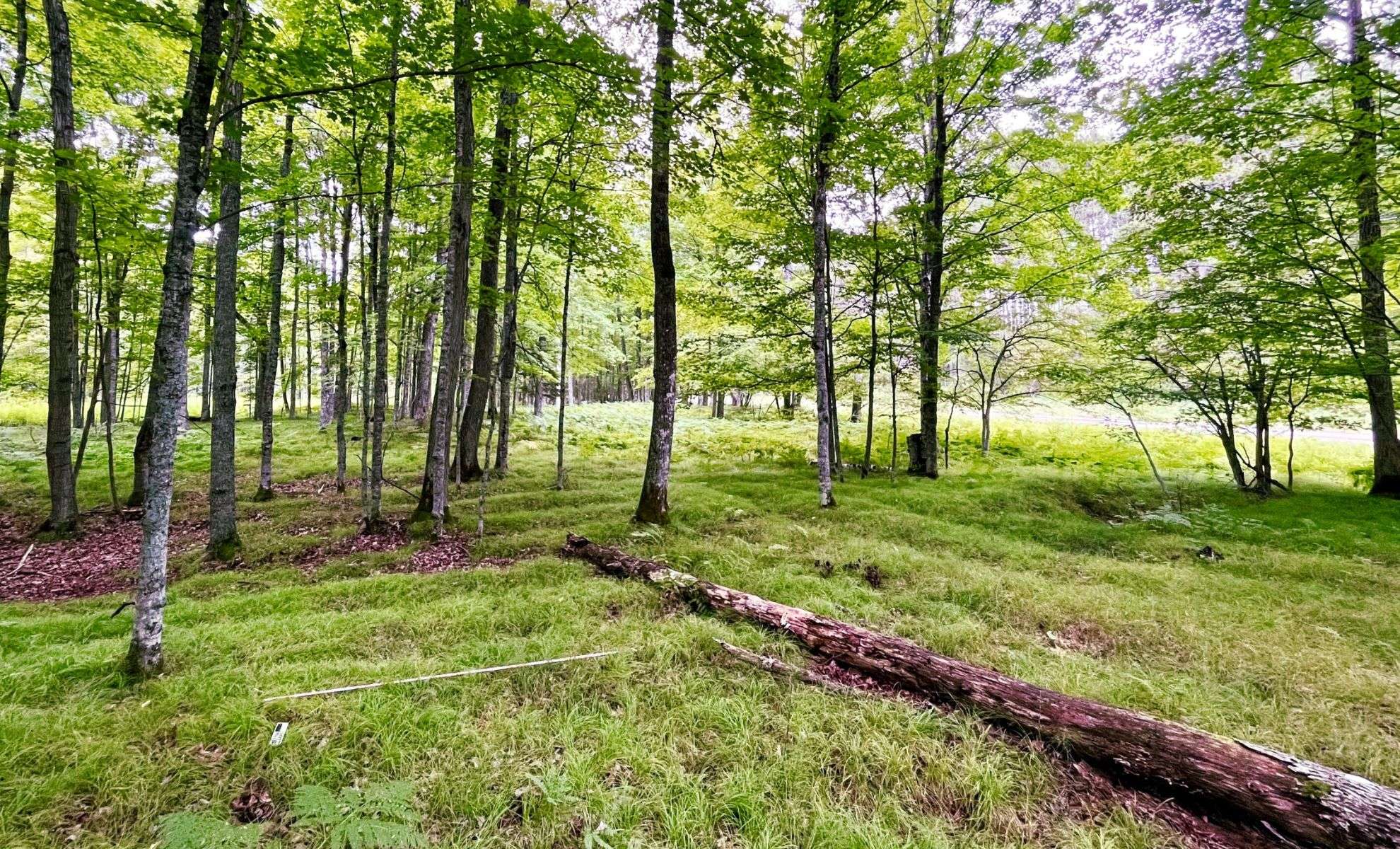
In a remote bend of the Menominee River nestled in northern Michigan’s forests, researchers have uncovered an ancient agricultural landscape that challenges established views on Indigenous farming before European contact. Buried beneath thick woodland in present-day Menominee County, the Sixty Islands archaeological site reveals an unprecedented extent of Native cultivation at a northern latitude.
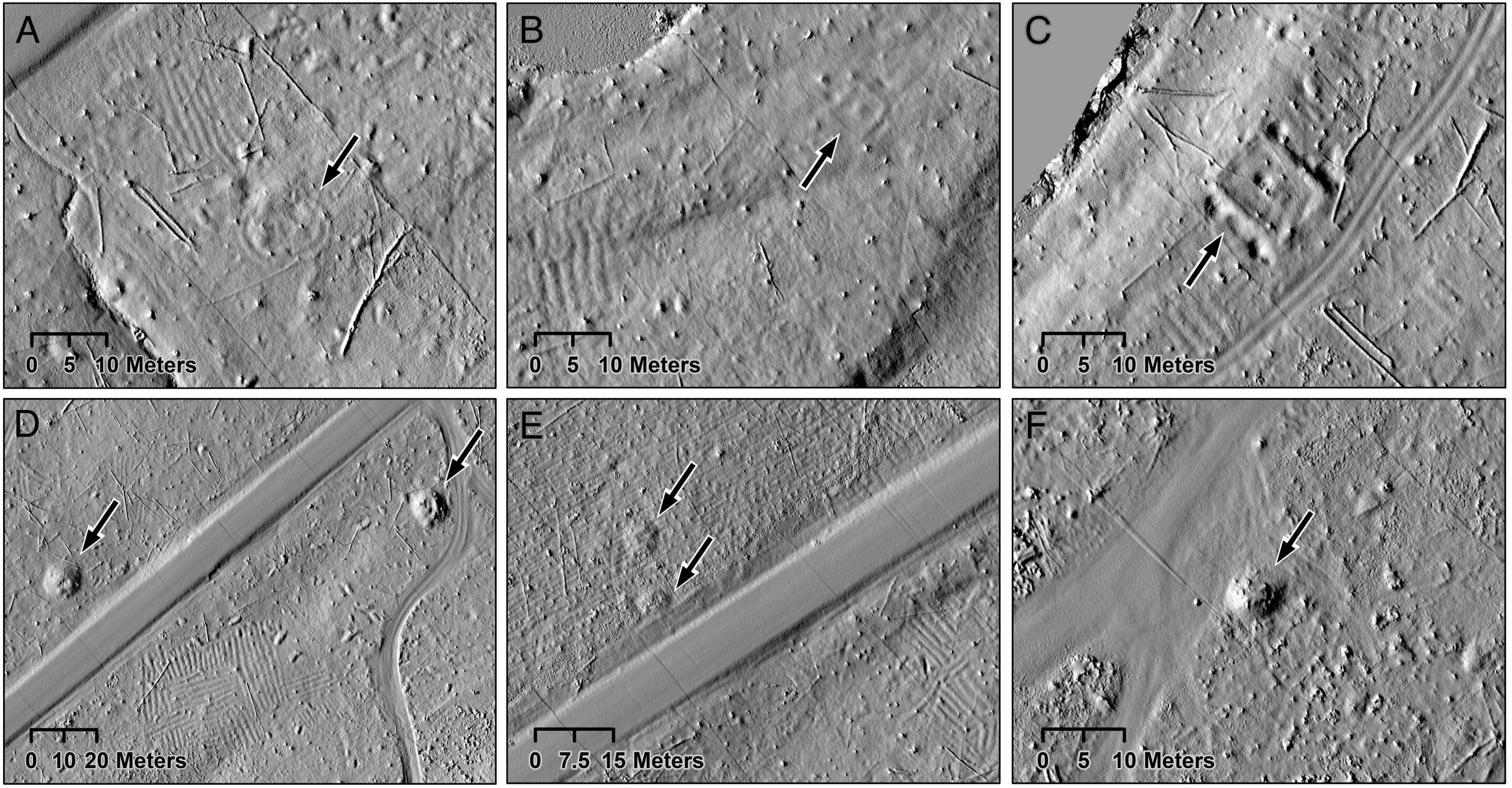
Using drone-mounted lidar scanning, a team led by Madeleine McLeester, anthropology assistant professor at Dartmouth College, detected a vast network of raised planting beds spanning over 330 acres. These ridged garden plots, measuring between 4 and 12 inches in height, were repeatedly constructed and maintained from roughly the 10th century through the 1600s.
Much of this ancient field system remains intact beneath the forest, providing a rare window into pre-contact agriculture in the Upper Midwest.

An Extensive Agricultural Network Concealed in the Woods
McLeester and colleagues estimate that about 70% of the mapped terrain is covered by parallel ridges arranged in intricate geometric forms across the landscape. The crops cultivated included maize, beans, squash, and other staples, grown in an environment previously thought unsuitable for extensive farming due to climate and dense forest cover. Collaboration with the Menominee Indian Tribe of Wisconsin indicates this system is far more extensive than earlier approximations.
“The magnitude of ancestral Menominee agricultural infrastructure is roughly tenfold what had been recognized before,” stated McLeester. This finding contradicts the belief that extensive agriculture was exclusive to rigid, hierarchical state societies. “Historical understanding held that this region was home to smaller, more egalitarian groups, but our discovery points to a potentially large and complex settlement,” she explained.
Key field investigations were conducted with the support of tribal preservation officials. David Grignon from the Menominee tribe and David Overstreet, a consulting archaeologist affiliated with the College of the Menominee Nation, played crucial roles. Sadly, Overstreet passed away during the study but had been involved with this site for several years.
Centuries of Agricultural Innovation in the Menominee Region
The archaeological season in 2023 began soon after winter’s end, timed to avoid leaf cover that might mask the ground. Drones equipped with advanced lidar technology flew close to the treetops, enabling detailed detection of subtle terrain changes. Unlike standard aerial lidar scans, which often miss smaller features, this technique generated highly refined data.
The resulting imagery exposed a landscape carefully sculpted over many generations. Excavations indicated that some ridge structures were renewed multiple times over 600 years, starting around 1000 AD during the Late Woodland period. Artifacts including charcoal fragments, , and other relics suggest sustained occupation and elaborate soil enrichment methods.
Jesse Casana, a Dartmouth anthropology professor and senior author of the report, explained that these ridges were likely enhanced with sediments from wetlands, household waste, and ash deposits. “Many ancient agricultural fields across North America have been lost due to modern land development,” Casana noted. “This discovery offers a rare glimpse into Indigenous farming practices from the Upper Michigan Peninsula prior to European settlement.”
Exploring Cultural Features Within the Landscape
The lidar results also revealed ceremonial and residential structures integrated with the farming fields. Notable discoveries included a circular dance arena, a rectangular foundation interpreted as a colonial-era trading building, and multiple burial mounds some believed previously destroyed. Two logging camps from the 1800s were also documented.
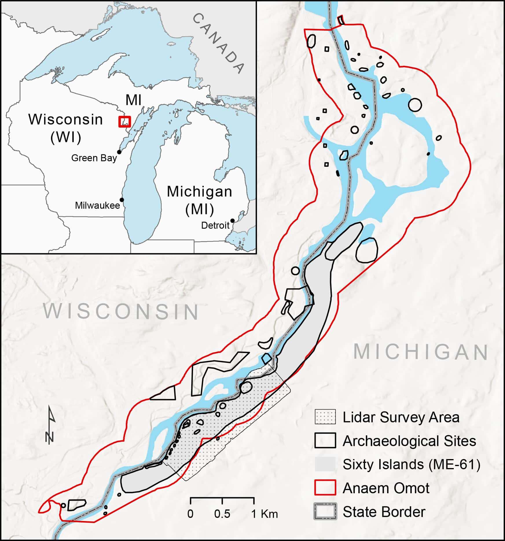
This location is part of the broader cultural zone called Anaem Omot, which translates as “Dog’s Belly” in the Menominee language. Listed on the U.S. National Register of Historic Places, Anaem Omot encompasses numerous ancestral sites lining the Menominee River with deep archaeological, historical, and tribal importance.
Initial mapping occurred in the 1990s by archaeologist Marla Buckmaster of Northern Michigan University, and partial excavations by Jan Brashler of Grand Valley State University included radiocarbon dating a corn cupule. However, only with recent drone lidar efforts has the full extent of this site become clear.
Reevaluating Forest and Indigenous Land Use Histories
This discovery prompts fresh investigations into how much of eastern North American forests once included similar agricultural networks. Researchers suspect many woodlands may hide comparable farming layouts lost to overgrowth or modern development.
“We may be seeing just a fraction of a far larger system,” Casana remarked.
Research continues, with plans for additional surveys to pinpoint ancestral Menominee habitation sites and to deepen understanding of how Indigenous societies structured their land management over centuries.
- Categories:
- News


0 comments
Sign in to Comment