
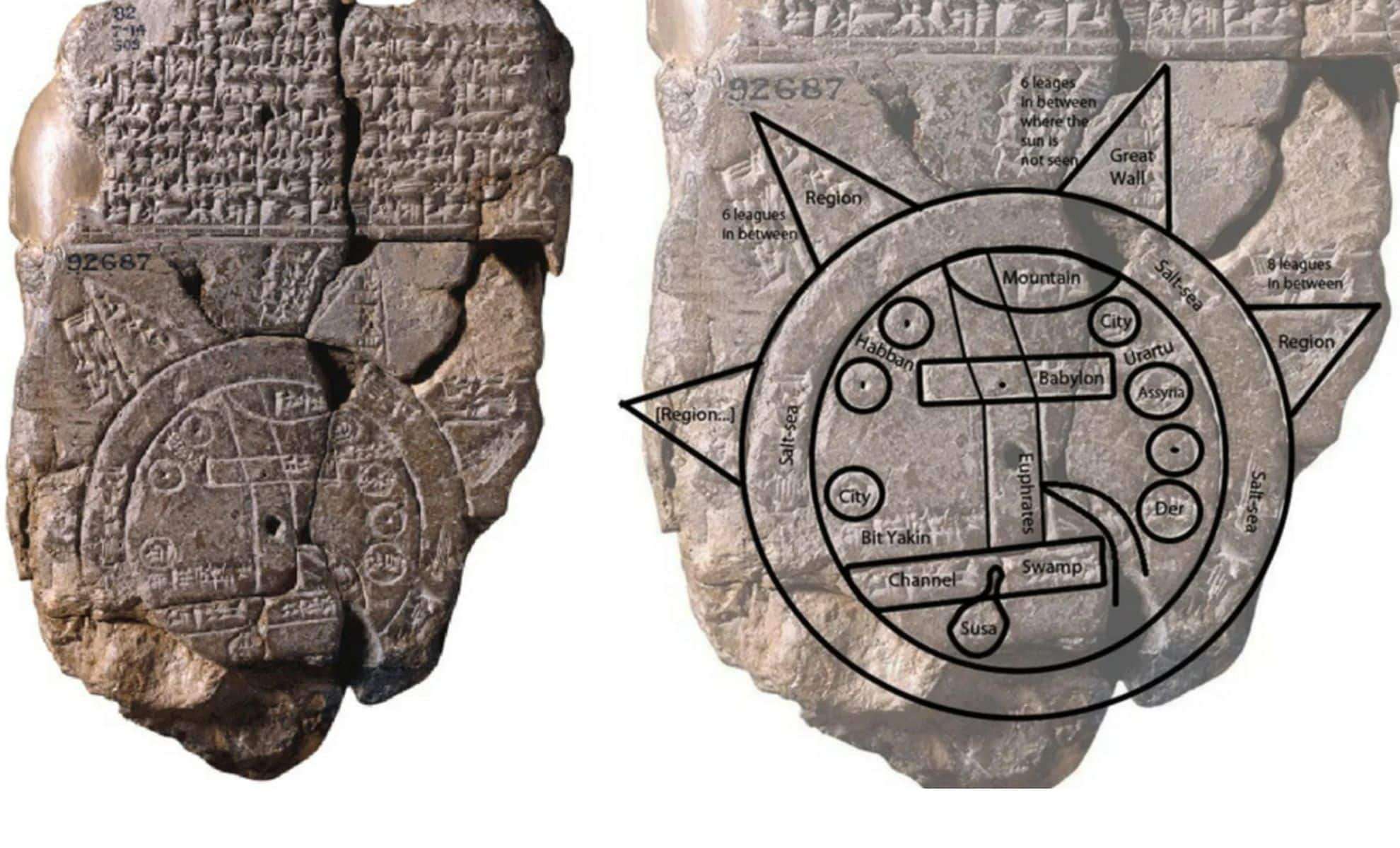
An extraordinary artifact emerging from ancient Mesopotamia provides an exceptional glimpse into how one of history's earliest societies envisioned the world around them. Known as the Imago Mundi, this Babylonian world map engraved on clay over 2,600 years ago merges elements of geography, mythology, and cosmology, revealing the intellectual and imaginative spirit of the 6th century BCE. Originally discovered in Sippar, near the historic city of Babylon, the map now resides in the British Museum, captivating historians and visitors alike. Detailed in the museum’s official presentation, this artifact stands as not only the oldest known global map but also a cultural reflection of how ancient Babylonians positioned themselves within the universe.
Design Elements: Geography Intertwined with Myth
The core of the Imago Mundi highlights Babylon as the world’s pivotal point, underscoring the city's perceived role as the center of civilization. This worldview parallels how ancient cities such as Athens, Rome, and Jerusalem likewise regarded themselves as the universe’s focal centers.
Encircling the map are two concentric rings symbolizing vast water bodies, identified as a salt sea and a “bitter water” river, marking the boundaries of the known world according to Babylonian thought. Within these limits, the map portrays key regions like Assyria, Urartu, Der, and Elam, along with numerous cities and natural landmarks. Mountains, marshes, and swamps are also illustrated, demonstrating the Babylonians’ keen awareness of both natural terrain and urban locations.

Cuneiform script surrounding the map adds descriptive labels and historical insights. The detailed depiction reveals that the artifact was more than a navigational aid; it served as a cultural canvas blending astronomy and geography, indicative of the Babylonian synthesis of earthly and heavenly knowledge.
Insight into Babylonian Cosmic Beliefs
A compelling feature of the Imago Mundi lies in its integration of mythology and astronomy. The tablet’s reverse side includes carvings of celestial bodies, featuring constellations recognizable as precursors to the modern zodiac. This artistic link reflects the Babylonians’ worldview where earthly geography and the sky were closely connected.
Mythical figures such as Scorpio-man and Anzu, a lion-headed bird, also appear on the map, embodying the belief in divine and supernatural beings influencing the physical realm. These symbolic creatures emphasize the spiritual dimension of Babylonian cosmology.
Contextual Significance and Historical Value
The Imago Mundi transcends its role as a mere map; it encapsulates the Babylonian perspective—a convergence of practical cartography, myth, and astronomy. Scholars recognize it as offering valuable insights into the Mesopotamian heartland, famously known as the land between the rivers, the cradle of ancient human civilization.
This artifact holds particular importance as it likely represents a copy of an earlier map, highlighting a tradition of cartographic knowledge that the Babylonians carefully preserved and enhanced over generations.
The depiction of Marduk, the Babylonian creator god, along with other mythological beings, points to the essential role of narrative and spirituality in Babylonian culture. These divine representations reinforce the idea that Babylonians perceived their universe as divinely ordered and governed by celestial forces.
The Enduring Impact of the Imago Mundi
The Imago Mundi stands as a priceless window into ancient Babylonian culture and their comprehensive understanding of the world. Its combination of symbolic and factual elements demonstrates the sophistication of Babylonian knowledge in geography and astronomy, which influenced subsequent civilizations and scientific thought.
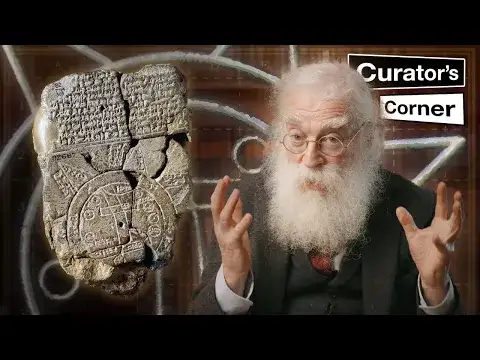
Currently preserved in London’s British Museum, the map remains a focus of ongoing scholarly research due to its cultural and intellectual importance. Dr. Irving Finkel emphasizes that the map embodies the Babylonians’ blend of curiosity and creativity, merging myth with geography to form a harmonious worldview.
Ultimately, the Imago Mundi testifies to one of humanity’s earliest achievements in intellectual history, symbolizing an enduring quest to comprehend both our planet and the cosmos beyond.
- Categories:
- News


0 comments
Sign in to Comment