
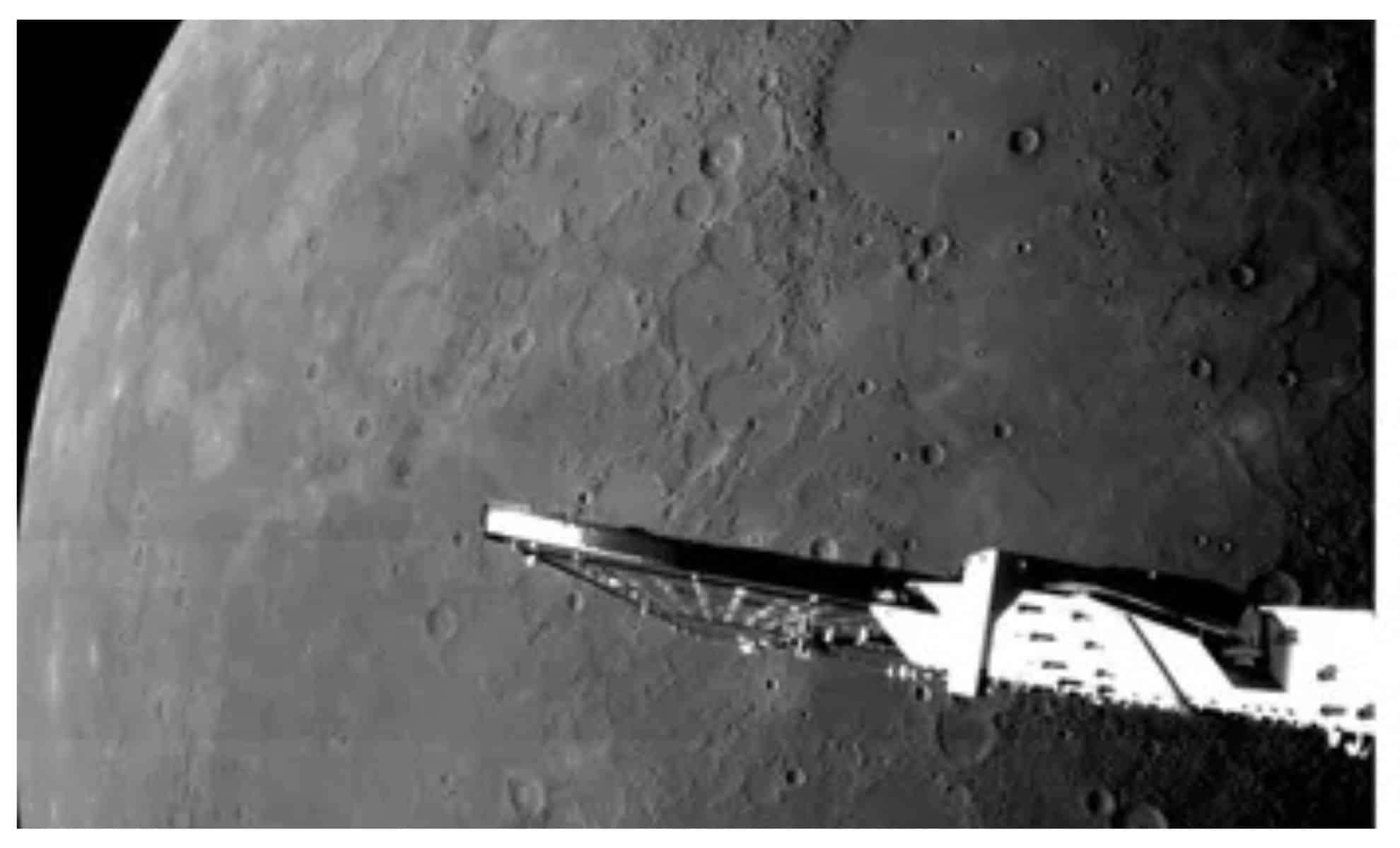
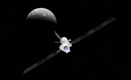
On January 8, 2025, the collaborative European-Japanese mission, the BepiColombo spacecraft, completed its crucial sixth and final flyby of Mercury. During this flyby, the spacecraft soared just 185 miles (295 kilometers) above Mercury’s terrain, capturing remarkable new images of the solar system’s smallest planet. These encounters are essential steps before BepiColombo begins orbiting Mercury in late 2026 to conduct its primary scientific investigations.
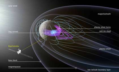
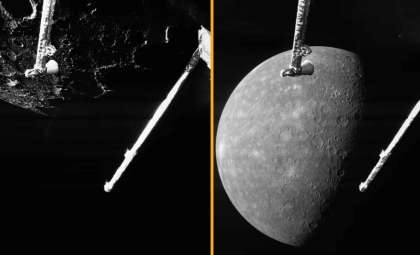
Mercury remains an enigmatic world due to its proximity to the Sun and unique geologic traits. The BepiColombo mission strives to deepen our understanding of the planet’s surface composition, interior structure, and magnetic environment. Since launching in October 2018, the spacecraft’s series of six flybys have delivered valuable observations, detailing Mercury’s craters, volcanic regions, and impact basins with unprecedented clarity.
Exploring Mercury’s Permanently Shadowed Craters
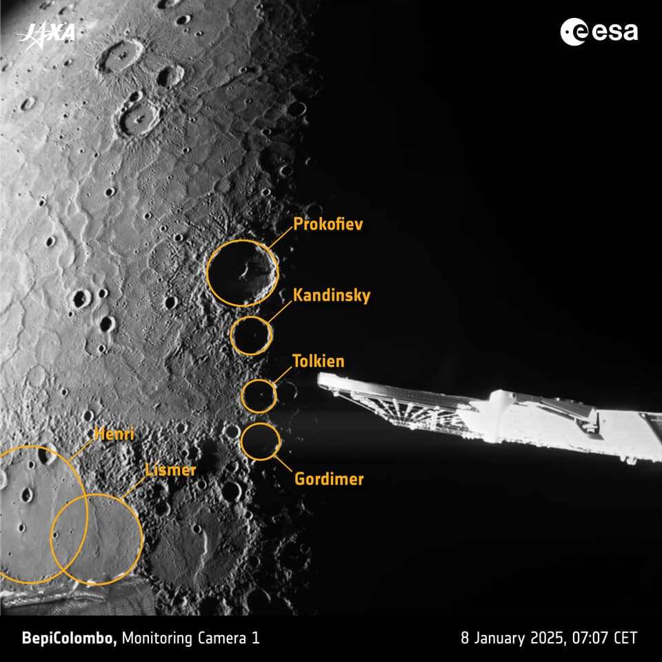
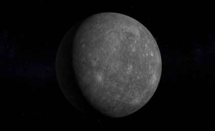
An especially captivating snapshot from the flyby focused on Mercury’s north pole, where the spacecraft flew over several craters that remain in permanent darkness. These areas, shielded from sunlight indefinitely, rank among the coldest spots in the entire solar system despite Mercury’s closeness to the Sun.

Notable craters such as Prokofiev, Kandinsky, Tolkien, and Gordimer form these deep shadow zones, which scientists hypothesize might contain deposits of water ice. This exciting possibility places these craters high on the list for future study. Investigating the existence of ice on Mercury could reveal valuable information about water distribution throughout the solar system, even in very hostile conditions.
Frank Budnik, Flight Dynamics Manager for BepiColombo, reflected on the achievement:
“This is the first time that we performed two flyby campaigns back-to-back. This flyby happens a bit more than a month after the previous one. Based on our preliminary assessment, everything proceeded smoothly and flawlessly.”
Volcanic Features of Borealis Planitia
Another incredible image highlighted Borealis Planitia, a broad volcanic plain located near Mercury’s north pole. These relatively flat plains were formed about 3.7 billion years ago when extensive lava flows flooded and filled prior crater depressions, creating a smooth surface. Visible craters such as Henri and Lismer are now partly covered by hardened lava layers.
The terrain also shows “wrinkle ridges,” formed as Mercury’s interior cooled and contracted. These features give important clues about the planet’s geological and thermal history, illustrating the complex relationship between its surface and interior over billions of years.
Geraint Jones, Project Scientist for BepiColombo at the ESA, emphasized the value of these data:
“BepiColombo’s main mission phase may only start two years from now, but all six of its flybys of Mercury have given us invaluable new information about the little-explored planet. In the next few weeks, the BepiColombo team will work hard to unravel as many of Mercury’s mysteries with the data from this flyby as we can.”
Insights Into the Caloris Basin
The Caloris Basin stands out as one of Mercury’s most prominent geological landmarks, measuring more than 930 miles (1,500 kilometers) in diameter. A flyby image revealed a distinctive boomerang-shaped lava flow close to the basin’s edge, sparking curiosity about its formation—whether it originated from volcanic activity within the basin or migrated from outside.
The image also captured the Nathair Facula, a bright deposit linked to Mercury’s largest volcanic eruption. The volcanic vent at its center spans roughly 25 miles (40 kilometers), while the surrounding ejecta stretch nearly 186 miles (300 kilometers). These volcanic characteristics are crucial for decoding Mercury’s volcanic past, which heavily influenced the planet’s surface landscape.

- Categories:
- News


0 comments
Sign in to Comment