
On July 15, 2025, NASA’s Curiosity Rover persisted in its quest to study Mars through a combination of detailed geological investigations and scientific measurements. As part of the Mars Science Laboratory Mission, Curiosity systematically examines Mars’ surface to reveal the planet’s ancient mysteries, progressing sol by sol. This article offers a closer look at the rover’s meticulous work and its ongoing impact on our understanding of Martian geology.
Adapting Scientific Efforts to Martian Winter
With winter dominating the Martian climate, Curiosity’s team has shifted operations to optimize activity during the warmer parts of the afternoon. Cooler mornings are reserved for minimal tasks, conserving energy and maintaining the rover’s heating systems essential for survival amid the harsh cold of Martian winter.
During Sols 4595-4596, the rover began with an extensive remote science sequence, capturing diverse images and data. Its Mastcam targeted a nearby trough to monitor sand movement, aiding researchers in understanding how wind dynamics shape the Martian surface.

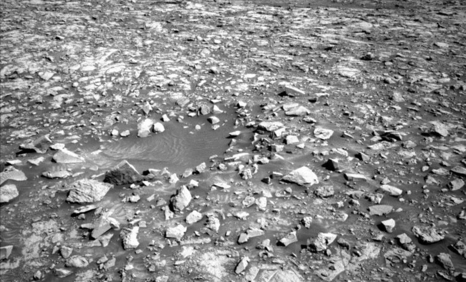
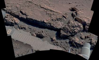
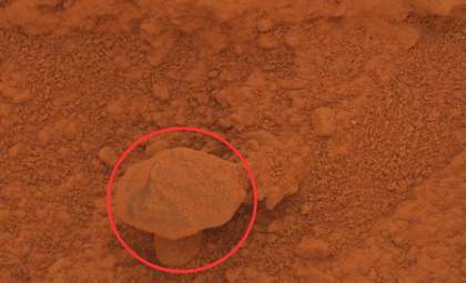
One notable Mastcam observation focused on a displaced rock named “Ouro” situated next to a round depression, which may mark a small impact crater, offering insights into local geological activity. Another focus was the ridge called Volcán Peña Blanca, where sedimentary layers were documented to help decode Mars’ water history and geological past.
Additionally, the rover’s ChemCam system collaborated with Mastcam to investigate Los Andes, a dark exposed bedrock patch. Analyzing this rock’s chemistry could unlock further details about Mars’ ancient environment.
Hands-On Geological Investigations
Following a brief pause, Curiosity engaged in contact science, involving direct interaction with the surface for in-depth analysis. The Arm Rover Planner directed the rover to clean dust from two flat bedrock areas: Cataratas del Jardín and Rio Ivirizu, chosen for their accessibility.
Using its MAHLI camera and APXS spectrometer, Curiosity captured detailed images and performed chemical testing to decipher the composition of these rocks. These investigations provide critical knowledge about the region’s geology and conditions that might have once supported life.
After data collection, the rover secured its arm and prepared for its subsequent movements, ensuring readiness for the next day.
Uncovering Mars’ Geological Layers
On Sol 4596, additional remote sensing focused on layered bedrock targets, including Torotoro. Utilizing ChemCam LIBS technology, researchers examined the chemical makeup of these layers to understand the mineral contents and geological formation history.
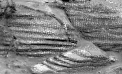
The rover assembled a mosaic image of Paniri, a pronounced rock incision filled with differing materials. This feature may provide clues about ancient tectonic movements, erosion, and volcanic processes on Mars.
Careful Navigation and Environmental Monitoring
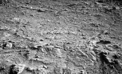
Once science operations concluded, Curiosity traveled roughly 50 meters southwest toward its next site. The route was meticulously chosen to bypass hazardous sandy spots and hidden obstructions, ensuring safe passage. The terrain offered relatively smooth conditions with limited sharp stones or large rocks that might cause wheel damage.
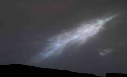
Post-drive, the rover conducted its standard imaging checks to verify operational health. These diagnostics assist Earth-based engineers in monitoring rover condition and planning ahead. Curiosity also captured images of dust devils, cloud formations, and the ground beneath it using the MARDI camera, enriching our understanding of daily atmospheric changes on Mars.
- Categories:
- News


0 comments
Sign in to Comment