
During Sols 4575 and 4576 of its ongoing mission, NASA’s Curiosity rover secured a position deemed one of the most reliable and risk-free areas the team has encountered on Mars. Per NASA’s mission blog, this location enables scientists to conduct extensive experiments with minimal danger to the rover—a significant benefit given Mars’ challenging and unpredictable terrain. This update, released on June 20, 2025, highlights the rover’s steady progress within Gale Crater, as it continues to explore Mars’ geologic past.
Accurate Navigation Leads Curiosity to a Prime Research Location
With a carefully executed maneuver, the Curiosity rover settled into what researchers describe as an optimal "parking spot." Each of its wheels found firm footing on stable ground—a considerable achievement on Martian soil—that allowed the safe extension of its robotic arm. Scientists immediately capitalized on this advantageous spot.
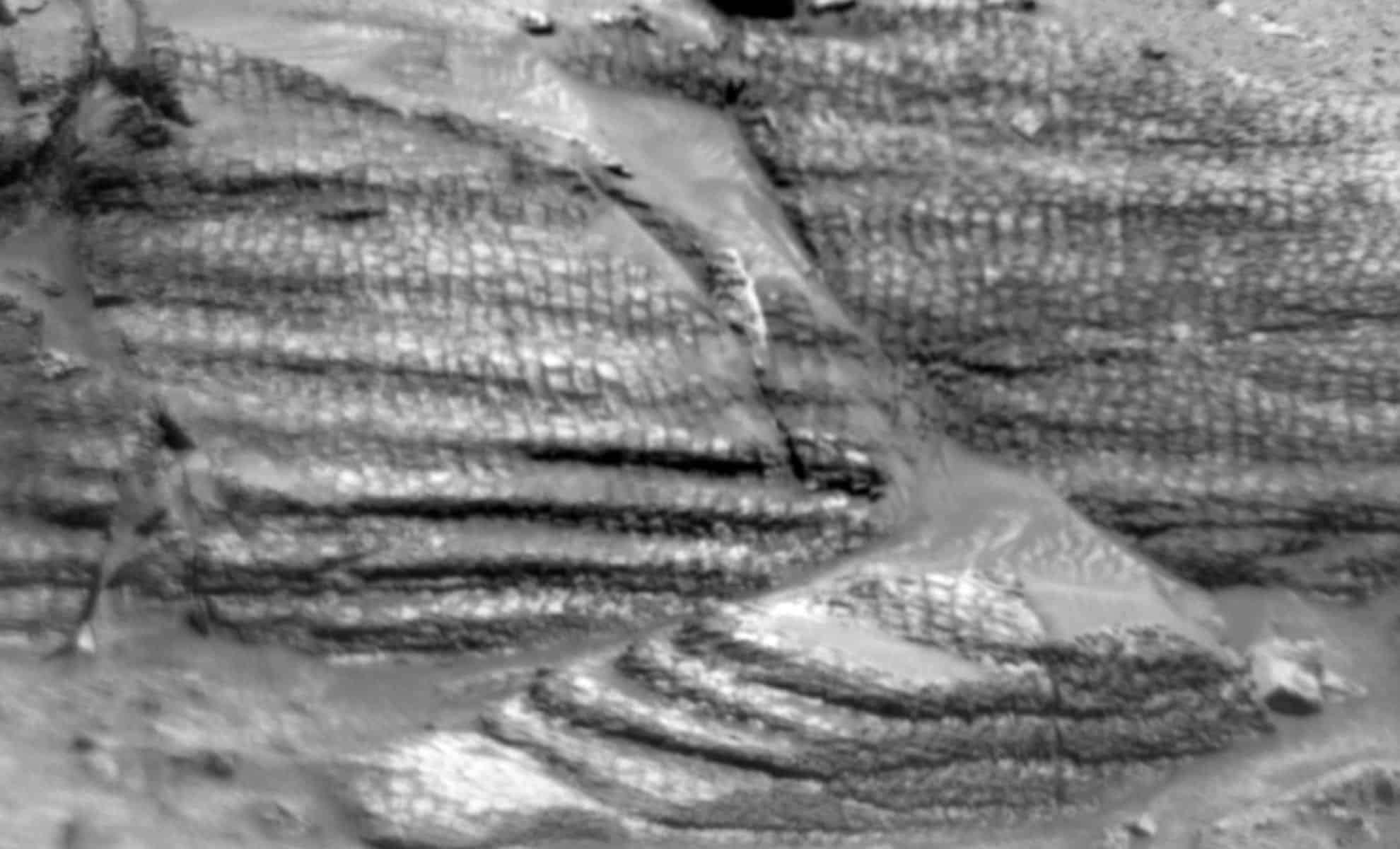
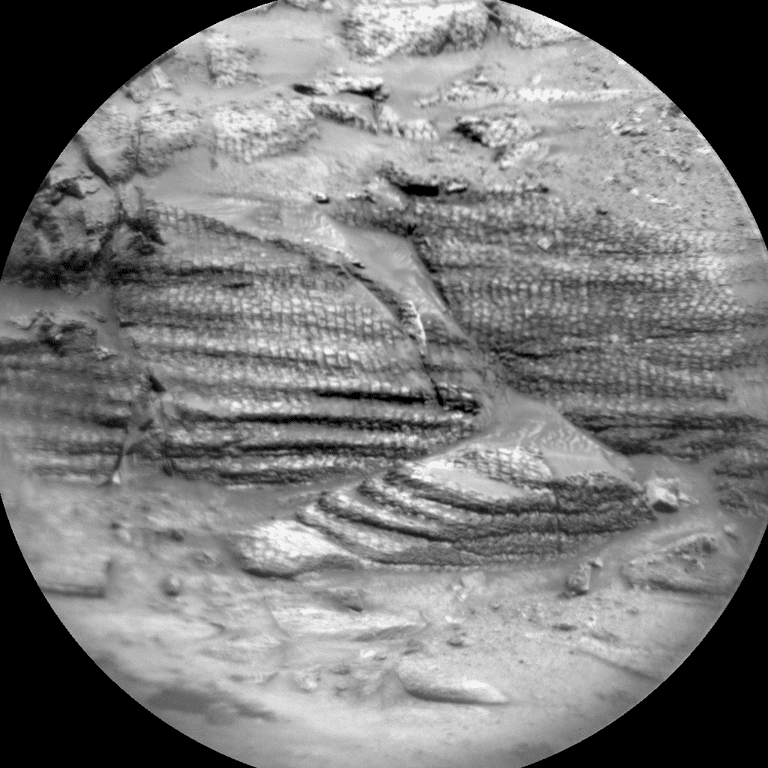
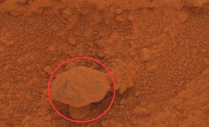
Curiosity equipped its Alpha Particle X-Ray Spectrometer (APXS) and ChemCam instruments to examine a selected flat rock named Tarija, representative of the local geology and associated with boxwork-like patterns. These lattice-shaped mineral formations suggest past interaction with water. High-definition imagery from the MAHLI and Mastcam cameras provides detailed views of the rock’s textures and setting. These compositional studies are vital for revealing the mineral composition and geological history after the rock’s formation.

Exploring Martian Fractures: Clues to Past Environments
Beyond analyzing composition, the mission team focused on detailed imaging of the nearby terrain. A notable feature is a series of linear ridges located north of the rover. These alignments could indicate underlying geological stresses or past fluid activity, both important for understanding Mars’ environmental development.
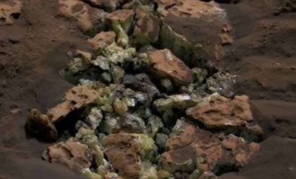
Curiosity is also investigating a site known as Laguna del Bayo, believed to contain fracture fill deposits—where mineral-rich fluids once filled cracks in rocks long after their initial formation. These spots can offer critical insight into the planet’s former chemical conditions and its potential to support life.
In addition, the rover revisited the Mishe Mokwa outcrop to acquire fresh imagery using ChemCam. By comparing new with previous data sets, scientists can refine their analysis and detect even subtle changes, a crucial strategy for this long-term mission.
Next Steps: A Careful 54-Meter Drive and Continued Atmospheric Monitoring
With current investigations winding down, engineers are preparing Curiosity for a 54-meter trek (approximately 177 feet) to a new site. This movement will be planned with the same precision that ensured the rover’s current stability. After arriving, Curiosity will enter a new phase of automated science, where its instruments will independently identify targets of interest.
This includes utilizing ChemCam’s autonomous targeting to perform chemical analyses on selected rocks. The Mars Descent Imager (MARDI) will capture detailed images beneath the rover to better understand the terrain it crosses. This documentation aids in creating a comprehensive record of the rover’s path and the geological formations encountered.
Meanwhile, environmental instruments remain active. Plans include Mastcam tau measurements to evaluate dust levels in Mars’ atmosphere, combined with a Navcam survey of dust devils and a suprahorizon video to deepen understanding of atmospheric conditions. Additional continuous data collection comes from DAN (detecting subsurface hydrogen), REMS (weather monitoring), and RAD (radiation measurement) instruments.
- Categories:
- News


0 comments
Sign in to Comment