
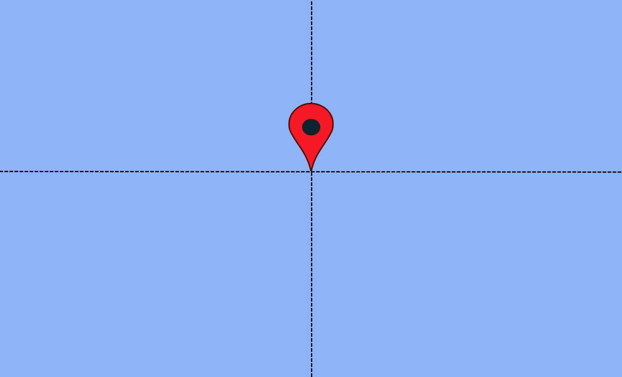
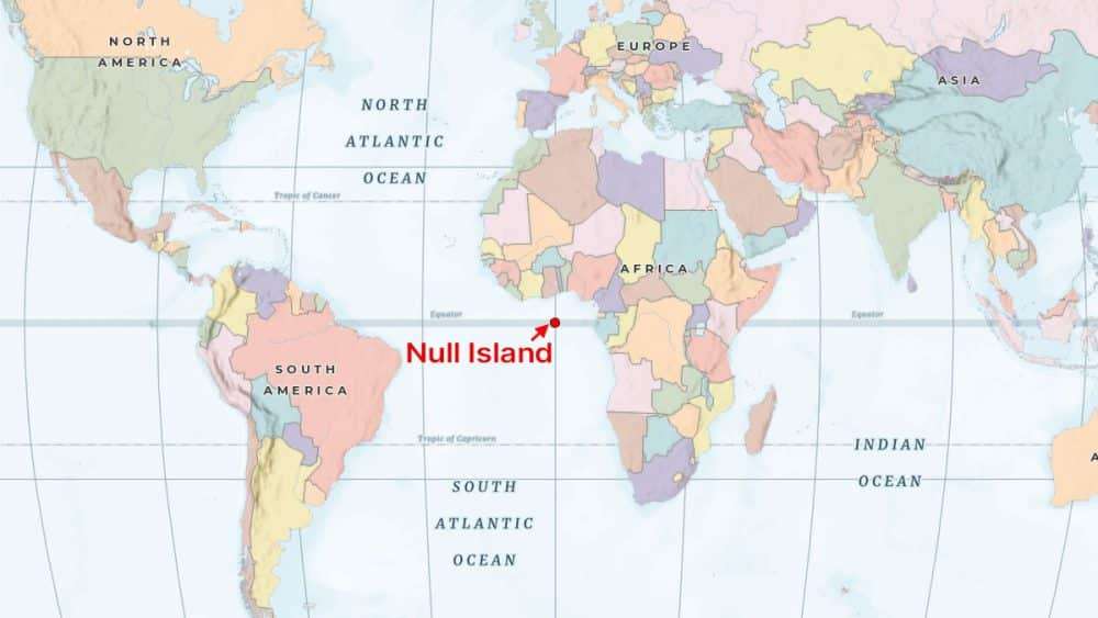
Located precisely where the equator intersects the prime meridian in the Gulf of Guinea, an intriguing mix of data quirks and climate research emerges. Known as Null Island, this spot at 0° latitude and 0° longitude began as a humorous placeholder in digital mapping, but has since become a significant reference point in fields ranging from data management to meteorology. A detailed feature by IFLScience explores how this imaginary island plays a vital role in understanding and managing geographical data errors.
A Synthetic Island Arising from Geographic Mistakes
Though Null Island is not a physical landmass, it appears regularly across numerous mapping databases. Its origin traces back to inside jokes among mapmakers, eventually gaining attention in 2011 when it was incorporated into the Natural Earth dataset. The fictional island, only about a square meter in size, was placed strategically at 0° latitude and 0° longitude as a tool to catch geocoding errors.
Geocoding translates readable addresses into precise geographic coordinates. When this process fails—due to mistakes such as typos, invalid locations, or corrupted inputs—mapping platforms often default to the coordinate (0,0). This point, situated in the Gulf of Guinea where the equator meets the prime meridian, thus becomes a catchall for faulty data entries.

As Tim St. Onge from the Library of Congress describes, this creates “an island of misfit data.” Over the years, Null Island has evolved into a symbolic site highlighting common mistakes in geographic information systems worldwide.
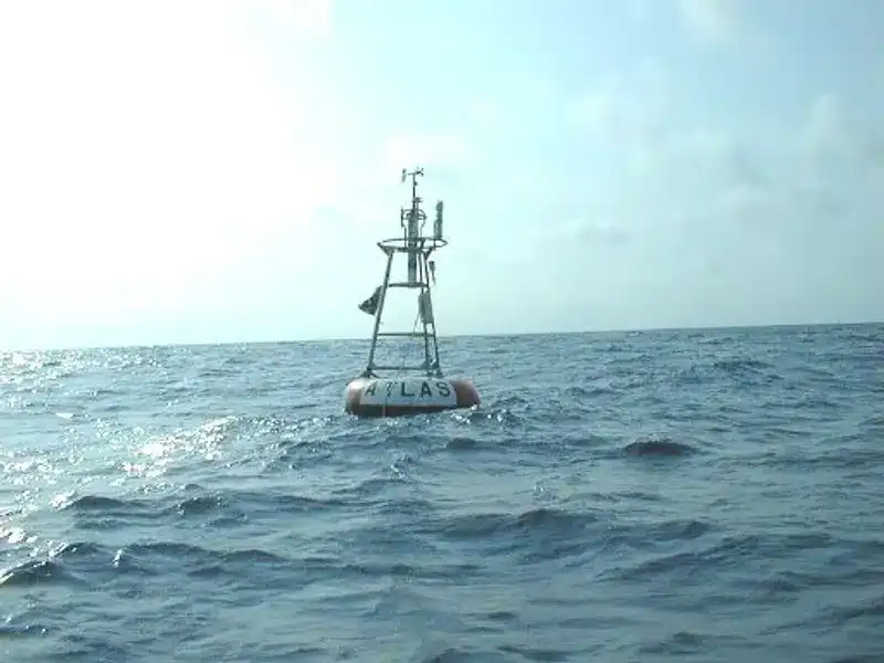
A Solitary Buoy Anchored in a Virtual Location
Despite its fictitious nature, Null Island hosts a genuine presence: the NOAA weather buoy known as Station 13010 – Soul. This buoy is part of the Prediction and Research Moored Array in the Tropical Atlantic (PIRATA), a system of 17 buoys tasked with tracking climatic factors. Positioned in the ocean, Soul gathers critical data on air and sea surface temperatures, humidity, wind speed, and direction, helping refine weather forecasting and climate modeling worldwide.
This real scientific asset adds an unexpected layer of importance to what started as a simple mapping joke. Null Island now stands as both a digital landmark signaling data errors and a functional node in global climate monitoring.
The Root of the 0,0 Glitch in Geo Data
The coordinates defining Null Island adhere to the World Geodetic System 1984 (WGS84), a global standard also employed by the U.S. Department of Defense and GPS technologies. This framework standardizes the way Earth’s locations are charted. When various platforms translate user data into geographic coordinates using WGS84, the presence of incorrect or incomplete data may still produce a default result landing at 0,0.
This problem spans multiple systems. Whether it’s Google Maps, OpenStreetMap, or proprietary GIS tools, any flawed geocode can inadvertently point to the same coordinate in the Atlantic Ocean.
For specialists in GIS, spotting entries at these zero coordinates is a telltale sign of data issues. In this role, Null Island functions as a digital quarantine, collecting erroneous points that otherwise lack valid mapping locations.
From Technical Marker to Digital Mythos
Null Island’s rise has sparked creative enthusiasm beyond mapping professionals. Within the GIS community, it transcends being just an error indicator. Imaginary maps illustrating its fictional terrain have been created, flags designed, and playful histories posted across online platforms and forums. This technical expedient has blossomed into a semi-mythical entity within digital cartography culture.
The Library of Congress describes Null Island’s blend of real and imaginary elements as “a curious blend of real and imaginary geography, of mathematical certainty and pure fantasy.” While it helps pinpoint digital mistakes, the real-world science conducted there enriches our understanding of climate and environment.
In an era of precise satellite data and massive datasets, Null Island reminds us that even the most advanced mapping and data systems are susceptible to errors. Thanks to a dedicated buoy, inventive data specialists, and a touch of humor, these errors now have a symbolic home—right at the heart of global maps.
- Categories:
- News


0 comments
Sign in to Comment