
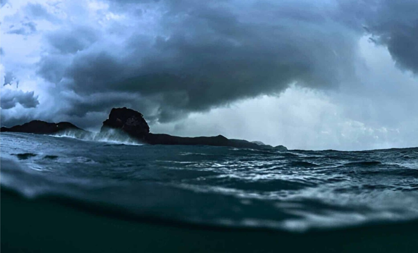
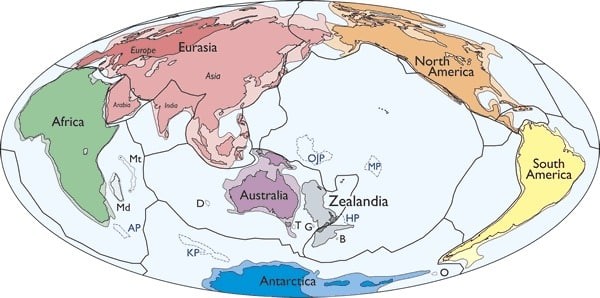
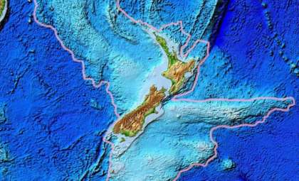
The traditional belief that Earth comprises only seven continents is being challenged by new geological evidence. A growing number of scientists now recognize an eighth continent named Zealandia, which lies mostly submerged beneath the southwestern Pacific Ocean.
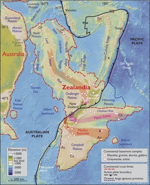
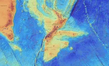
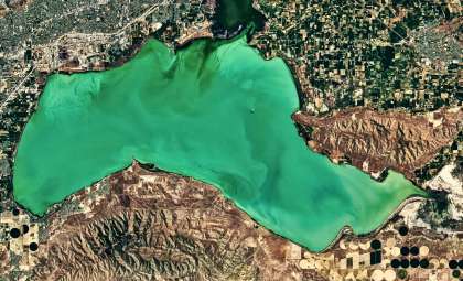
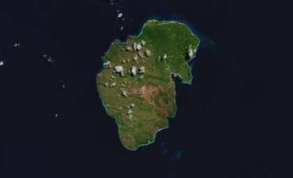
Spanning almost 1.9 million square miles, Zealandia surpasses the size of India and is about two-thirds as large as Australia. Despite its vast area, approximately 94 percent remains underwater. Only areas such as New Zealand, New Caledonia, and several smaller islets emerge above sea level.
While the concept of a submerged southern landmass is centuries old, it was not until 2017 that a comprehensive scientific publication formally classified Zealandia as a continent. This study, featured in GSA Today—the journal of the Geological Society of America—presented detailed geological evidence supporting this designation.

Criteria Defining Zealandia as a Continent
Zealandia was long thought to be merely a microcontinent or continental fragment. Recent advances in satellite gravity studies, seafloor topography analysis, and deep-sea sediment drilling uncovered its cohesive nature.
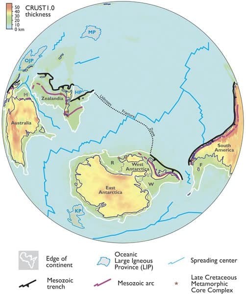
The paper published by the Geological Society of America outlined four essential conditions Zealandia fulfills to qualify as a continent: its clear elevation above the oceanic crust, the presence of diverse continental rock types, a crust thicker than typical oceanic plates, and a distinct geological framework.
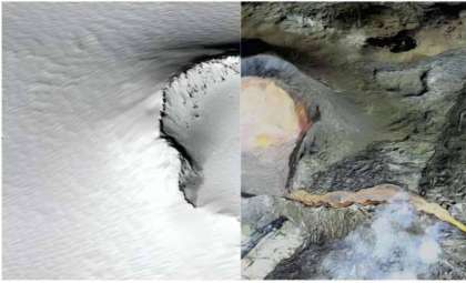
Oceanic crust generally measures about 7 kilometers thick, whereas Zealandia has an average crust thickness of around 20 kilometers, consistent with continental standards, though somewhat thinner than other continents. This submerged continent features underwater landscapes such as ridges, plateaus, and basins, which collectively define a continuous landmass.
The study’s authors emphasized: “Zealandia is not just a collection of continental fragments. It is a coherent continent and should be recognized as such.” This declaration remains the most authoritative peer-reviewed endorsement of Zealandia’s continental status.
Efforts to classify Zealandia have developed over decades. In 1995, geophysicist Bruce Luyendyk introduced the name Zealandia for this submerged region, reigniting interest in its geological identity. Subsequent technological improvements enabled detailed mapping, solidifying the continent’s recognition.
From Gondwana Origins to Oceanic Depths
Zealandia originated as part of the ancient supercontinent Gondwana, which fragmented over 100 million years ago. During its detachment from present-day eastern Australia, Zealandia experienced extensive tectonic extension and thinning of its crust, leading to significant subsidence below sea level.
Estimates suggest Zealandia began submerging around 85 million years ago, potentially completely underwater by 25 million years ago. However, some scientists argue parts may have remained exposed for an extended period.
In 2017, an international research voyage on the JOIDES Resolution drilled over 4,000 feet into Zealandia’s seabed at six locations. The extracted cores contained pollen, spores, and microfossils typically associated with terrestrial or shallow marine ecosystems, indicating some regions were once above water. BBC Future’s report on Zealandia explores how this expedition transformed scientific understanding of the continent.
Further support comes from fossil records in New Zealand and the Chatham Islands, where remains of sauropods, ankylosaurs, and possibly allosaur-like dinosaurs have been discovered. These creatures roamed long after Zealandia separated from Gondwana, suggesting sustained terrestrial habitats.
A remarkable find—a dinosaur-era foot bone on the Chatham Islands, as highlighted in the aforementioned BBC story—raises the prospect of numerous fossils still buried under Zealandia’s ocean floor.
Wider Significance and Resource Potential
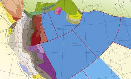
Identifying Zealandia as a continent carries important scientific and political consequences. Under the United Nations Convention on the Law of the Sea (UNCLOS), nations can claim rights to an extended continental shelf beyond their recognized Exclusive Economic Zones if geological continuity is demonstrated.
For New Zealand, such a claim could substantially enlarge its exclusive economic zone, granting access to lucrative subsea mineral deposits, rights for seabed mining, and potential hydrocarbon reserves. Satellite data mapping has already illustrated Zealandia’s clearly defined continental elevation features.
From a scientific viewpoint, Zealandia prompts a reevaluation of established concepts in plate tectonics and continental drift, especially for landmasses that have become deformed or submerged over time. Its unique crustal composition offers valuable insights into continental development processes.
Researchers at GNS Science, notably Nick Mortimer and Andy Tulloch, have been key in substantiating Zealandia’s continental status, building on ideas first introduced more than a century ago. Notably, Sir James Hector, a 19th-century Scottish geologist, presented evidence in 1895 suggesting New Zealand was part of a submerged continental ridge. Although largely overlooked then, his findings are now seen as early validation of Zealandia’s existence.
- Categories:
- News


0 comments
Sign in to Comment