
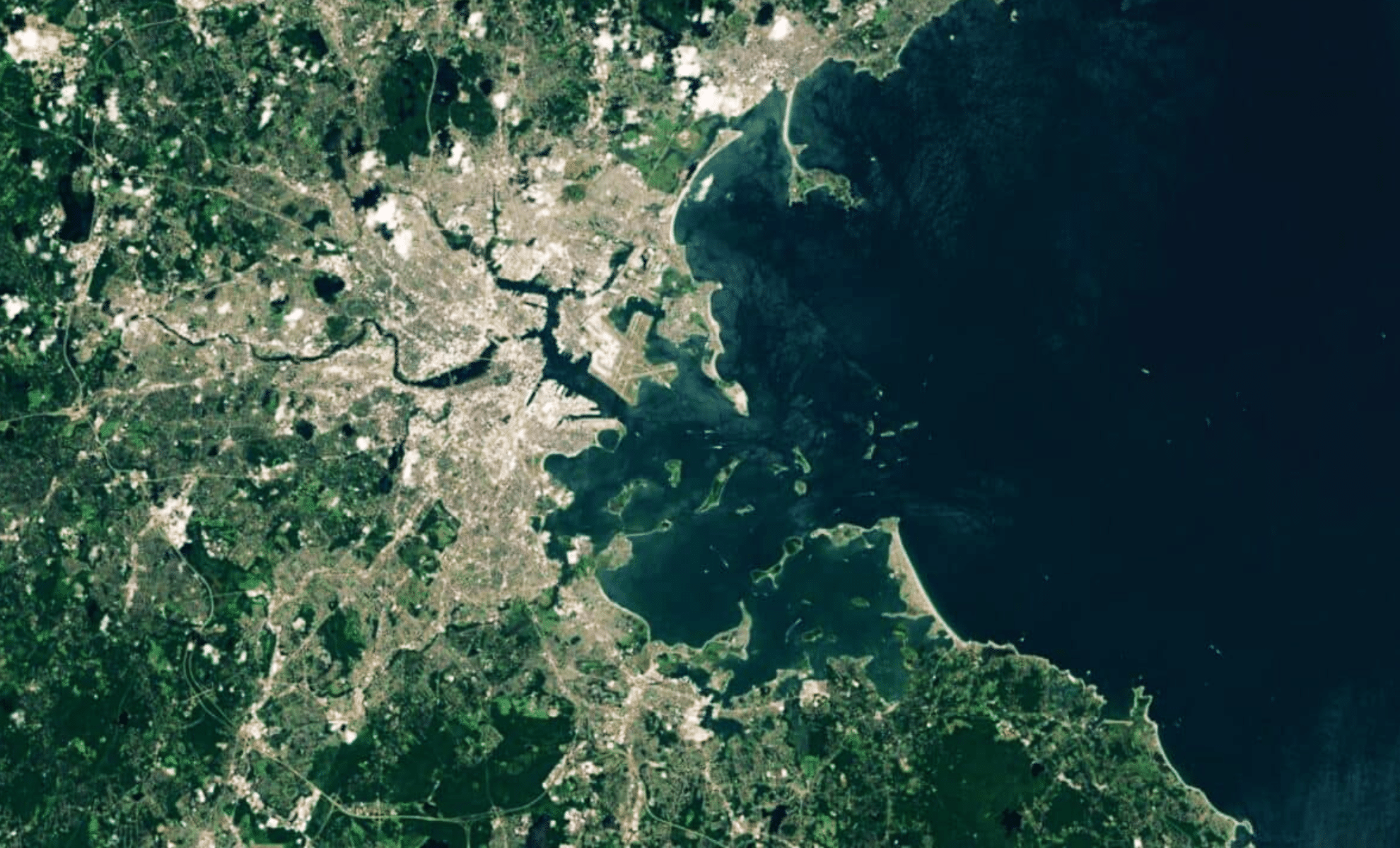
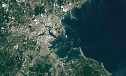
NASA’s Earth Observatory recently provided a breathtaking satellite image of the drumlin islands located in Boston Harbor, revealing a fascinating chapter of Earth’s glacial history. These striking landforms, created more than 20,000 years ago during the Wisconsin Glaciation, remain relatively unrecognized despite their geological significance. The July 2024 image from NASA’s Landsat 8 satellite highlights their scientific value and vital role in both the local ecosystem and ongoing climate change research.
What Are Drumlins? The Sculpted Remnants of Ancient Ice
Drumlins are streamlined hills formed beneath glaciers when moving ice reshapes sediments like sand, rock, and clay. The drumlins in Boston Harbor trace back to the last Ice Age, when glaciers sculpted and deposited material across the landscape. As the glaciers advanced and eventually retreated, these distinctive elongated mounds emerged across the region.
While drumlins exist in various locations globally—including prominent fields in Clew Bay, Ireland, and parts of Canada—the Boston Harbor drumlins are exceptional because some lie partially underwater. This makes Boston Harbor unique in North America, offering researchers a rare opportunity to investigate how rising sea levels interact with glacial formations.

As geoscientist Jasper Knight from the University of Witwatersrand in South Africa explains, “Previous ideas of slow, steady advance, or retreat, really don’t hold. Glaciers are dynamic.”
Such observations underscore the complex and dynamic processes glaciers used to carve the Boston Harbor drumlins, producing landscapes shaped by more than slow, gradual movements.
Boston Harbor’s Partially Submerged Drumlins: A Geological Rarity
Although drumlins appear worldwide, the phenomenon of partially submerged drumlins around Boston Harbor stands out as a truly rare glacial feature. Post-Ice Age sea level rise suddenly engulfed portions of these landforms, producing islands that float between water and earth, bridging glacial legacy with modern oceanic influences.
This exceptional interplay of ice, sediment, and seawater has shaped islands that preserve glacial histories while simultaneously serving as ongoing research sites to understand changes driven by climate and sea level variations. Their partly underwater status offers a distinctive lens into how natural forces continuously reshape shorelines.
With sea levels on the rise due to human-driven climate change, these drumlin islands face increasing erosion and transformation. Close monitoring will be key to forecasting how such coastal landforms respond to evolving environmental pressures.
Sea Level Rise’s Impact on the Drumlin Islands’ Formation
The current island landscape resulted from the melting glaciers that once blanketed North America during the Wisconsin Glaciation. As massive ice sheets thawed, sediments left behind were shaped into drumlins. Subsequent sea level increases submerged lower portions of the terrain, turning what were once simply hills into an archipelago.
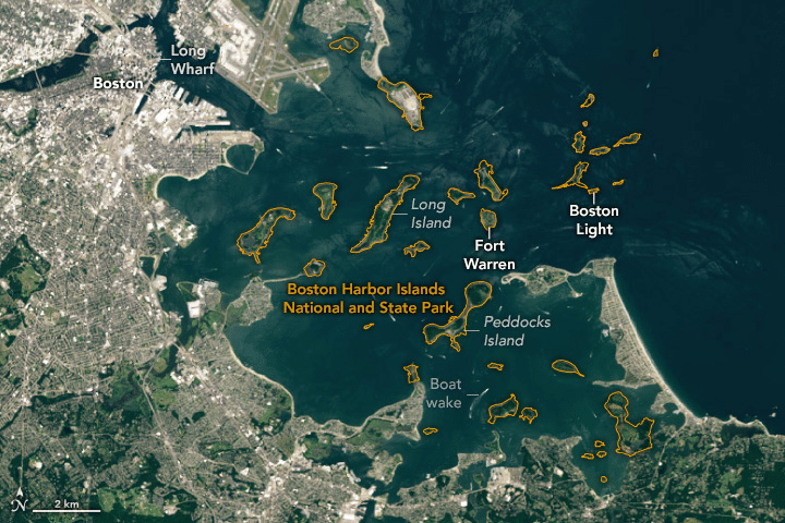
Ongoing sea level rise linked to modern climate change continues to reshape these islands. Boston Harbor’s drumlin islands serve as vivid reminders of Earth’s ceaseless geological and environmental transformation. They also form a crucial part of the Boston Harbor Islands National and State Park, preserving this dynamic record for scientific investigation and public appreciation.
Ecological and Cultural Importance of the Drumlins
The drumlin islands in Boston Harbor are treasured not only for their geological significance but also for their rich biodiversity and historical heritage. Accessible by car, ferry, or boat, some of the islands welcome many visitors each year who come to enjoy their natural splendor and historical landmarks.
Highlighted within the park is Boston Light on Little Brewster Island, the longest-operating lighthouse in the United States since 1716. Another prominent site is Georges Island’s Fort Warren, which served as a Civil War prison housing Confederate prisoners, notably Vice President Alexander Stephens.
Ecologically, the islands encompass diverse habitats including tidal pools, salt marshes, and hardwood forests. These environments support a variety of marine and terrestrial species, making the drumlins crucial for wildlife conservation as well as cultural preservation.
Boston Harbor Drumlins: A Living Laboratory for Climate Research
Beyond their natural wonder, Boston Harbor’s drumlin islands function as critical research sites investigating climate change impacts. Researchers study how rising seas influence delicate ecosystems around these islands, which represent miniature models of global coastal changes.
Salt marshes and tidal pools on the islands are particularly sensitive to sea level fluctuations. Scientists closely monitor shifts in plant and animal communities alongside shoreline erosion to understand the effects of climate variability.
For climate scientists, these drumlin islands offer vital insights into how coastal habitats respond and adapt to environmental stressors. As climate change accelerates, observations made here provide valuable clues about the future resilience of coastal ecosystems worldwide.
- Categories:
- News


0 comments
Sign in to Comment