
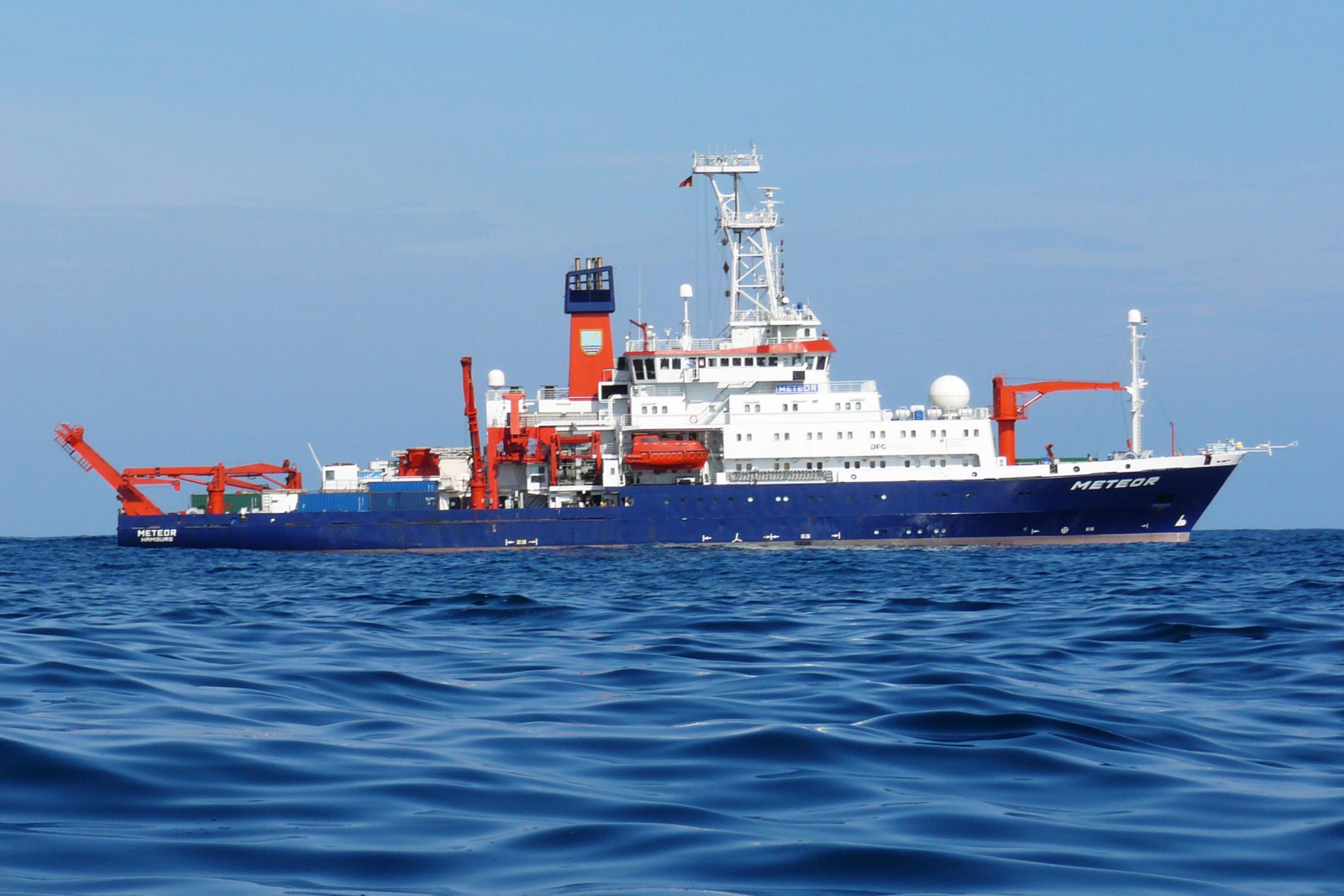
While aboard the research vessel METEOR, a geophysicist couldn’t believe what appeared on his sonar display. Just six kilometers off Sicily’s southwestern shore, sonar scans revealed an unexpected rocky formation: a previously unidentified volcano wrapped in a lava flow extending four kilometers westward.
This surprising discovery belongs to Emanuele Lodolo, a scientist affiliated with Italy’s National Institute of Oceanography and Experimental Geophysics (OGS). “It was a genuine shock, especially since we were so close to land,” he remarked. The volcanic structure, named Actea, is among six new submarine volcanoes uncovered in the Sicily Channel, a heavily trafficked maritime route near the island’s southwest coast.
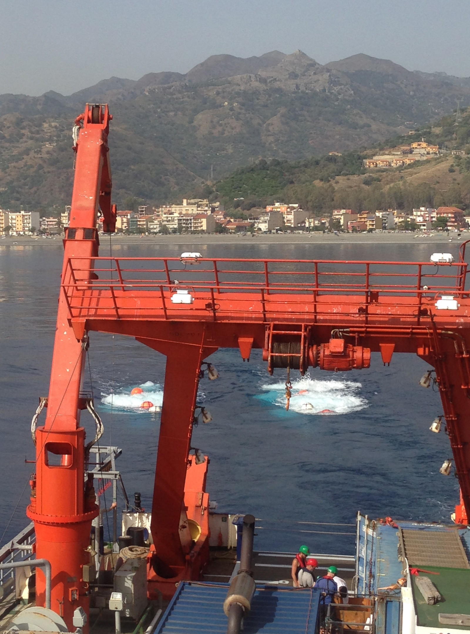
The research mission, termed M191 SUAVE (Submarine Volcanism in the Western Sicilian Channel), united experts from GEOMAR Helmholtz Centre for Ocean Research (Germany), the Monterey Bay Aquarium Research Institute (MBARI) in the U.S., OGS in Italy, and Victoria University of Wellington in New Zealand. Over three weeks aboard the German vessel METEOR, they conducted detailed scans of the Mediterranean seabed.

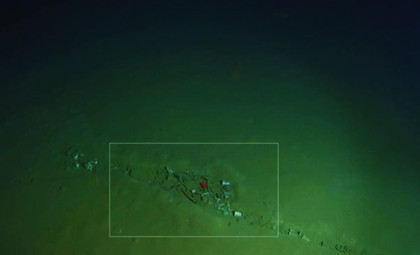
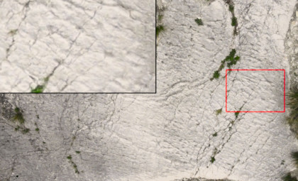
Using sophisticated equipment including multibeam echosounders and magnetometers, the team mapped volcanic formations both exposed and buried beneath sediment. Their survey located three volcanic centers at least six kilometers wide and rising around 150 meters high—comparable in height to Paris’s Tour Montparnasse. Yet these underwater giants had never appeared on previous geological charts.
Previous Geological Maps Missed the Mark
The team encountered an unexpected revelation: many features identified in bathymetric forecasts as seamounts and assumed to be volcanic were either nonexistent or non-volcanic upon closer inspection. The earlier map models were flawed in two ways—they both overlooked real volcanoes and erroneously included fictitious ones.
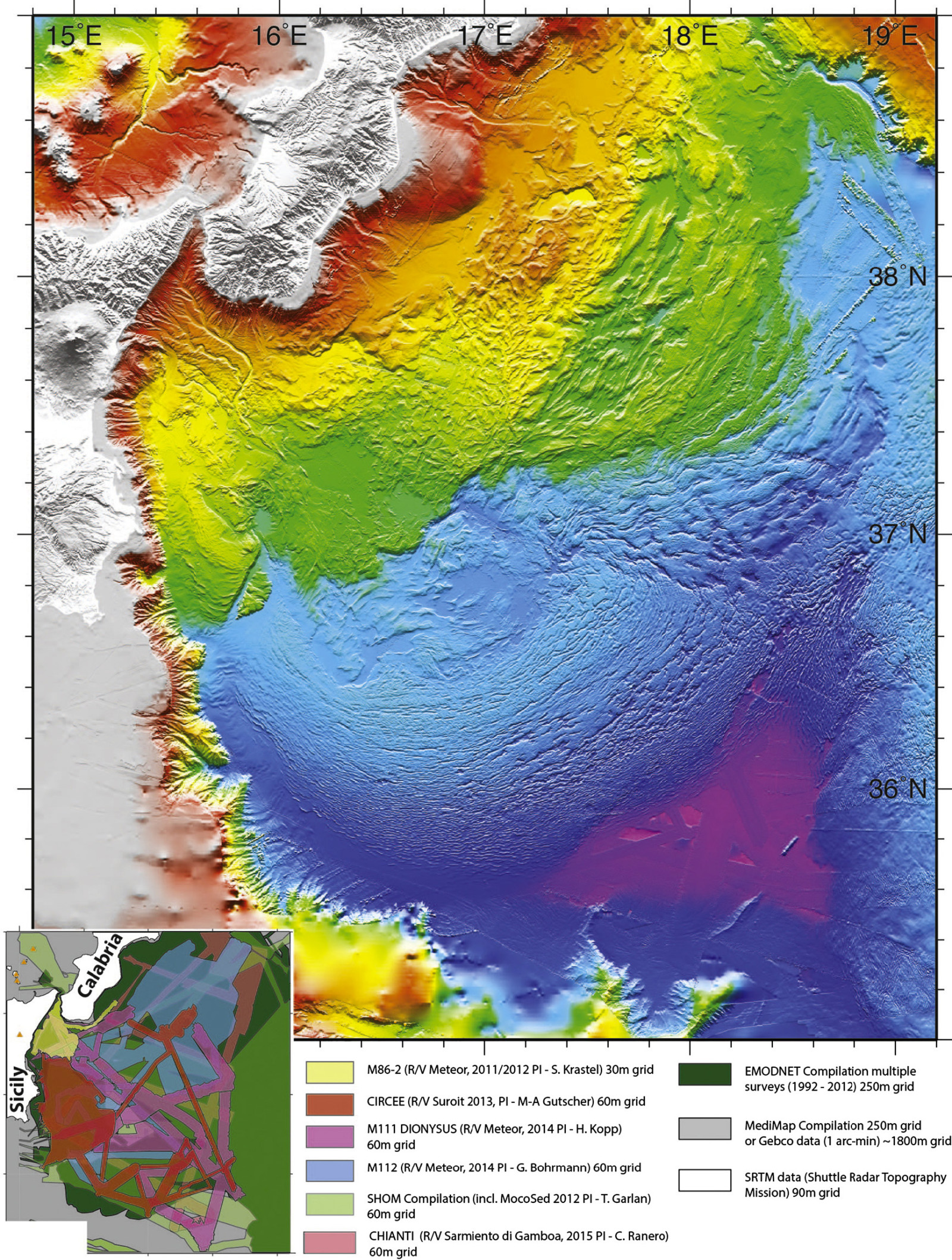
Understanding volcanism within passive continental rift zones such as the western Sicily Channel remains challenging compared to other tectonic regions. Positioned in the central Mediterranean, this area undergoes significant crustal stretching, leading to dense volcanic formations along extensional faults. Such structural complexity necessitates high-resolution mapping for accurate interpretation.
The recent expedition transformed the geological perspective. By cross-referencing new multibeam data against older models, many previously identified features failed to stand up to investigation or lacked volcanic origins. Conversely, previously unknown structures—Actea and five others—became clearly visible. While earlier research published in Earth and Planetary Science Letters documented active tectonics at the Calabrian subduction zone northeast of Sicily, the western Sicily Channel’s volcanic activity remained poorly understood until now.
An Active Volcano Near the Shoreline
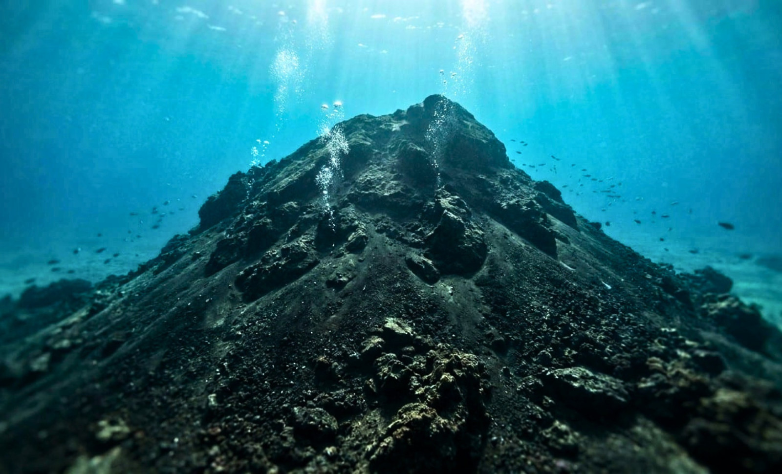
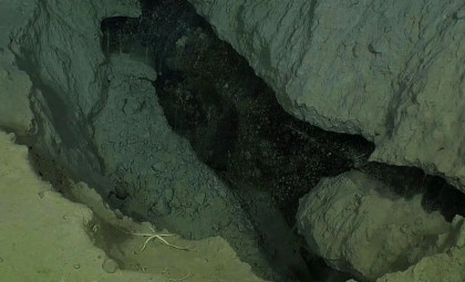
Among the new volcanic centers, Actea is the most striking due to its proximity to the coast. It lies atop the northern segment of the Capo Granitola fault zone at water depths between 62 and 70 meters, with its peak standing just 34 meters below the sea surface. This is shallower than many popular diving areas bustling with swimmers during summertime.
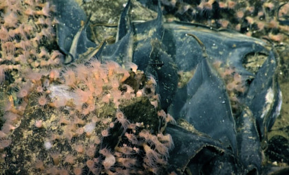
Actea shows compelling signs of renewed magmatic activity, likely happening between the Last Glacial Maximum and early post-glacial sea-level rise. The evidence includes a substantial lava flow emplaced fairly recently. Interestingly, both Actea and its neighboring volcano, Climene, exhibit gas bubbles escaping from their craters.
Without sampling the chemical makeup of these bubbles, their exact origin remains undetermined. They might be biological methane emissions or evidence of ongoing hydrothermal activity. These observations confirm that both magmatic and hydrothermal mechanisms remain active beneath the seafloor, indicating a dynamic geological environment hidden from view.
A related ScienceDaily article highlights that this Mediterranean region lies along an active plate boundary where tectonic stress persists, though the recently discovered volcanic field introduces distinct hazards beyond those posed by earthquakes.
Ferdinandea Island: A Historic Example of the Channel’s Volcanic Power
This part of the Mediterranean has a history of dramatic volcanic events. In July 1831, the submarine volcano Ferdinandea erupted, creating a volcanic island rising approximately 65 meters above sea level, less than 300 meters across, with a perimeter nearing one kilometer—an island that seemingly emerged from the sea between Sicily and Tunisia.
The newly formed landmass became the subject of a territorial contest involving England, France, Spain, and the Kingdom of the Two Sicilies. However, the island’s tephra composition made it vulnerable to wave erosion, and after the eruption ceased, it gradually submerged. By January 1832, the island had disappeared beneath the waves. Record shows it has surfaced four times over the centuries, with political disputes dissipating as quickly as the land itself.
The Sicily Channel’s relatively shallow depths, by Mediterranean standards, mean that volcanic pressure buildup can bring submarine eruptions very close to the surface—within tens of meters instead of kilometers. Today, Ferdinandea’s summit lies just six meters underwater, presenting a navigational hazard for ships with deeper drafts. To prevent renewed sovereignty disputes if the island re-emerges, Italian military divers planted a Sicilian flag on the submerged peak in 2000.
Implications and Next Steps
Discovering underwater volcanoes so close to Sicilian coastal communities underscores how little is known about nearshore submarine landscapes and raises awareness of volcanic hazards in densely inhabited regions. The threat extends to critical infrastructure, as submarine communication cables and gas pipelines traverse these seafloor areas.
Analyzing samples from these volcanoes aids in reconstructing the geological history and informs risk management efforts, especially for seafloor installations. The research calls for an updated tectono-magmatic model of the Sicily Channel, showing how fault structures dictate volcano formation and evolution. These findings pave the way for future studies focusing on the timing, origins, and lifecycle of volcanism in this actively stretching rift environment.
With over 80 percent of volcanic activity occurring beneath the seas, and the Mediterranean hosting millions of ferry passengers annually, hundreds of daily flights, plus vital internet cables connecting continents, it’s telling that detailed high-resolution maps of its depths are only now being crafted this century. This reveals how much remains to be explored within our planet’s hidden underwater world.
- Categories:
- Science


0 comments
Sign in to Comment