
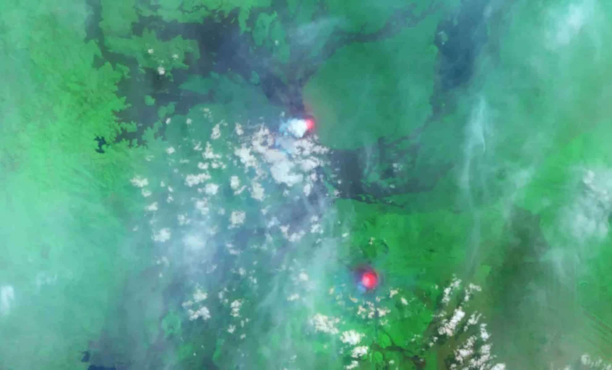
In a striking satellite image from 2014, both Mount Nyamuragira and Mount Nyiragongo, the Democratic Republic of Congo's most eruptive volcanoes, are seen erupting at the same time. Captured by the Landsat 8 satellite, this infrared image highlights glowing lava lakes on both peaks, emphasizing their ongoing volcanic activity and the looming hazards they pose to surrounding communities.
Fiery Lava Lakes Mark Dual Eruptions
The Landsat 8 satellite provided an eye-opening false-color infrared photo, showcasing an extraordinary natural event where two volcanoes erupt concurrently. This image was taken just weeks after Nyamuragira restarted erupting following a two-year pause, with its molten lava shining brightly.
Mount Nyamuragira is a broad shield volcano with a summit elevation of approximately 10,033 feet (3,058 meters). It is characterized by frequent eruptions and long-lasting lava flows, including notable features like the “Murara” cinder cone formed between 1976 and 1977. The volcano has remained active since 2018.

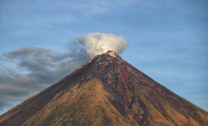
In contrast, Mount Nyiragongo is a taller stratovolcano, reaching 11,385 feet (3,470 meters) above sea level. Though it erupts less often, its highly fluid lava flows pose a greater threat due to their rapid speeds.
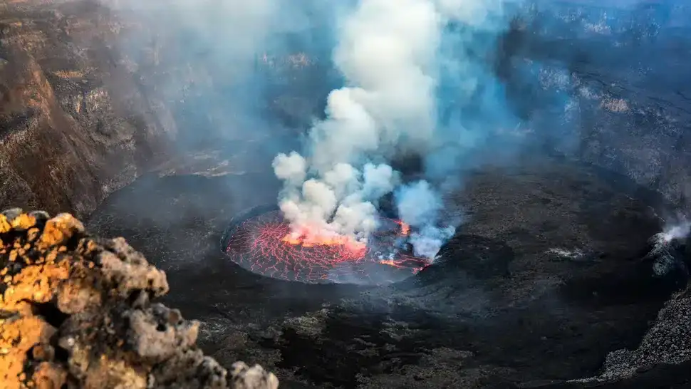
Nyiragongo hosts one of Earth’s largest lava lakes, an uncommon feature for a stratovolcano, which has been persistently active since 2002, drawing significant scientific interest.
Geological Twins with Shared Risks
Both volcanoes emerged about 12,000 years ago amid vigorous tectonic shifts along the Kameronze fault zone, explaining why their eruptions often occur simultaneously. This 2014 image is a rare documentation of such concurrent volcanic activity at their zenith.
Live Science reports that together, these volcanoes have erupted around 60 times since 1900, accounting for a significant share of Africa's volcanic output. Nyamuragira is the more frequent producer of eruptions visible from afar, whereas Nyiragongo's sudden, fast-moving lava has caused catastrophic destruction, including the devastating January 2002 eruption that displaced over 100,000 residents.
Constant Peril for Nearby Populations
The cities near these volcanoes, especially Goma located close to Nyiragongo, face serious hazards. This urban center of over a million inhabitants has endured severe damage from previous eruptions.
Nyiragongo’s lava flows are among the swiftest ever documented, racing downhill at speeds up to 62 mph (100 km/h) as seen in the 1977 eruption, which led to around 2,000 fatalities. Such rapid flows leave minimal time for evacuation efforts.
Scientific Insights from Space
Infrared images from Landsat 8 have been instrumental in enhancing our understanding of volcanic dynamics, the behavior of lava lakes, and potential environmental impacts. The vivid contrast between the glowing lava and green vegetation around the volcanoes enables researchers to track ecological changes caused by eruptions.
Continuous volcanic activity observed on these sites underscores the importance of ongoing satellite monitoring to better predict eruptions and mitigate their consequences.
- Categories:
- Science


0 comments
Sign in to Comment