
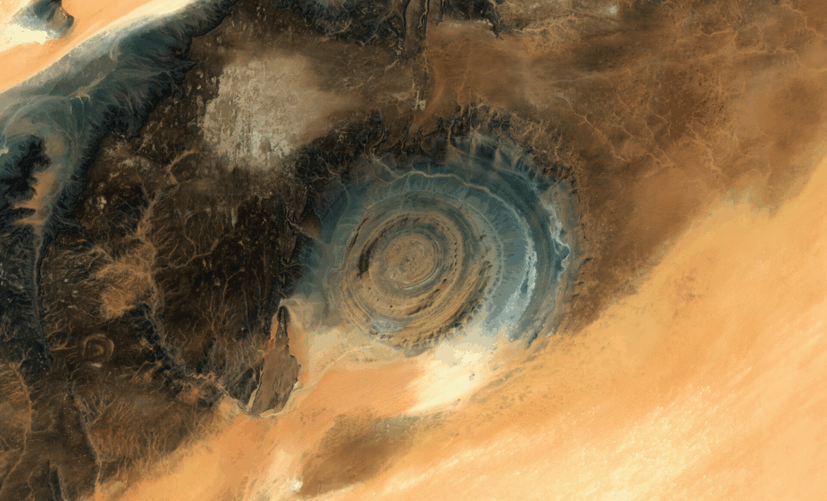
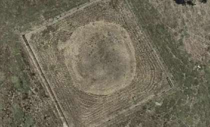
Deep within the vast expanse of the Sahara Desert lies a captivating geological phenomenon that has intrigued scientists and space explorers alike. Termed the “Eye of the Sahara,” or the Richat Structure, this striking formation in Mauritania’s desert stands out as a remarkable natural spectacle. Viewed from orbit, it resembles a colossal bull’s-eye, sparking curiosity about its true origins. The European Space Agency (ESA) provides an extraordinary perspective on this ancient feature.
Unraveling the Mystery of the Eye of the Sahara
Recent images from ESA highlight the Richat Structure’s impressive concentric rings, which for years were thought to result from a meteor strike. Modern research, however, reveals that these formations emerged due to a significant geological uplift. Lava and molten rock pushed upward below the surface millions of years ago, with erosion by wind, water, and sand sculpting the distinctive bull’s-eye pattern we observe today.
The structure covers roughly 50 kilometers across and is believed to be over 100 million years old. Its impressive size and ancient origins make it a vital subject for geologists eager to decode Earth’s geological narrative. ESA’s Copernicus Sentinel-2 satellites continue to capture detailed images, offering new clues about the Richat Structure’s layered composition and erosion history.

Decoding the Layers: Insights into Earth’s Past
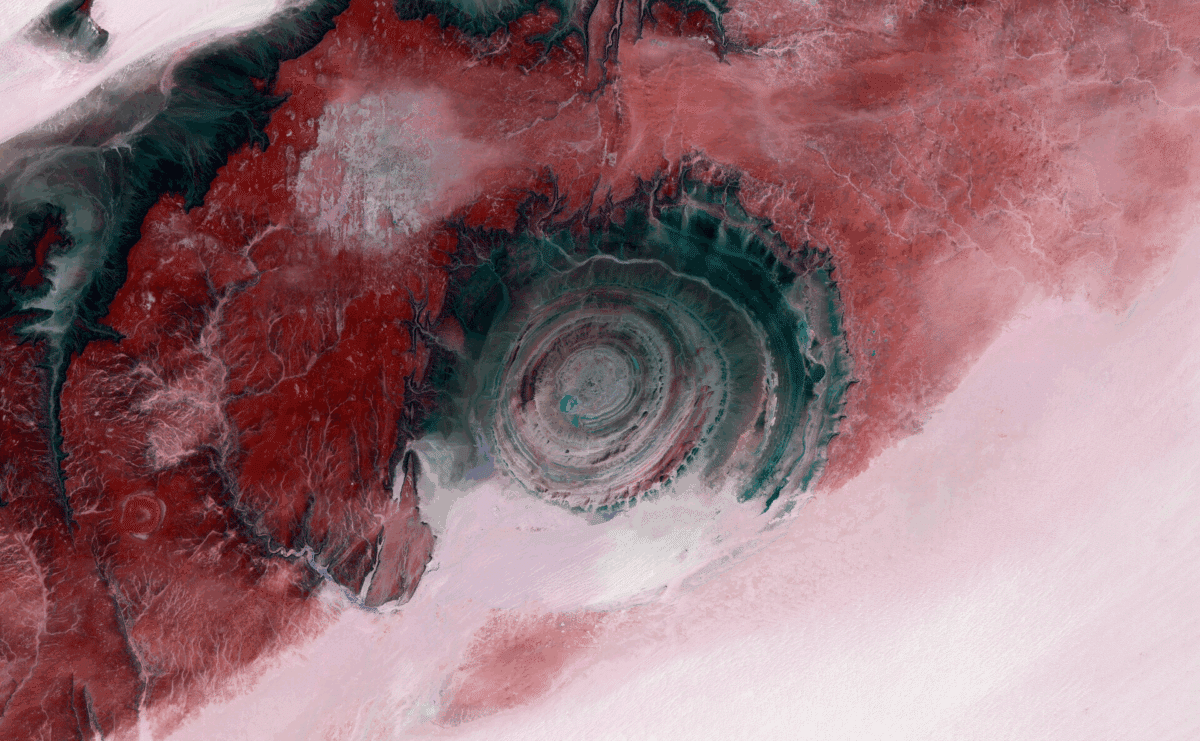
The concentric bands of sedimentary rock that characterize the Richat Structure are particularly fascinating. ESA’s false-color satellite imagery accentuates these geological variations, highlighting resilient rock types like quartzite sandstone in shades of red and pink. These rocks, once part of the Earth’s crust, have been shaped over extensive periods through a mix of uplift and erosion.
The innermost rings stand taller—up to 80 meters high—and consist of older rock formations compared to the outer layers. This difference allows scientists to analyze the erosional forces that have transformed the landscape over time. ESA’s observations demonstrate how even the aridest environments preserve detailed geological histories.
Life Amidst the Desert: Vegetation and Wildlife
Although the Richat Structure is primarily recognized for its geological features, ESA’s satellite imagery also uncovers traces of life in the desert. The false-color pictures reveal spots where scattered bushes and trees thrive, marking the locations of dry riverbeds and isolated patches of greenery. This rare view into the Sahara’s ecological fabric underscores the resilience of life in even the harshest conditions.
ESA’s advanced imaging technologies enable scientists to monitor the desert environment in unprecedented detail, deepening our knowledge about natural resources and ecosystem processes. Such data are vital for ecologists and conservationists dedicated to protecting fragile desert habitats.
ESA’s Contributions to Earth Science
Through its Earth observation initiatives, including the Copernicus Sentinel-2 mission, the European Space Agency keeps advancing satellite technology. By delivering high-resolution images of the planet’s surface, ESA empowers researchers to study and safeguard Earth’s remarkable natural features. The Richat Structure exemplifies the stunning clarity and insights these satellites provide.
As ESA continues its satellite missions and scientific investigations, it ensures a continual flow of valuable information about our world’s geological and ecological makeup, strengthening global efforts to understand the planet’s history and future.
- Categories:
- News


0 comments
Sign in to Comment