

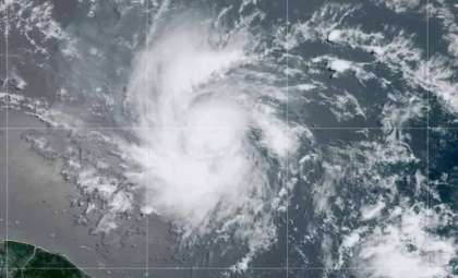
Weather experts are tracking a nascent system in the Atlantic that might develop into the next tropical storm of the season, potentially named Ernesto.
The National Hurricane Center (NHC) forecasts the emergence of a low-pressure zone somewhere in the central or western tropical Atlantic early in the upcoming week.
This disturbance, as it nears the Lesser Antilles, currently has a 40% chance of becoming a tropical storm within the week, although its immediate formation probability remains almost zero.

This evolving weather pattern is closely observed by atmospheric scientists given its potential to become a significant storm.
Tracking and Forecast Updates
A substantial high-pressure system is presently exerting influence, keeping the developing system pushed southward. However, meteorological simulations indicate this high-pressure zone might shift eastward soon, possibly allowing the system a path to move north.
FOX 13 meteorologist Nash Rhodes notes, “more models are starting to jump on board with the possibility of this forming.” This changing atmospheric setup could enable the disturbance to gain strength.
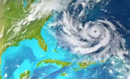
If it intensifies into a tropical storm, it will be designated Ernesto, succeeding the recent downgrade of Tropical Storm Debby to a depression.
The National Oceanic and Atmospheric Administration (NOAA) has revised its hurricane outlook, calling for an "exceptionally active" season. They now anticipate between 14 and 21 named storms, with 6 to 11 possibly becoming hurricanes and 2 to 5 reaching major hurricane status (Category 3 or above). Such projections underline the heightened risk of storms like Ernesto emerging as the season advances.

Present Situation and Possible Effects
The NHC’s current analysis anticipates minimal intensification over the next 48 hours, though conditions could evolve once the system approaches the Lesser Antilles. While the chance of development is moderate, residents should remain alert and prepare for potential weather shifts.
This developing system could impact broader weather conditions across the Atlantic Basin, possibly triggering notable meteorological effects in the Caribbean and surrounding areas. Weather specialist Nash Rhodes remarked, “We could be looking at another named storm by the end of next week,” highlighting the probability of further intensification.
Moreover, this system is part of an overall increase in disturbances across the Atlantic Ocean. With the hurricane season reaching its peak, the combination of warm seas and conducive atmospheric factors may lead to several new storms forming soon. This heightened activity stresses the need for ongoing observation and readiness.
Hurricane Season Preparedness
As hurricane season moves forward, this potential storm serves as a timely reminder to prioritize preparedness. Tropical storms and hurricanes can develop rapidly and cause destructive effects such as intense rainfall, damaging winds, and flooding.
Local officials urge residents in vulnerable coastal areas to have emergency plans ready and to keep checking updates from reliable sources such as the National Hurricane Center.
The current disturbance in the Atlantic underscores the unpredictable nature of the season and the critical importance of staying vigilant. Whether it ultimately becomes Ernesto or not, this system highlights the necessity of being equipped for any weather emergencies during this critical period.
Meteorologists will continue to watch the system’s trajectory and strength closely, focusing on keeping the public informed and prepared for any changes in its path or intensity.
- Categories:
- News ,
- Climate change


0 comments
Sign in to Comment