
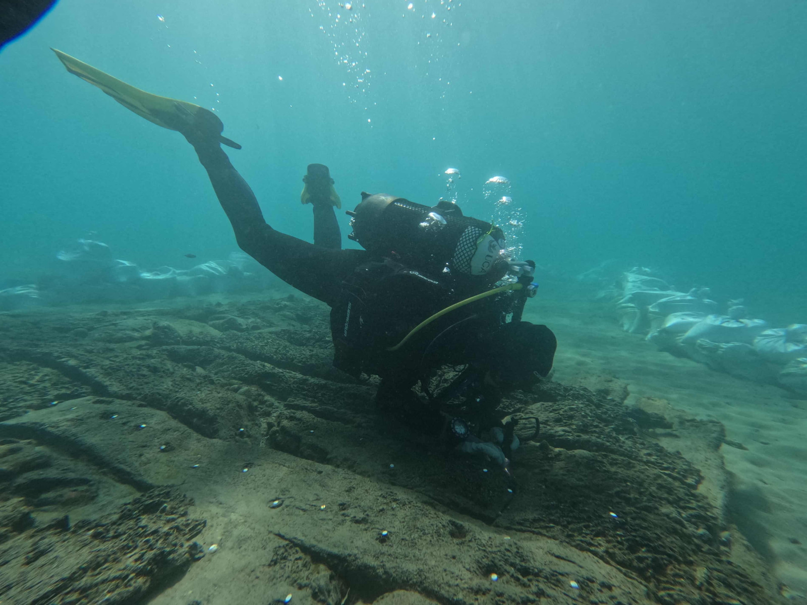
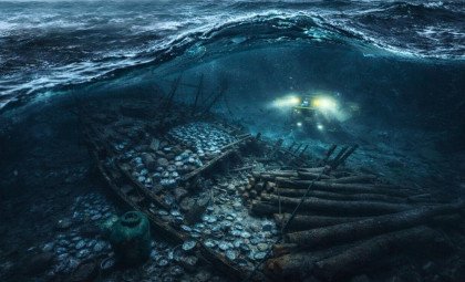
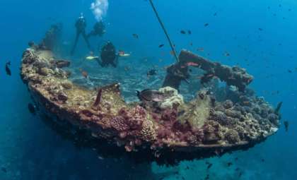
The seabed of the Bay of Algeciras serves as an accidental repository of maritime history. Over millennia, countless vessels anchored in this area, awaiting safe passage through the challenging Strait of Gibraltar, only to be lost to storms, conflict, or unpredictable sea conditions. Today, researchers have documented the remnants of these sunken ships.
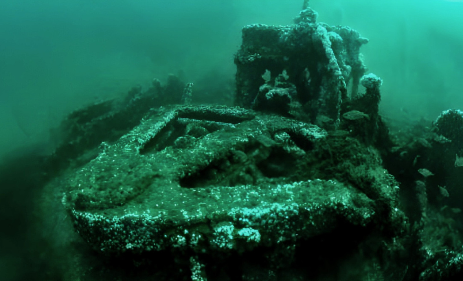
During a comprehensive three-year initiative known as Project Herakles, archaeologists identified 151 submerged archaeological sites spanning 29 square miles between Algeciras, Spain, and Gibraltar, a British overseas territory. More than 100 of these sites represent shipwrecks. The oldest wreck dates back to the fifth century B.C., from the era when Carthage dominated the western Mediterranean, while the most recent hail from World War II.
This collection of shipwrecks offers a rare glimpse into several historical periods, including Punic commerce, Roman imperial expansion, medieval navigation, and modern naval conflicts. “Few locations in the Mediterranean feature such an impressive variety and density of maritime archaeological records,” remarked Felipe Cerezo Andreo, an underwater archaeology expert at the University of Cádiz who led the project, in an interview with The Guardian.

Strategic Perils at the Mediterranean's Gateway
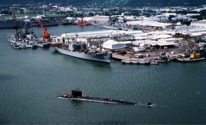
The Strait of Gibraltar forms the sole natural maritime corridor between the Mediterranean Sea and the Atlantic Ocean. Vessels navigating this channel encounter fierce currents, abrupt weather changes, and complex geopolitical tensions. The Bay of Algeciras, situated near the strait's eastern mouth, functioned as a waiting area where ships anchored to evade unfavorable conditions.
“Any vessel transiting between the Mediterranean and the Atlantic must pass through the Strait of Gibraltar, and most are compelled to anchor in the Bay of Algeciras while waiting for safer conditions,” explained Cerezo Andreo during a conversation with CNN.
This mandatory pause often proved fatal, resulting in numerous shipwrecks on the bay’s bottom. Historically, the bay witnessed two significant maritime battles: the Battle of Gibraltar in 1607 and the First Battle of Algeciras in 1801. During the latter, British Rear Admiral James Saumarez withdrew after sustaining damage on July 6th, but quickly repaired his fleet in Gibraltar and re-engaged to defeat a superior combined French and Spanish fleet six days later, as recorded by the Society for Nautical Research. Outside wartime, many accidents continued to litter the seafloor with ship debris over centuries.
Wrecks from Ancient Carthage to Unexpected Medieval Finds
The Roman era is represented by 25 identified shipwrecks, reflecting Rome's long-standing influence on the strait’s shores. The earliest known vessel stems from the Punic period, providing evidence of Carthaginian naval presence from the fifth century B.C., predating Rome’s dominance. An entry on the University of Cádiz's research portal details how geophysical surveys and direct observations confirmed two Punic shipwrecks, uncovered artifacts from two anchorage locations, and identified two additional possible sites awaiting verification.
Unexpectedly, three medieval shipwrecks were uncovered, rare finds since timber remains from this period are scarcely preserved in the Mediterranean. Cerezo Andreo told The Guardian that examining these hulls might greatly enhance understanding of maritime activity during the Islamic rule period in southern Spain, a time with little archaeological data.
By the early modern era, the bay had become an international hub, evidenced by the presence of Dutch, Venetian, Spanish, and English vessels among the documented shipwrecks. “We found ships from nearly every nationality, since all maritime powers passed through this critical chokepoint,” Cerezo Andreo reported to The Guardian. Popular Mechanics noted that 134 wrecks have been catalogued in total, with 34 fully documented.
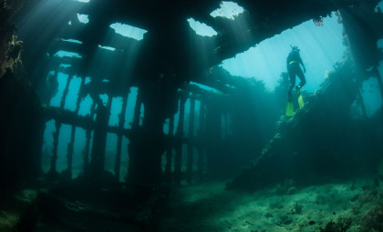
A Deceptive Gunboat Concealed by Fishing Nets
The Puente Mayorga IV is notable due to its tactical design. This small 18th-century Spanish gunboat was built to launch surprise attacks on British ships near Gibraltar, which Britain acquired in 1713 via the Treaty of Utrecht.
These vessels disguised themselves as fishing boats, with nets masking concealed cannons that could be rapidly deployed to attack targets at close range. Historical accounts referenced this ploy, but this wreck provides the first physical example available for study.
Researchers also found a Maiale—Italian for "pig"—a human-piloted torpedo from World War II. Italian Navy divers rode these slow submersibles close to enemy moored ships, attached explosives to their hulls, and escaped before detonation. These devices were a strategic tool for Italy’s naval forces when conventional fleets could not match Allied strength in the Mediterranean.
Seafloor Threatened by Human Activity and Invasive Algae
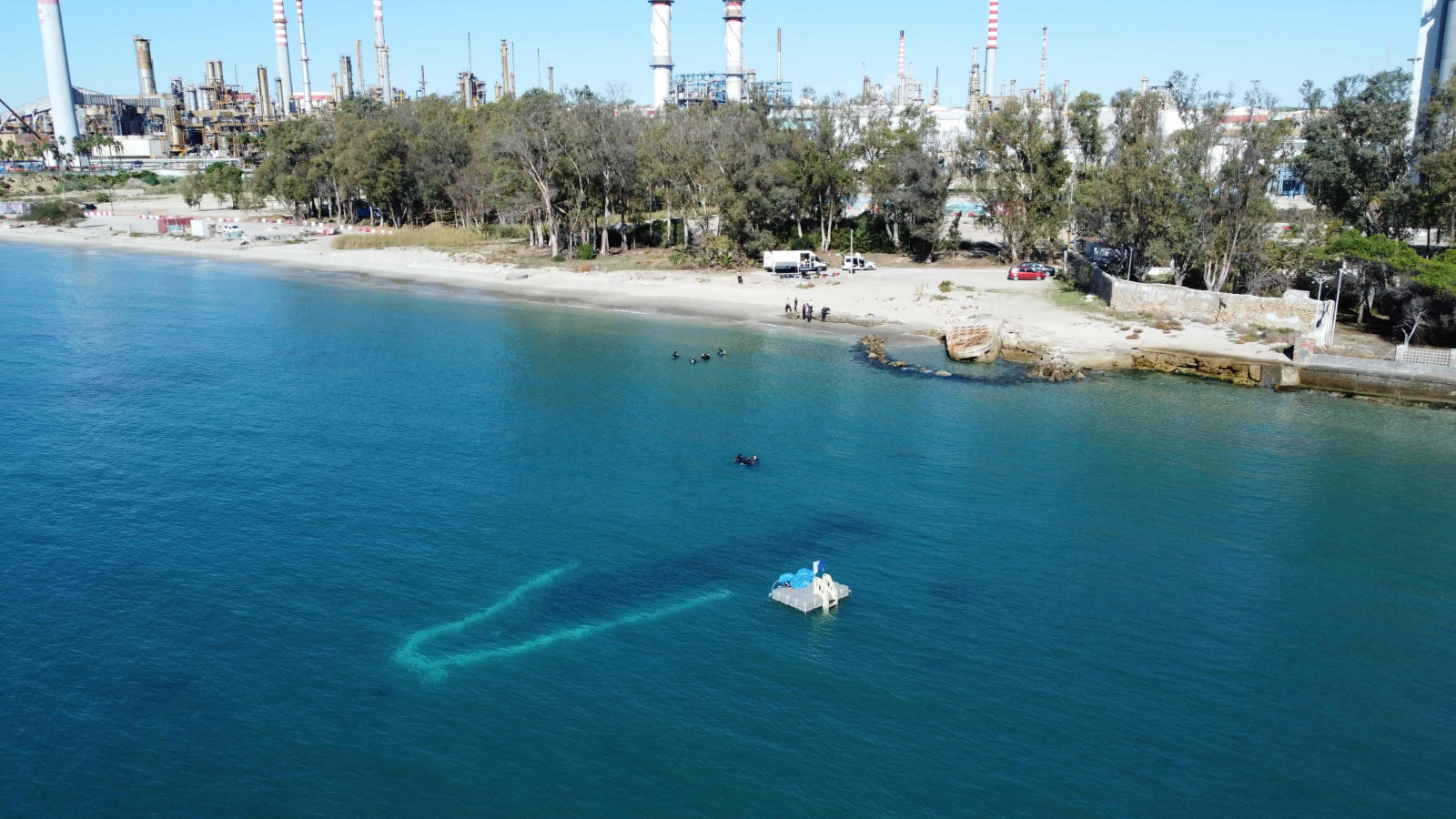
Mapping these underwater sites requires contending with both industrial activity and ecological changes. The Bay of Algeciras remains one of Europe’s busiest maritime areas, where shipyards, oil processing plants, and dredging operations impact the seabed. Climate change and port development have altered sediment dynamics, unpredictably exposing or further burying ancient wrecks.
Additionally, an invasive brown algae species, Rugulopteryx okamurae, native to the Northwest Pacific, spread rapidly after showing up in the area a few years ago. It forms thick mats that choke out native life and obscure underwater surveys. In as little as five years, it has enveloped shipwrecks that had been visible for centuries.
El País reported that researchers compared underwater photos from the 1970s and 1980s with current conditions to track how much the marine environment has shifted due to this invasive species.
Protection Efforts and Digital Preservation
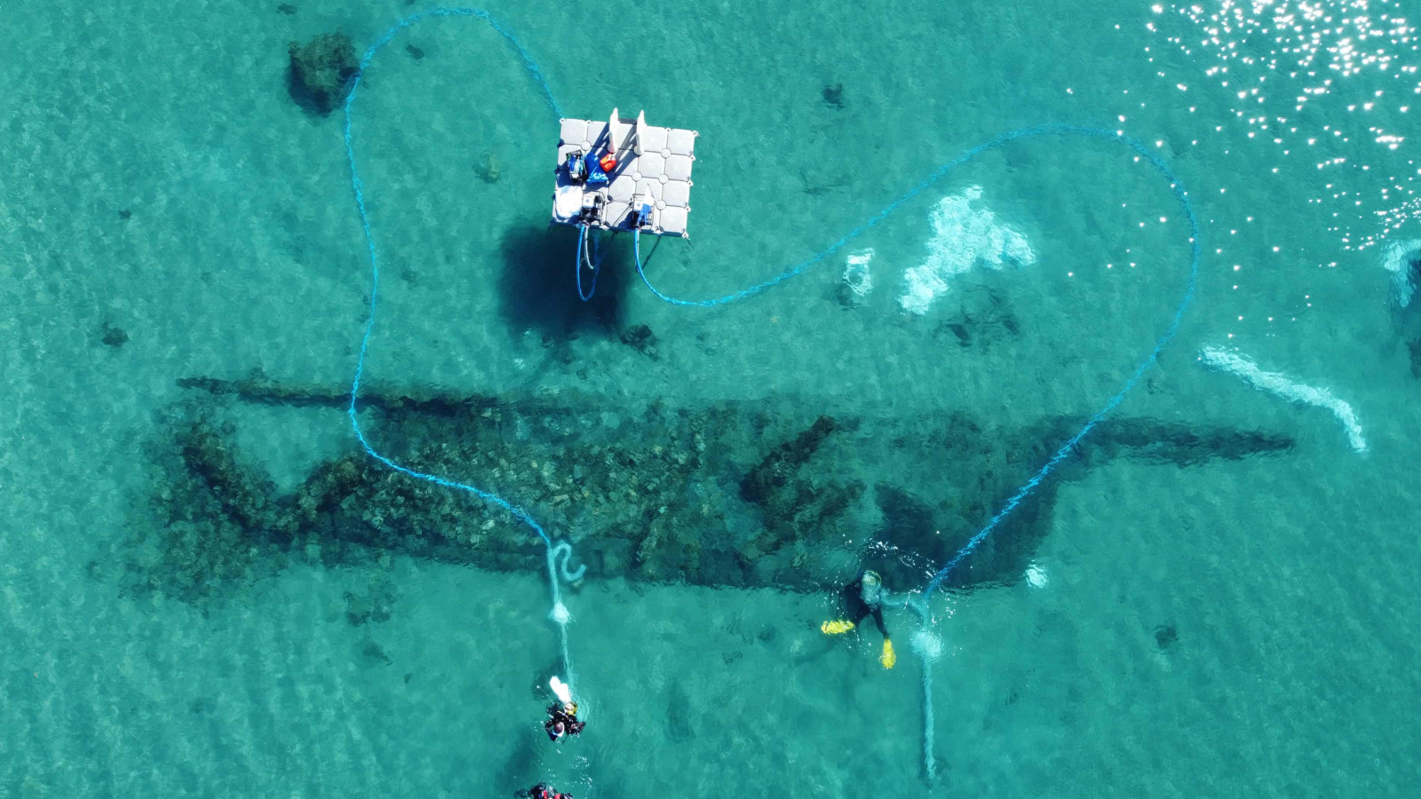
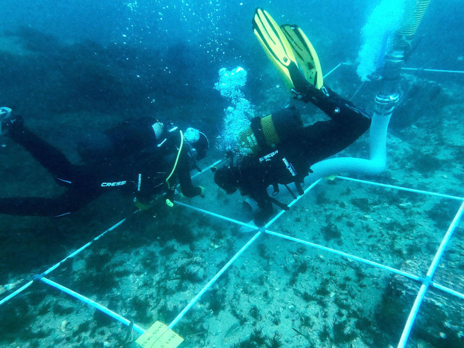
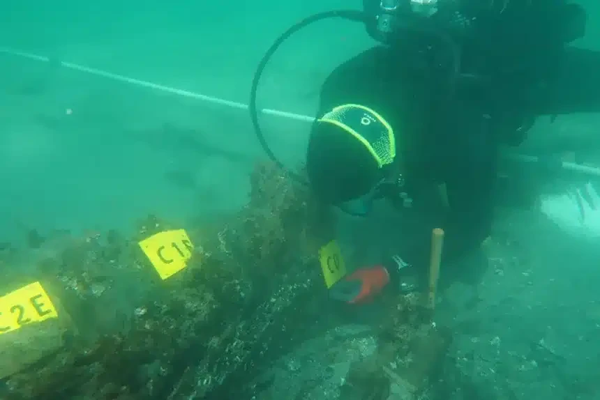
So far, the project has surveyed roughly 23 percent of the bay, focusing mainly on coastal areas. In deeper waters, heavy ship anchors, sometimes exceeding twenty tons, pose a significant risk of physical destruction upon impact.
According to the team’s evaluation, 56 percent of known sites remain stable, while the remaining 44 percent urgently need attention and conservation efforts. The researchers advocate for official underwater cultural heritage status to limit anchoring and maritime development in vulnerable zones.
Meanwhile, the data collected is being transformed into a public digital archive featuring 360-degree dive footage and three-dimensional reconstructions. This resource enables scholars and enthusiasts alike to explore the wrecks virtually, preserving the sites without disturbing them. The extensive work of analyzing these discoveries and determining preservation priorities is just beginning.
- Categories:
- News


0 comments
Sign in to Comment