
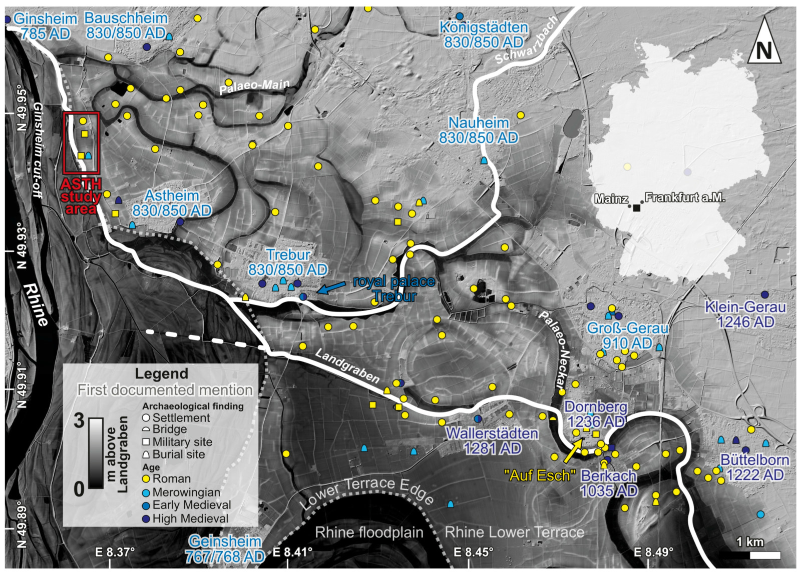
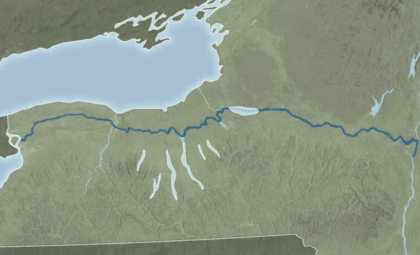
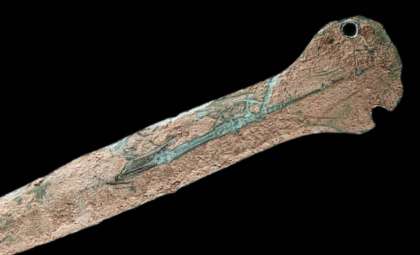
Beneath the expansive fields of Germany's Hessische Ried region, archaeologists have uncovered a perfectly straight water channel extending for several hundred meters. Farmers unknowingly cultivated above this feature for many years until research revealed it to be a submerged Roman canal used to transport military units and goods nearly two millennia ago.
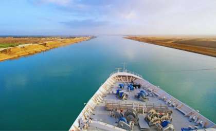
This channel is neither a natural Rhine river branch nor a medieval drainage trench. It was a crafted watercourse, engineered by Roman experts to link the busy Rhine River with a fortified port named Trebur-Astheim. As reported in the journal Land, it represents one of the scarce navigable Roman canals documented north of the Alps.
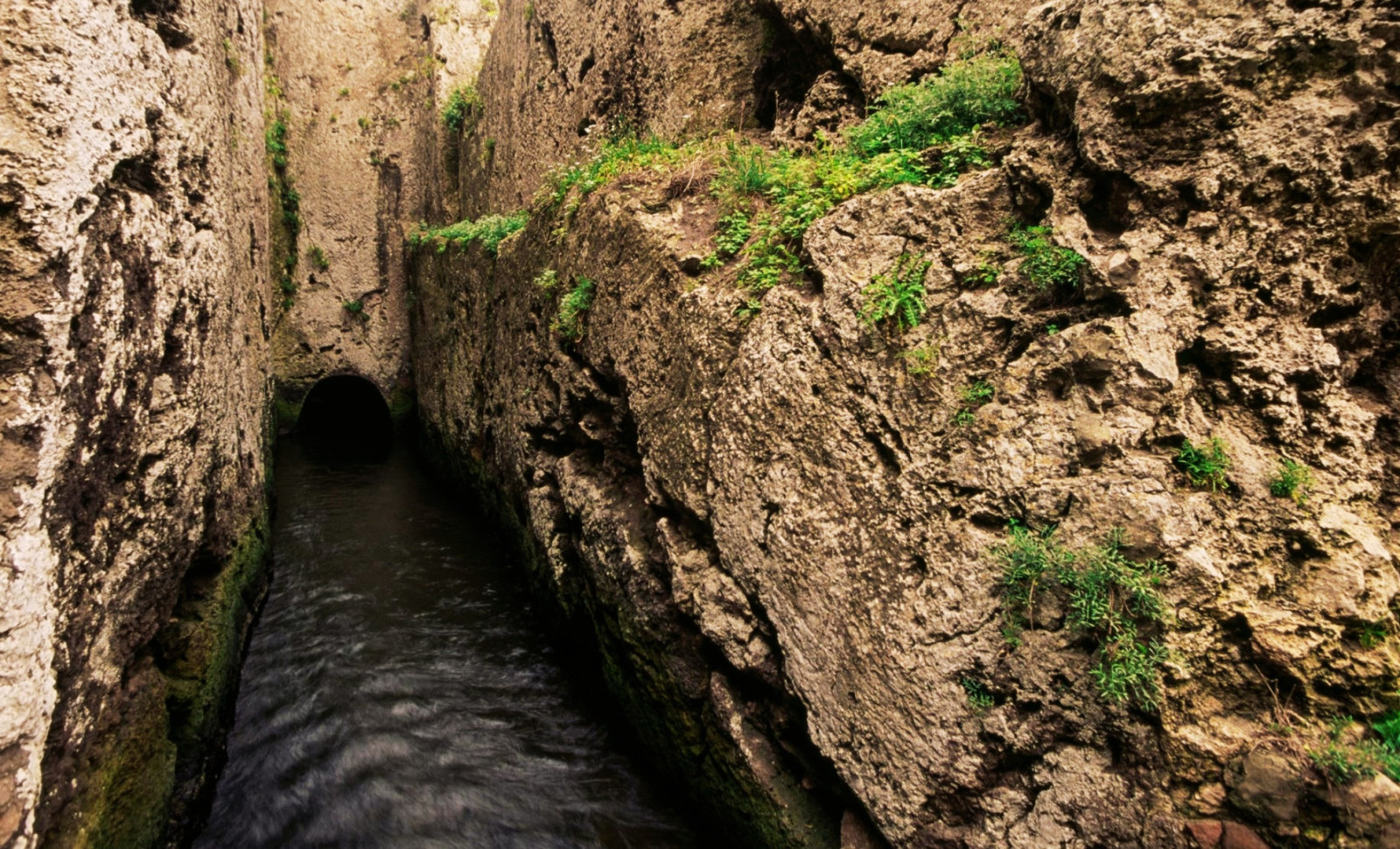
Measuring about 15 meters wide with an estimated water depth of 2.5 meters, this large canal could accommodate both Roman patrol boats and cargo ships. Its straight course headed toward a late Roman burgus—a fortified post that served as an inland harbor on the empire’s Germanic frontier during Emperor Valentinian I’s rule between 364 and 375 AD.

One remarkable aspect of this discovery is the canal’s extended period of use. Radiocarbon analyses of sediments taken from within the canal indicate that maintenance continued well beyond the collapse of Roman authority in the region. It remained operational through the 7th or 8th centuries AD, with Merovingian and Carolingian communities relying on this waterway long after the Western Roman Empire’s end.
Unveiling Underground Features Without Excavation
Experts from Johannes Gutenberg University Mainz, Goethe University Frankfurt, and Hessen’s archaeological office conducted the study. They encountered a challenge: the canal was buried under private farmland and surrounded by a saturated water table, making digging impossible. To overcome this, they utilized a combination of non-invasive geophysical approaches to visualize the canal beneath the surface.
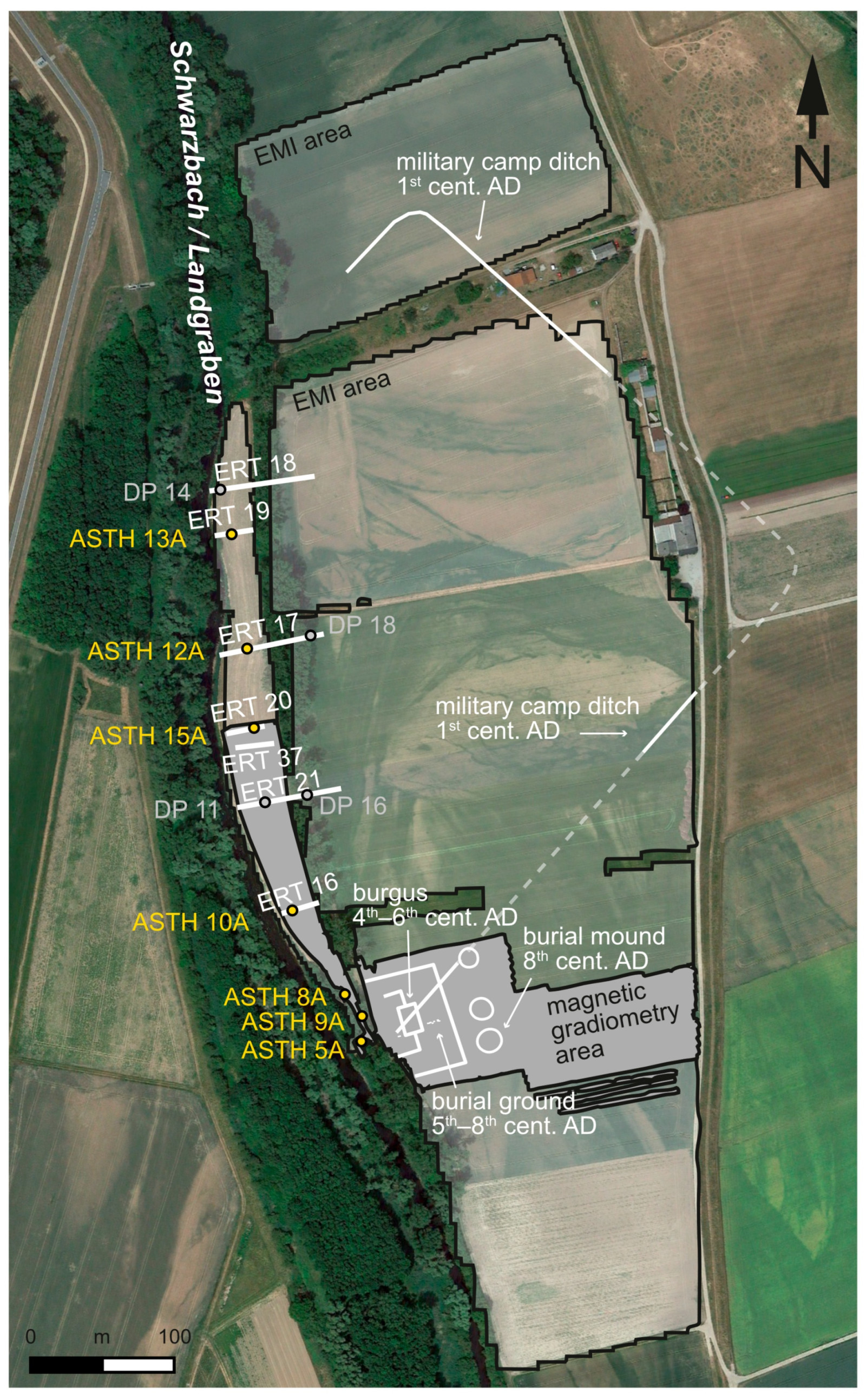
Magnetic gradiometry detected subtle fluctuations in the earth's magnetic field. Frequency domain electromagnetic induction transmitted harmonic signals underground, observing how materials responded. Using electrical resistivity tomography, electrodes mapped the ease of electric current flow through different soil layers. Together, these methods rendered a detailed image of the canal’s size and trajectory without any ground disturbance.
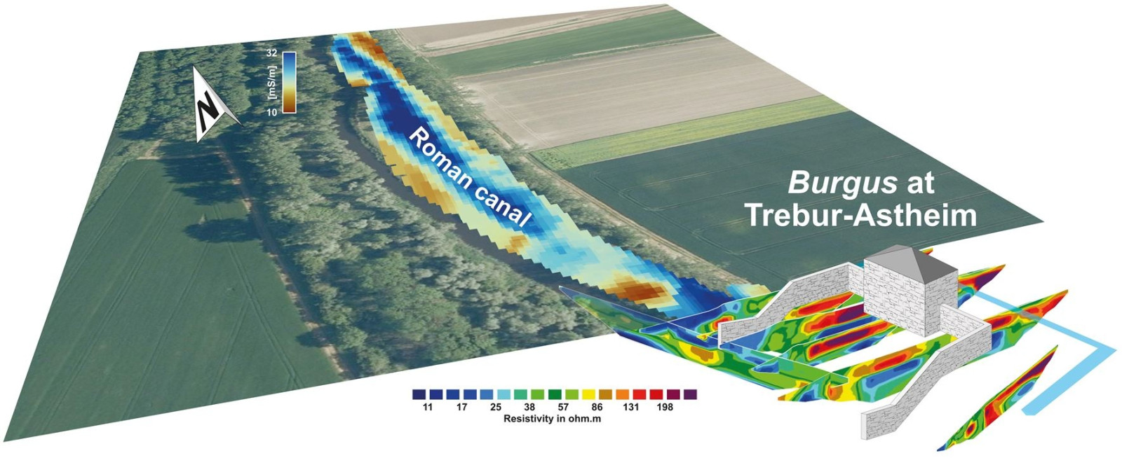
The key indicator in their data was electrical conductivity. Sediments like fine clay and silt filling the old canal contrasted with the surrounding sandy gravel of the ancient Rhine terrace. The canal appeared clearly as a linear feature pointing toward the fort. Additional verification came from direct push sensing, where a hydraulic probe penetrated the ground to measure sediment characteristics at various depths, confirming geophysical results and providing detailed vertical profiles.
With precise locations identified, researchers collected sediment core samples along the canal’s route. These revealed alternating layers representing phases in the canal’s history: coarse sand layers suggested periods of flowing water, while finer gray silt layers indicated times of stagnation and channel infilling. This cyclical pattern pointed to regular upkeep required to keep the canal functional.
Intersecting a Long-Lost Roman Military Encampment
Dating the canal was aided by its relation to a former Roman camp it intersected, dating between 14 and 20 AD during Emperor Tiberius’s reign. Since the canal cuts through this earlier camp site, it must have been constructed after the early first century but before the establishment of the fortified harbor in the late fourth century.
The fortified site at Trebur-Astheim was substantial, boasting a central structure measuring 27 by 18 meters, stabilized by wooden stakes driven into the Rhine terrace sands. Robust walls extended from this core building to the waterside, creating a secure environment where ships could dock. The design matches other Valentinian defensive works constructed to protect the Rhine frontier amid growing tensions with Germanic tribes.
This canal and its associated harbor were integrated into a larger Roman waterway system linking the Landgraben river network with the Rhine. Forts and civilian settlements further inland could efficiently send and receive goods through this engineered connection. Scholars believe the burgus functioned as a transshipment point where large Rhine vessels unloaded onto smaller boats suited for inland travel.
A Unique Legacy Above the Alpine Region
As Popular Mechanics notes, navigable Roman canals north of the Alps are exceedingly uncommon in archaeological records. Although the Romans are noted for aqueducts, roads, and urban waterworks, dedicated shipping canals in northern parts of Europe were rare, with most waterways involving adaptation of natural rivers rather than full artificial construction.
The Trebur-Astheim canal is among a select few confirmed examples that remained in use into the Early Middle Ages. It shares this rare status with projects such as Charlemagne’s unfinished Fossa Carolina of 793 AD and the Kanhave Canal in Denmark. The canal’s persistence into the 7th and 8th centuries highlights how early medieval populations maintained and utilized Roman hydraulic engineering.
The canal’s last dredging phase coincides with the establishment of the royal palace at Trebur, first recorded in 829 AD, suggesting the canal may have transported building materials for the Carolingian seat of power. Sediment analysis revealed rapid infilling following abandonment, with deposition rates of at least 11 millimeters per year, meaning that without upkeep, the waterway would have become unusable within a few decades.
This discovery also revises our understanding of human impact on the Hessische Ried region. Prior research largely credited early modern drainage initiatives under Landgrave Georg I in the 16th century for shaping the landscape. The Roman canal shows significant engineered alteration of the fluvial environment took place some 1,500 years earlier.
- Categories:
- News


0 comments
Sign in to Comment