
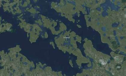
By late 2025, numerous locations throughout the South China Sea displayed clear evidence of ongoing land reclamation activities and the enhancement of military facilities attributed to China. Sequential satellite imagery reveals significant transformation of both natural and man-made islands within the disputed Paracel and Spratly archipelagos.
This escalation of infrastructure expansion contradicts earlier Chinese claims that reclamation efforts had ended over a decade ago. Data gathered by the Asia Maritime Transparency Initiative (AMTI) throughout 2023 to late 2025 demonstrates that construction progressed unabated. Several previously undeveloped or minor islets have been methodically converted into fortified outposts.
The uniformity and scale of these developments suggest a strategic design. These fortified locations now include airstrips, radar installations, reinforced shelters, and logistical hubs tailored for prolonged military deployment. Their strategic positioning along vital shipping routes has drawn increased concern from neighboring governments and global analysts.

Detailed Review Identifies Over 20 Militarized Outposts Across the Paracels
In a comprehensive update by AMTI, Chinese activity was verified at more than 20 outposts within the Paracel Islands. Many of these sites, once modest reefs or low-lying landforms, now support hardened structures and permanent installations.
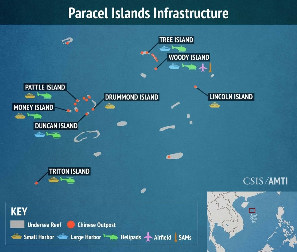
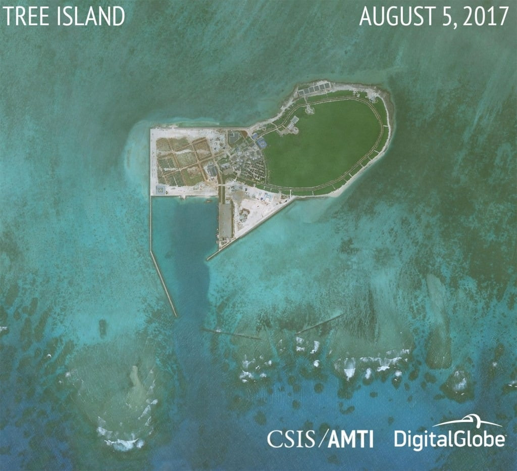
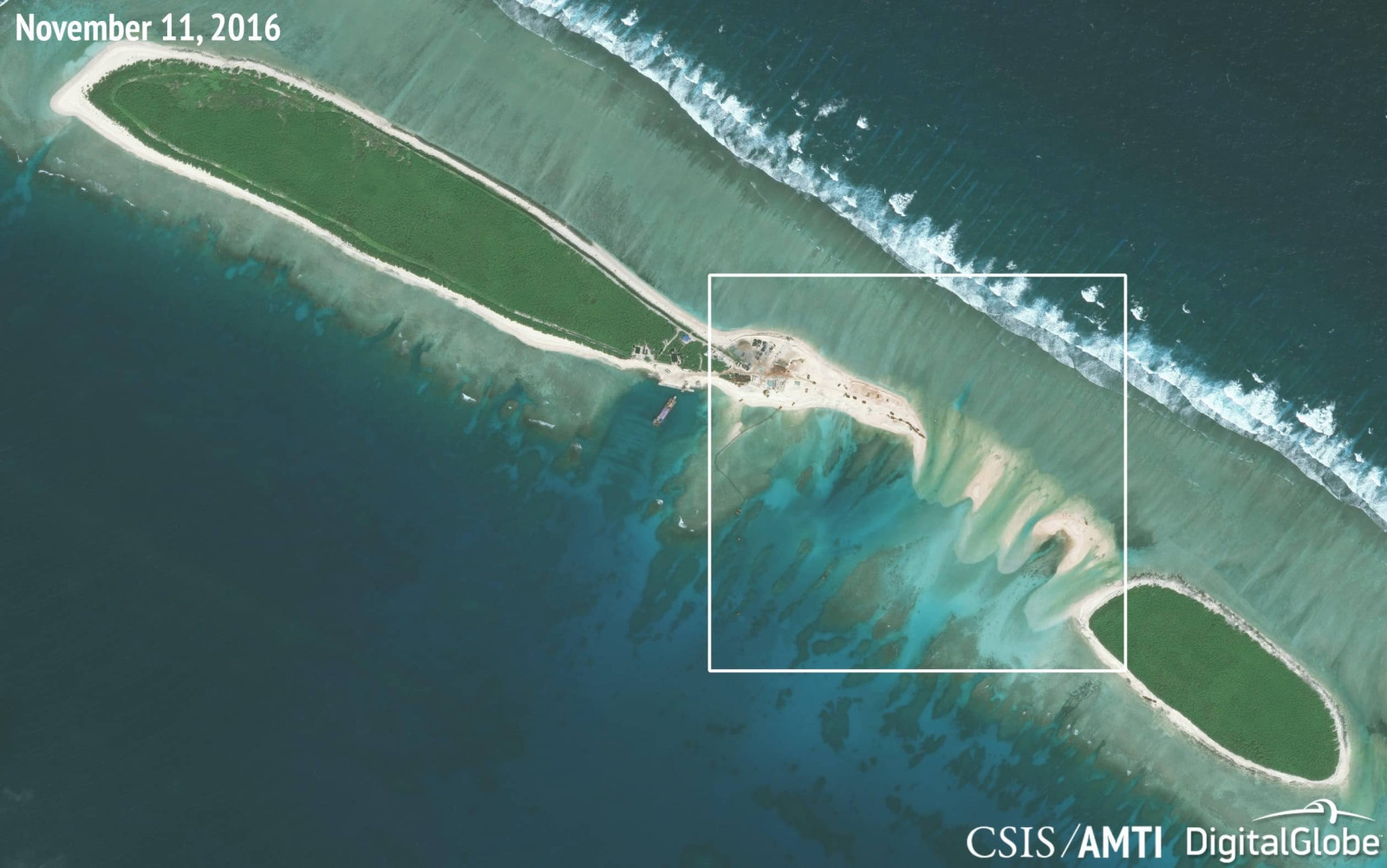
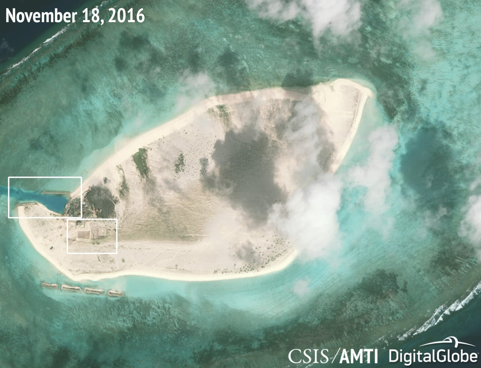
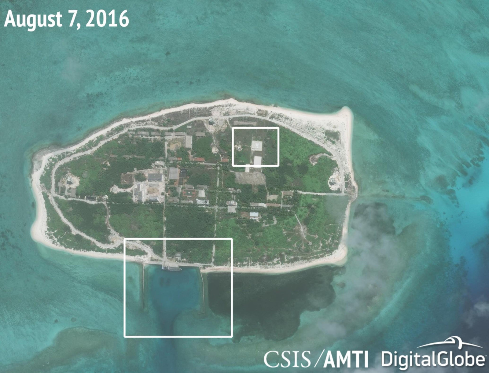
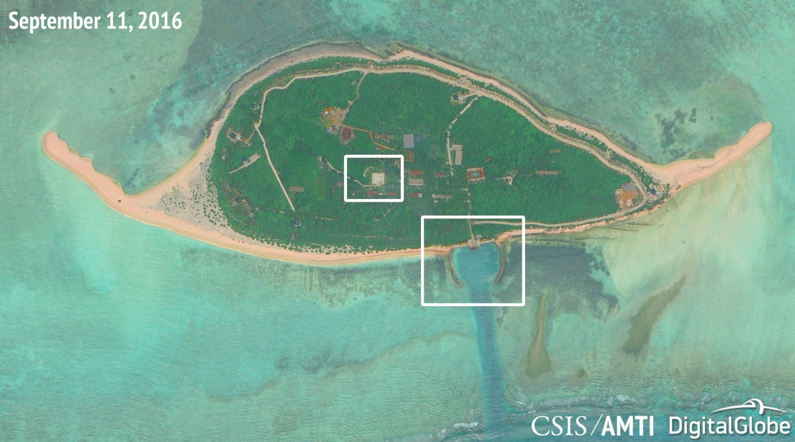
One of the most significantly altered is Tree Island, which has expanded by about 25 acres through land reclamation since mid-2015. This island now features a dredged harbor, a helipad, and hybrid energy systems including solar and wind power installations. Similarly, North Island has grown with new retaining walls and development aimed at reconnecting it to Middle Island via a restored land bridge.
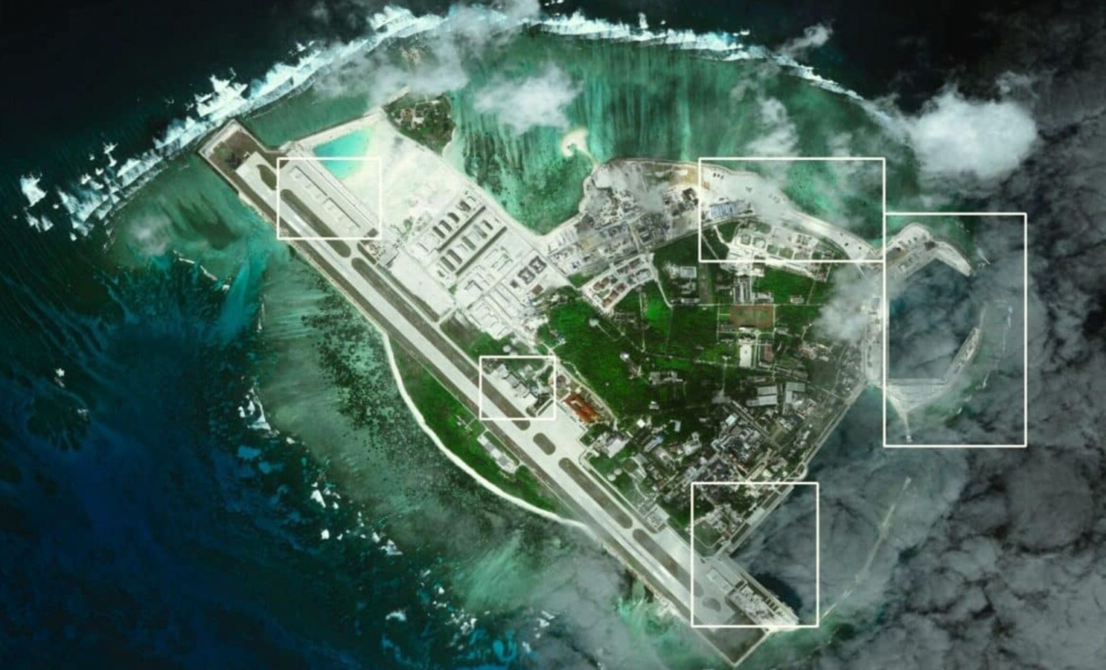
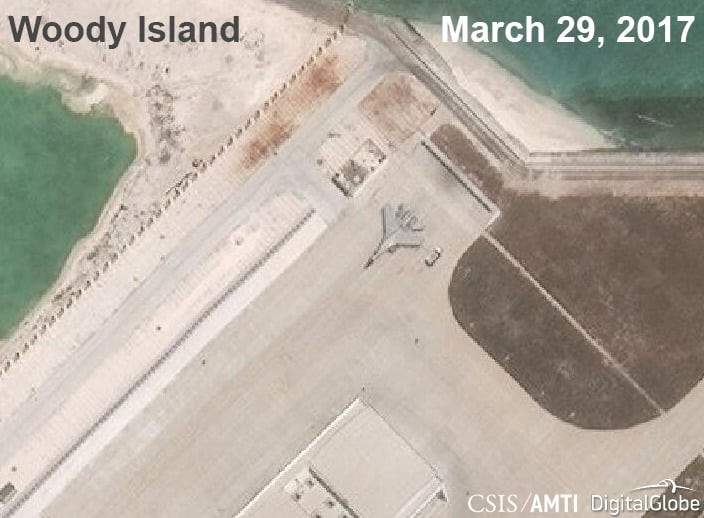
The most extensive transformation is evident on Woody Island, China’s primary military and administrative base in the Paracels. Satellite photos confirm a 2,700-meter runway, protective shelters, and surface-to-air missile batteries. In March 2017, AMTI confirmed the stationing of a Shenyang J-11 fighter jet at this location. Later reports have tracked facility expansions rather than new aircraft deployments.
Similar upgrades are visible in the Spratly Islands, where Fiery Cross Reef, Subi Reef, and Mischief Reef have been equipped with lengthy airstrips, extensive radar networks, and large support complexes. The consistency in design strongly implies coordinated military operations across these key maritime positions.
The U.S.-China Economic and Security Review Commission reports that between 2013 and 2015, China created over 12 square kilometers of artificial land—surpassing the combined area reclaimed by all other regional claimants in the prior 40 years.
Official Claims Diverge from Evidence Since 2015
Since 2015, Chinese authorities have declared that major land reclamation activities in the South China Sea had stopped. During the 50th ASEAN Foreign Ministers’ Meeting in Manila in August 2017, Foreign Minister Wang Yi refuted allegations of ongoing land creation. While the Philippines supported this view, other ASEAN members, particularly Vietnam, voiced worries about militarization in disputed waters.
The resulting joint statement reflected this division, noting that “some Ministers” expressed concern over reclamation and military developments, emphasizing the principle of non-militarization without explicitly naming China. This wording was a diplomatic compromise after extensive discussions.
Contrary to these official positions, satellite evidence gathered and confirmed by AMTI and other independent entities indicates ongoing facility enhancements beyond 2017, including new harbors, helipads, and military-grade infrastructure additions.
Though Vietnam has performed limited reclamation on some of its Spratly-held features, these activities remain modest and lack the systematic militarization evident in Chinese-controlled Paracel and Spratly islands.
Environmental Consequences and Geopolitical Implications Persist
Reclamation and construction on coral reef environments have caused significant ecological damage. AMTI’s collected observations, supported by scientific studies, estimate that between 12 and 18 square kilometers of coral reef habitat have been destroyed due to dredging, sediment dispersal, and infrastructure placed directly atop reef structures.
Some Chinese scientific evaluations acknowledge the loss of marine biodiversity around construction zones. One study cited by AMTI reports local marine life has been “eradicated” near the expanded islands. Official Chinese agencies attribute reef degradation more broadly to climate change and ocean acidification rather than reclamation alone.
The strategic impact is unmistakable. The established network of fortified islands now supports continuous military operations, with harbors prepared to host major naval vessels, extensive airstrips, and comprehensive radar systems, consolidating Chinese control over key maritime routes and contested areas.
The Spratly and Paracel archipelagos, once lightly inhabited and under disputed claims, now serve as strategic bases enabling overlapping surveillance, anti-access capabilities, and regional response initiatives.
No new land reclamation efforts have been officially confirmed in the latter half of 2025, but ongoing facility expansions continue at key outposts tied to military or logistical operations. Defense experts and regional watchers closely observe developments at sensitive hotspots like Scarborough Shoal.
China has yet to provide updated statements detailing the purpose or breadth of current construction activities. Presently, no diplomatic framework limits further land reclamation or addresses the deployment of military assets on these artificial islands.
- Categories:
- News


0 comments
Sign in to Comment