

In September 2023, scientists worldwide detected a unique seismic vibration never before observed. This distinctive rumble persisted continuously for nine days, unlike any typical earthquake or volcanic activity recorded in history.
According to a study published in Nature Communications, researchers linked this extraordinary seismic occurrence to a monumental landslide in the isolated Dickson Fjord of Greenland. This devastating event underscored alarming concerns regarding climatic changes destabilizing Earth's fragile environments.
Unraveling the Mysterious Prolonged Seismic Vibration
Initially baffling experts, the anomaly was categorized as a “USO” (unidentified seismic object) due to its sustained and constant nature, setting it apart from typical earthquake tremors. For over a week, the Earth exhibited a persistent vibration that defied conventional explanations. Prominent geologists like Stephen Hicks from University College London and Kristian Svennevig of the Geological Survey of Denmark and Greenland struggled to pinpoint its origin, until Greenland became the focus of their investigation.

Both Hicks and Svennevig highlighted the unprecedented duration and consistency of the signal spanning nine days. Worldwide seismic stations detected the vibration, yet its source remained elusive until detailed analysis revealed it originated from Greenland.
Greenland’s Landslide Triggers Massive Tsunami
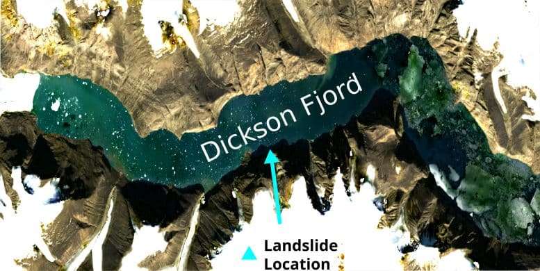
The investigation identified a massive landslide as the root cause, occurring along Greenland’s East Coast in the remote Dickson Fjord. This immense geological event served as a stark indicator rather than an isolated accident. Accelerated glacier melting caused by climate warming undermined the stability of the terrain beneath, prompting a colossal rock mass to detach and plunge into the fjord below.
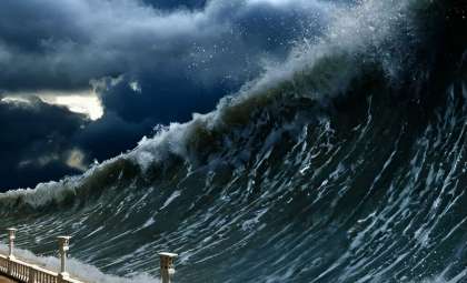
This was far from a typical landslide; the impact produced a towering tsunami wave soaring 656 feet high. The resulting seismic shockwaves propagated through the Earth's crust, generating the enigmatic hum that perplexed the scientific community. Additionally, the landslide caused a seiche effect—repeated oscillations of water within the fjord—that lasted several days and worsened the disaster’s consequences.
Linking Climate Change to Escalating Geological Hazards
This event exemplifies an increasing trend of extreme geological disturbances triggered by climate-related factors. As global temperatures climb, Arctic and sub-Arctic glaciers destabilize, causing more frequent and intense incidences of landslides and tsunamis that were previously uncommon in these regions.
Lead author Thomas Monahan from the University of Oxford noted that such catastrophic events are becoming more prevalent due to global warming. The remoteness and limited sensor coverage of areas like Greenland make early detection difficult, increasing the challenges in disaster preparedness and response.
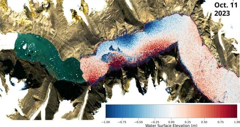
Advanced Satellite Imaging Illuminates the Event
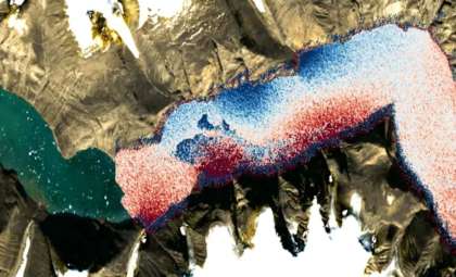
The Surface Water Ocean Topography (SWOT) satellite was instrumental in capturing data on the water dynamics within the fjord. It revealed the scale of the tsunami and confirmed the persistence of the seiche oscillations, information that would have been nearly impossible to obtain otherwise.
Monahan emphasized that SWOT’s capabilities provide scientists with real-time insights into such complex natural phenomena, which is crucial for understanding disaster mechanisms and improving global emergency responses.
Emerging technologies are enabling researchers to link climate-induced environmental changes with escalating geological hazards. Future strategies will depend heavily on enhanced scientific cooperation and cutting-edge monitoring tools to better manage the growing threats posed by our changing planet.
- Categories:
- News


0 comments
Sign in to Comment