
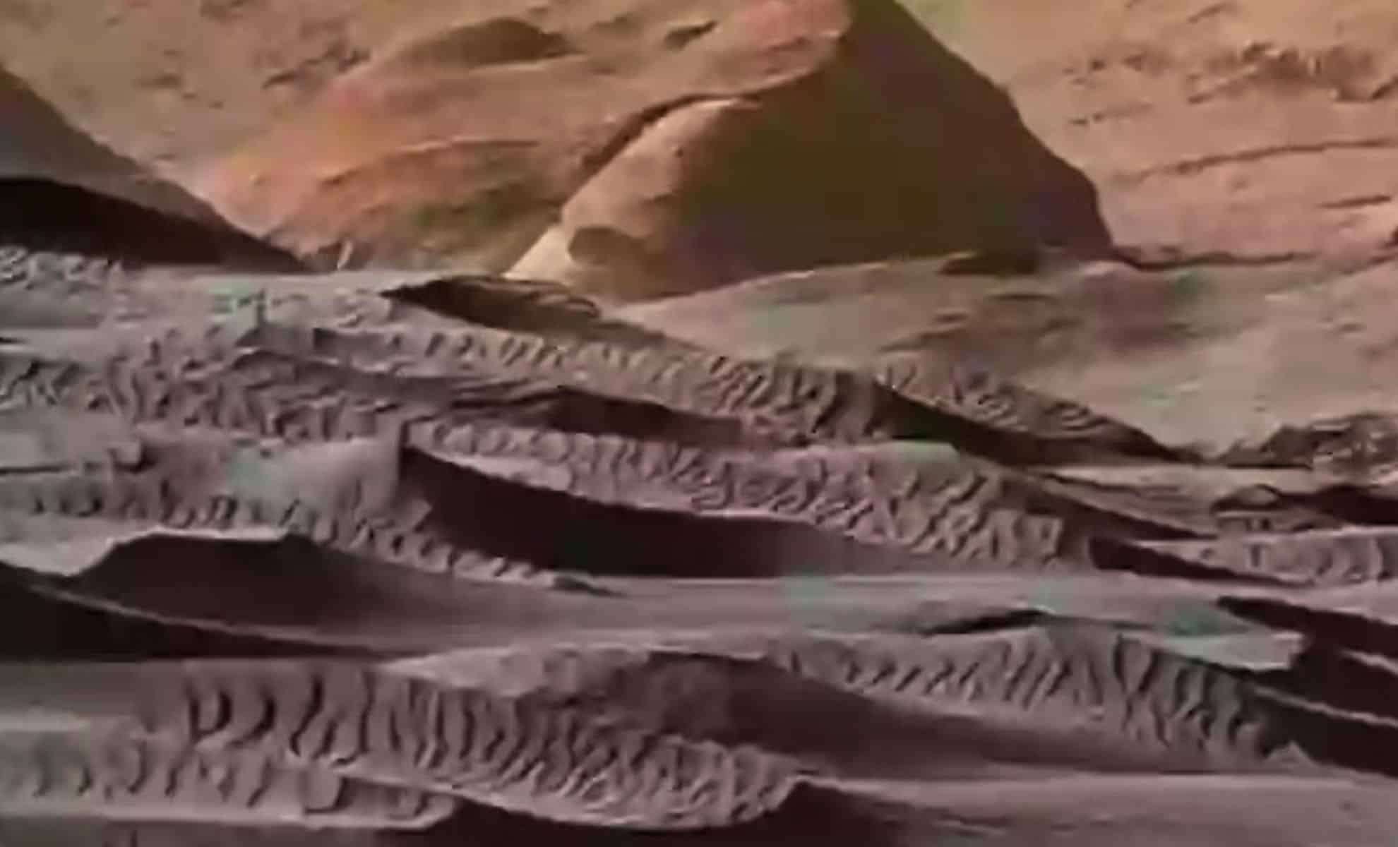
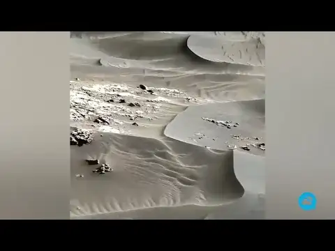
NASA has shared an impressive 360-degree panoramic image captured by the Curiosity rover at the foothills of Namib Dune within the Bagnold Dune Field on Mars. Though taken back in 2015, these photos have recently gone viral online, sparking fascination and unexpected comparisons with Earth-based imaging technology.
Expansive View of the Bagnold Dune Area
This immersive panorama, assembled from shots taken on December 18, 2015, provides a detailed and rare glimpse into the Martian terrain.
Recorded on Curiosity’s 1,197th Martian day (sol), the image reveals portions of Mount Sharp, a prominent peak that resides inside the Gale Crater, explored by the rover since its 2012 arrival.

The spotlight is on Namib Dune, positioned on the northwestern slope of Mount Sharp, part of a broader dark-sand dune field known for its dynamic landscape.
NASA’s data reveal that dunes in the Bagnold region can move approximately one meter (three feet) annually, making the site ideal for geological observation.
The dune’s base is roughly 7 meters (23 feet) from Curiosity’s Mast Camera, rising sharply at about 28 degrees to reach nearly 5 meters (16 feet) tall.
Image Processing and Camera Capabilities
The panorama was color-corrected to depict how the scene would appear under Earth-like sunlight, enhancing the visibility of rock and sand hues to better align with human visual perception.
Some of the rover’s own components are also visible in the image, with exposure adjusted to integrate them seamlessly into the frame.
These photos were captured using the Mastcam, a high-resolution imaging system engineered by Malin Space Science Systems based in San Diego, California.
This advanced camera provides both color and stereoscopic images, which aid in comprehensive geological assessments of Mars’ surface.
NASA’s Jet Propulsion Laboratory (JPL), part of the California Institute of Technology in Pasadena, oversees the Curiosity rover mission.
Online Buzz and Public Reaction
Lately, these images have reemerged on platforms such as Reddit, where users are amazed by their exceptional clarity. Comments frequently describe the visuals from a planet over 140 million miles away as “astonishing” and “remarkable.”
Many have humorously pointed out the irony that Curiosity produces far clearer footage than many security systems here on Earth.
Remarks like “My home security cam can’t even read license plates from 20 feet away” highlight the public’s mixed feelings of admiration and amusement about this technological gap.
One contributor offered a down-to-earth perspective, emphasizing that NASA’s cameras are designed specifically for space exploration, unlike typical commercial surveillance cameras.
“Are the Mars exploration team the same people who set up ordinary security cameras?” they joked, underscoring the vast difference between specialized scientific equipment and everyday consumer devices.
Importance of Studying Martian Dunes
Curiosity’s investigation of the Bagnold Dune Field represents the first-ever detailed examination of active sand dunes beyond Earth.
This research was part of the rover’s ascent on Mount Sharp’s lower slopes, aimed at understanding how sediment moves, wind influences, and how the surface evolves on Mars.
The dunes, evolving with seasonal winds and forming distinct shapes, offer critical information on Mars’ ongoing geological activity.
NASA regularly updates information about the Curiosity mission through its Mars Science Laboratory Project pages on official agency sites.
This project continues to play a pivotal role in NASA’s long-term goals to comprehend the Martian environment and ready the planet for future human missions.
- Categories:
- Space


0 comments
Sign in to Comment