
For the first time ever, NASA has transmitted GPS signals to the lunar surface, marking a key advancement in extraterrestrial navigation. The Lunar GNSS Receiver Experiment (LuGRE), part of the Blue Ghost mission, successfully detected and tracked signals from Earth’s Global Navigation Satellite System (GNSS), which includes GPS satellites.
This achievement lays critical groundwork for precise positioning on the Moon, an essential capability as NASA prepares for upcoming endeavors like the Artemis program that aims to establish a sustained human presence there.
Building the Framework for Lunar Navigation
Unlike Earth, where GPS is widely used for daily navigation, the Moon previously had no similar system. The NASA Space Communications and Navigation (SCaN) program views LuGRE as a pioneering step toward enabling GPS technology for future lunar explorers.
Kevin Coggins, SCaN’s program manager at NASA, highlighted this success as proof that GNSS signals can be effectively tracked from the Moon.

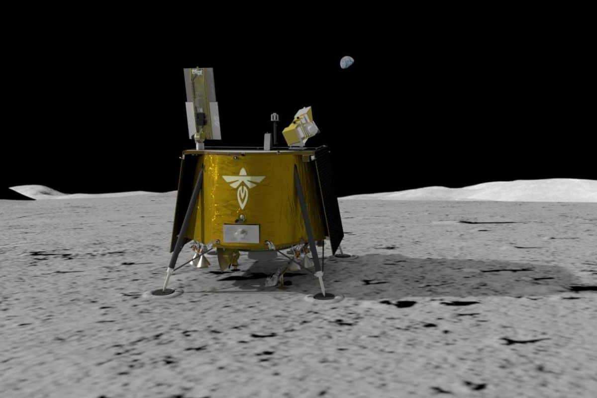
Deployed on March 2 aboard the Blue Ghost lander, built by Firefly Aerospace, LuGRE managed to lock onto signals from Earth-based GPS satellites orbiting over 20,000 kilometers away from its position on the lunar surface.
Revolutionizing Exploration on the Moon
Navigation poses one of the most complex challenges for lunar missions today. Current spacecraft rely on intricate calculations from terrestrial tracking stations that involve continuous communication with Earth, which is both slow and resource-demanding. A lunar GPS-enabled system would offer a more autonomous and accurate approach to tracking spacecraft, landers, and eventually astronauts.
By accurately receiving GNSS signals, LuGRE enables determination of position, velocity, and timing with higher precision than existing methods. This capability is poised to play a critical role in missions involving long stays, surface rovers, and infrastructure deployment.
Moreover, human spaceflight missions stand to gain, with astronauts venturing to the Moon potentially benefiting from improved navigation independent of solely relying on Earth-based tracking systems.
An International Partnership with Global Impact
LuGRE is the result of collaboration between NASA and the Italian Space Agency (ISA). This marks a milestone as the first Italian-developed technology hardware to function on the Moon.
The long-term objective is to create a dedicated lunar GNSS constellation, which could later extend support to missions beyond the Moon’s orbit, such as travel to Mars and other deep space excursions. Establishing a network of lunar satellites offering GPS-like capabilities promises to lower mission expenses and enhance safety for future explorers.
Artemis and Future Prospects
LuGRE is a key component of a broader initiative to build sustained lunar exploration infrastructure under NASA’s Artemis program, which aims to return humans to the Moon by 2027 and construct a permanent base supporting eventual Martian missions.
The experiment will operate for 14 days, during which NASA will study how well the receiver maintains GNSS signal acquisition across the vast distance of 360,000 kilometers. Insights gained will guide the development of more resilient navigation systems suited for extended Moon missions.
Flight dynamics engineer Joel Parker from NASA’s Goddard Space Flight Center emphasized that this mission aims to facilitate more frequent, efficient lunar operations benefiting all spacefaring nations.
A Major Leap Forward in Space Navigation
Receiving GPS signals on the Moon is more than just a technical success — it ushers in a new era of accessible and efficient lunar exploration. This breakthrough will reduce reliance on Earth-based tracking, empowering astronauts, rovers, and future settlers to navigate the Moon confidently and independently.
- Categories:
- Space


0 comments
Sign in to Comment