
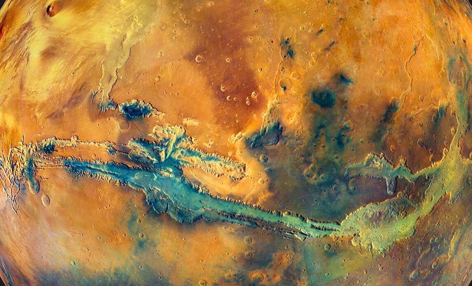
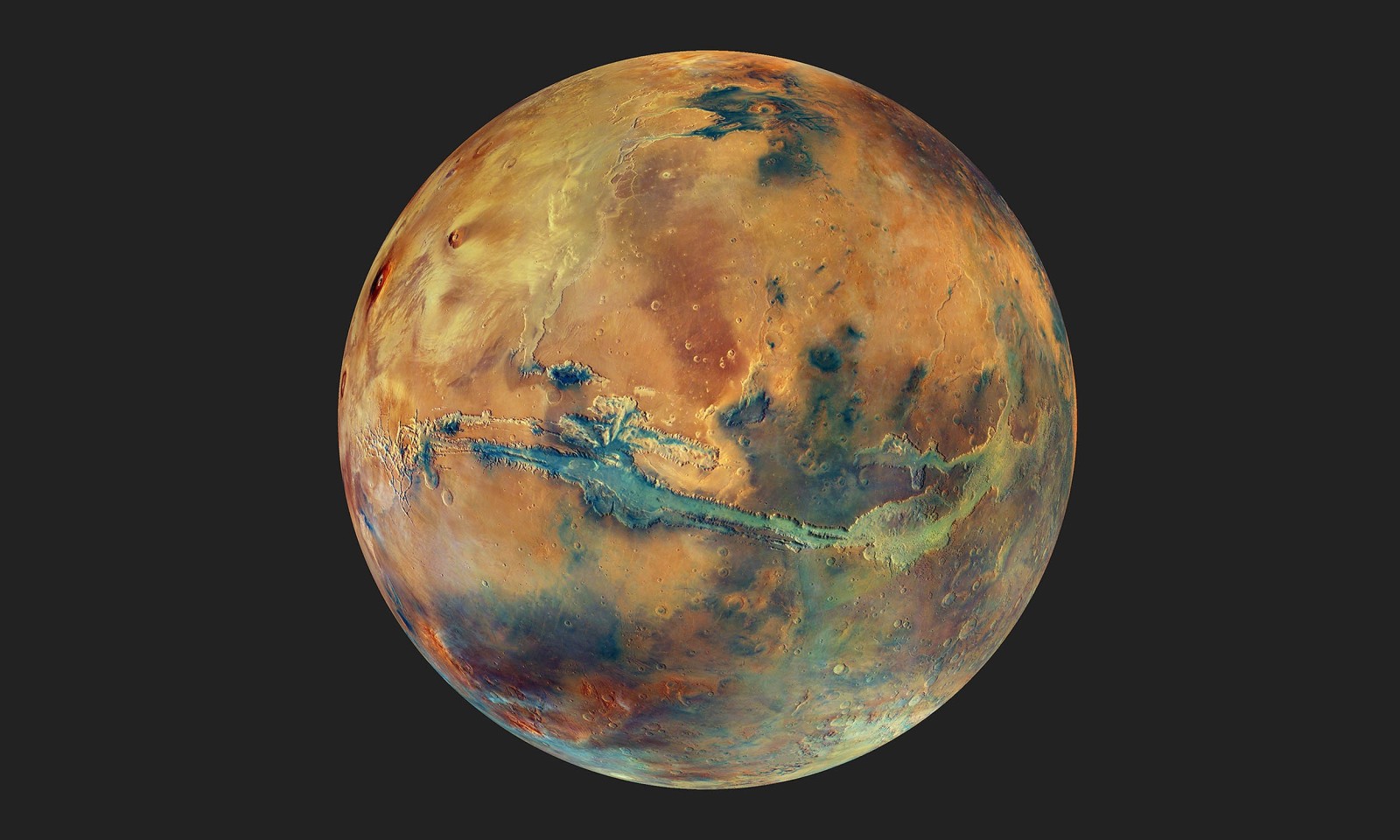
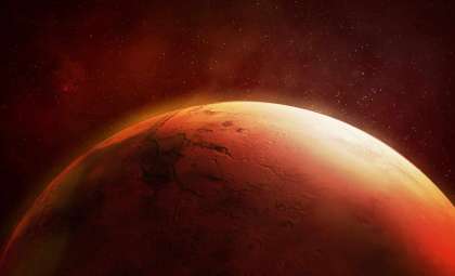
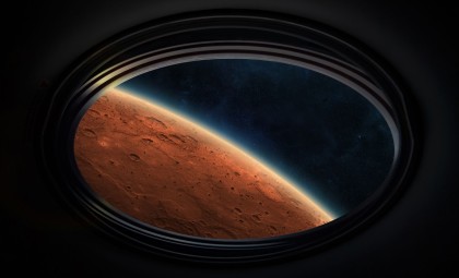
A breakthrough true-color composite image of Mars is reshaping the way both scientists and enthusiasts visualize the Red Planet. Unlike the traditionally enhanced images emphasizing deep reds and rusty tones, this new photo features natural colors derived solely from visible light wavelengths, providing an unprecedentedly authentic view from orbit.
Developed by the European Space Agency (ESA) using data from the High Resolution Stereo Camera (HRSC) aboard the longstanding Mars Express spacecraft, this image represents the most comprehensive and color-accurate global mosaic of Mars so far. Spanning the entire planet at about 2 kilometers per pixel, the mosaic is composed of tens of thousands of observations gathered throughout over 20 years.
Rather than a planet dominated by red shades, the mosaic reveals a spectrum of subtle grays, yellows, oranges, and light blues that illustrate Mars' varied mineral compositions. Features shaped by ancient volcanic flows, hydrated minerals, and frequent dust activity become more distinct in this authentic palette.

Seeing Mars Through Human Vision
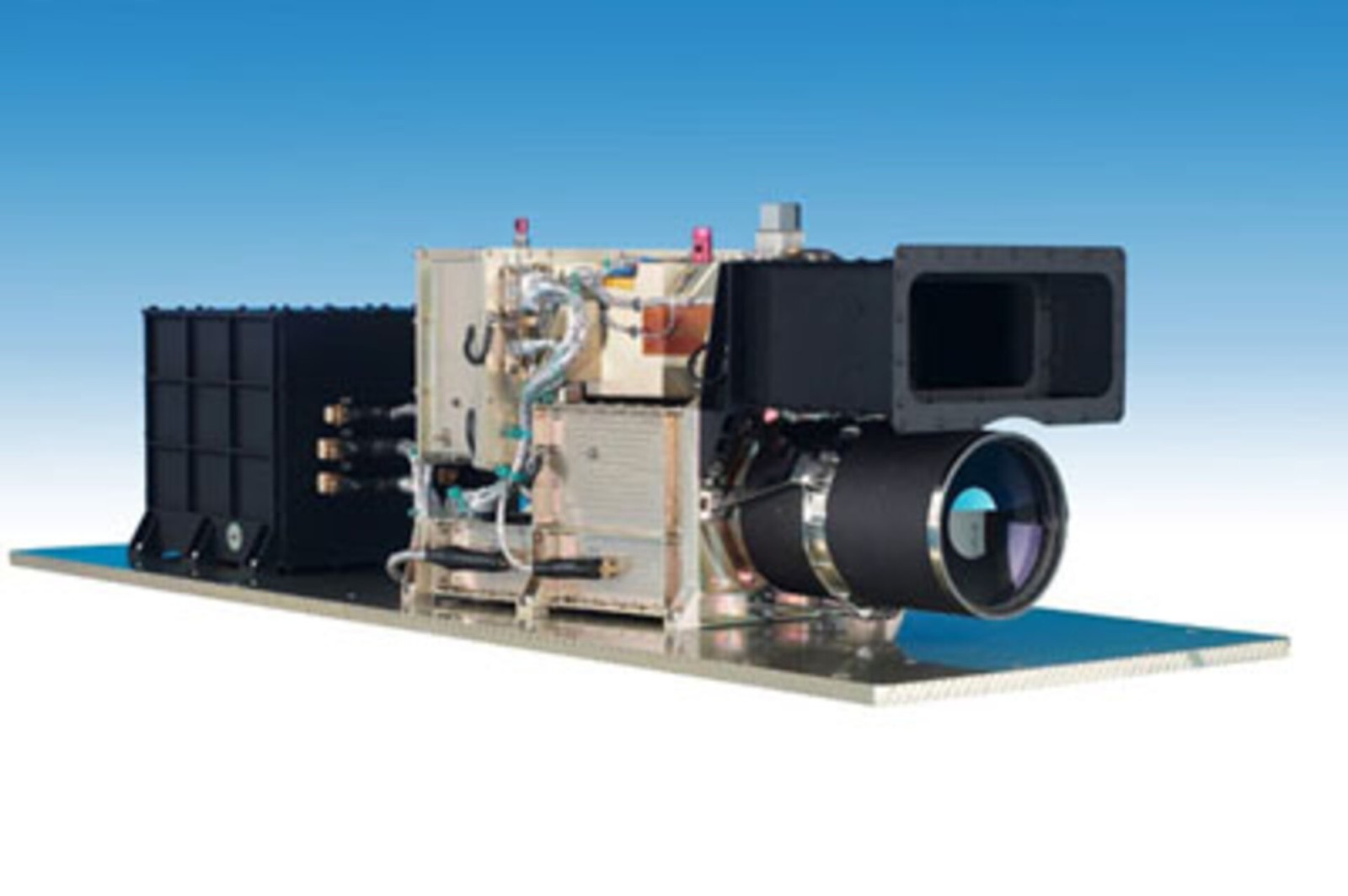
The HRSC sensor on Mars Express is specifically designed for creating such detailed mosaics. Unlike cameras restricted to single-filter imaging, HRSC captures several color channels simultaneously, enabling it to produce high-resolution, three-dimensional views of the Martian surface. These capabilities were harnessed to build a color-calibrated global map that retains nuanced mineral differences alongside accurate light and shadow portrayals.
Creating this seamless image required overcoming several obstacles. Variations in dust coverage, changing angles of sunlight, and atmospheric haze demanded meticulous corrections across thousands of image segments. Each segment underwent radiometric calibration, precise alignment, and color standardization to ensure the entire planet's surface appears consistently natural.
ESA details on its Mars Express instrument overview reveal that the HRSC’s array of nine CCD sensors enables multispectral imaging, stereo vision, and high resolution within a single orbit pass. This instrument, built for geological study, has been instrumental in compiling an extensive visual record of Mars.
Repetitive overpasses during more than ten years allowed the spacecraft to capture overlapping images under different lighting and atmospheric conditions. These multiple observations were critical for smoothing inconsistencies and achieving uniform color tones throughout the global map.
Interpreting Mars’ True Colors
Colors in this mosaic go beyond mere appearance — they offer vital geological insights. The image helps scientists identify basaltic sands, sulfate layers, iron-rich clays, and other crucial minerals linked to Mars’s ancient volcanic and water-related history.
Dark gray to near-black areas depict regions covered by old lava flows and volcanic plains. Meanwhile, lighter tones such as yellows and pale greens highlight clay-rich zones formed with water presence, hinting at times when Mars could have hosted habitable conditions.
These color details are reinforced by complementary datasets from other instruments, including OMEGA, a spectrometer aboard Mars Express that identifies surface minerals via visible and infrared wavelengths.
The image brings clarity to vast features like Valles Marineris, Tharsis Montes, and the Hellas Basin, enhancing our understanding of Mars' tectonic evolution, weathering processes, and climate transitions.
Two Decades of Martian Data Yield Results
The mosaic draws on imagery recorded between 2004 and 2022, with major inputs from high-altitude imaging passes between 2015 and 2019. These orbits extended coverage and bridged previous data gaps, delivering a harmonized color scheme across the whole planet.
Importantly, the creators preserved natural shadow contrasts rather than equalizing brightness, which aids in visualizing surface relief like slopes and crater depths—mimicking human depth perception.
ESA’s Mars Express media archive prominently features this map, complementing HRSC’s existing 3D terrain datasets and supplying valuable spectral information for future missions.
The German Aerospace Center (DLR), which oversees HRSC operations, continues to play a lead role in Martian imaging. Their main portal, DLR.de, posts ongoing mission updates and planetary research news.
Future Directions in Planetary Imaging
What sets this release apart is not only its photo-realistic accuracy but also its utility in advancing Mars science. This authentic color baseline provides a reliable reference for both aesthetic appreciation and scientific investigation.
Moreover, the mosaic lays groundwork for AI-driven planetary data analysis. Machine learning models trained on HRSC datasets can classify terrain types, detect erosion characteristics, and monitor seasonal surface changes over time. This promises faster insights, increased automation, and improved predictive modeling of Martian environmental and geological dynamics.
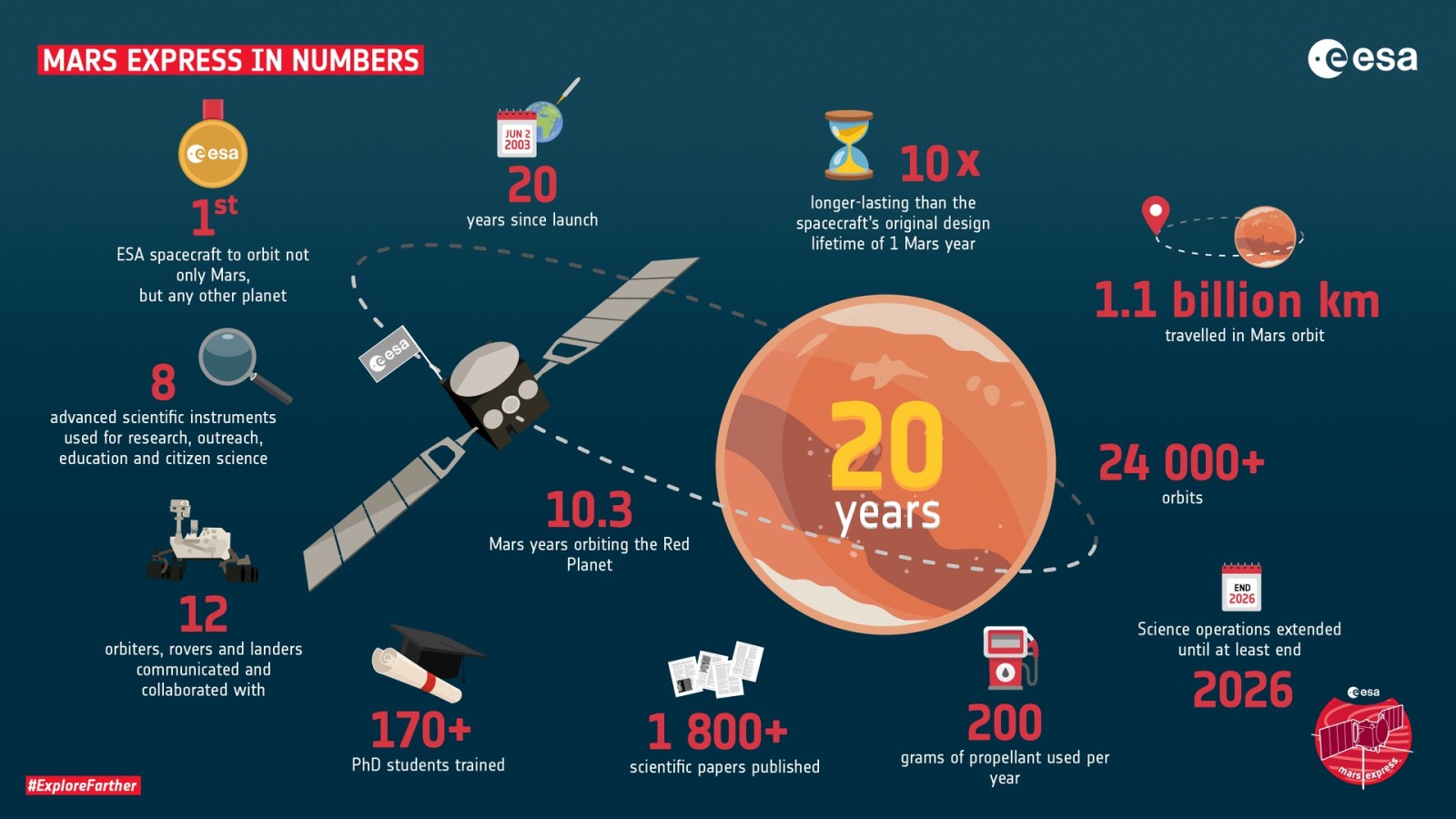
Originally planned as a two-year mission, Mars Express is now in its 22nd year, its continued operation exemplifying how legacy spacecraft can still generate groundbreaking discoveries years post-launch.
- Categories:
- Space


0 comments
Sign in to Comment