

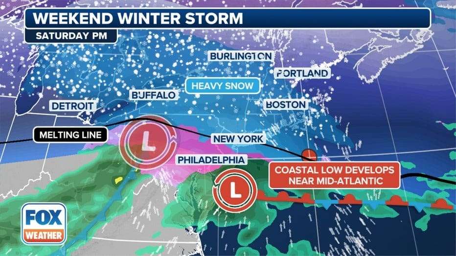
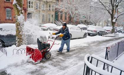
An intense winter weather event is predicted to affect the New York City metropolitan area and the surrounding Tri-State region this weekend, bringing a mix of heavy snow, sleet, and freezing rain. This will be the second major cold front in a short span, with another possible winter system expected early next week.
According to forecasts from the National Weather Service, FOX 5 NY, and NBC New York, northern parts of the region could receive as much as 8 inches of snow, while areas around NYC are projected to record between 3 and 5 inches. Since the storm is expected overnight into Sunday morning, this may limit severe travel delays; however, officials warn that slick and dangerous road conditions are likely.
Snow Accumulation Forecast: Regional Variations
Weather models predict varying snowfall amounts throughout the region based on elevation and location, with the heaviest snow likely north of New York City where temperatures will stay below freezing longer.

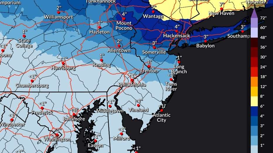
Estimated Snowfall by Location
- New York City (Manhattan, Brooklyn, Queens, The Bronx, Staten Island):
- Accumulations of 3 to 5 inches are anticipated, though parts of the northern Bronx could see up to 8 inches.
- Staten Island and southern Brooklyn and Queens may experience only 1 to 3 inches due to sleet mixing in.
- Hudson Valley (Westchester, Rockland, Orange, Putnam, Dutchess, Ulster Counties):
- Snow totals between 5 and 8 inches, with the highest amounts in the northern Hudson Valley.
- Northern New Jersey (Passaic, Bergen, Essex, Morris Counties):
- Between 5 and 8 inches, with some spots potentially receiving localized heavier snowfall.
- Southern Connecticut (Fairfield, New Haven Counties):
- Expected snowfall of 5 to 7 inches, with coastal areas seeing less due to rain mixing.
- Long Island (Nassau, Suffolk Counties):
- 3 to 5 inches forecasted, with larger amounts farther inland.
- Central and Southern New Jersey (Middlesex, Monmouth, Ocean Counties):
- Snowfall likely between 1 and 3 inches, with minimal accumulation toward the south.
Storm Timeline: When Snow Will Begin and End
The National Weather Service and FOX Weather outline this schedule for the storm’s development:
- Saturday afternoon (1 p.m. – 5 p.m.): Overcast skies with a 30% chance of snow starting late afternoon.
- Saturday evening (5 p.m. – Midnight): Snowfall begins in earnest, with rates reaching up to 1 inch per hour in some locations.
- Saturday night (Midnight – 4 a.m.): Snow intensifies and changes to sleet and freezing rain along coastal zones.
- Sunday morning (4 a.m. – 10 a.m.): Snow diminishes but icy conditions persist on roads.
- Sunday afternoon: Weather improves gradually, although some slick patches may remain.
Issued Warnings: Current Winter Weather Alerts
The National Weather Service has released multiple winter storm warnings and advisories for the area:
- Winter Storm Warning
- Ulster, Dutchess, Orange, Putnam, and Rockland Counties (NY)
- Northern Westchester, Passaic, and Bergen Counties (NJ)
- Southwestern Connecticut
- Effective from 7 p.m. Saturday to 10 a.m. Sunday
- Winter Weather Advisory
- New York City, Long Island, much of New Jersey and Connecticut
- Valid from 5 p.m. Saturday to 11 a.m. Sunday
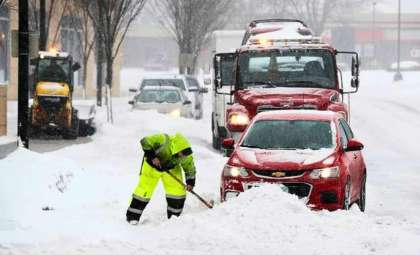
The National Weather Service highlights that bridges, overpasses, and roadways will become extremely slick, posing significant travel hazards overnight.
Safety and Travel Recommendations
As the Super Bowl is scheduled for Sunday evening, officials urge attendees and commuters to prepare accordingly. NYC transit and road departments have taken precautions to mitigate storm impacts:
- Suspension of alternate side parking regulations on Saturday to facilitate snow removal.
- NYC Sanitation has deployed salt spreaders and snowplows in anticipation of the storm.
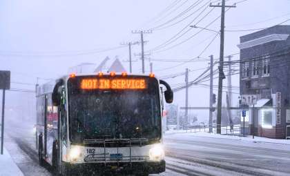
- Potential delays in public transit systems, especially buses and elevated subway lines.
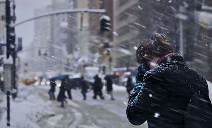
The National Weather Service advises, “Persons should consider delaying all travel. If travel is absolutely necessary, drive with extreme caution.”
Possible Follow-up Storm Next Week Brings More Snow Chances
Forecasters are keeping an eye on another weather system that may affect the Tri-State region midweek, likely bringing further snow.
FOX Weather notes an active storm track shaping up for the East Coast with several upcoming opportunities for wintry precipitation:
- Tuesday, February 11: A 50% chance of snow with highs near 35°F.
- Tuesday night: Snow likely, with temperatures falling to around 31°F.
- Wednesday: A 30% chance of snow, cloudy skies, and highs near 37°F.
- Wednesday night: A 50% chance of snow, lows near 31°F.
- Thursday: Possible mixed precipitation of rain and snow, highs near 37°F.
Final Summary: Prepare for a Challenging Snowy Weekend
Heavy snowfall, ice accumulation, and dangerous travel conditions are expected this weekend. Residents should stay informed with latest weather updates and take proper safety precautions from Saturday night through Sunday morning.
This weekend’s storm may not be the last winter challenge, as additional snow could affect the NYC metro area in the coming week.
- Categories:
- News


0 comments
Sign in to Comment