
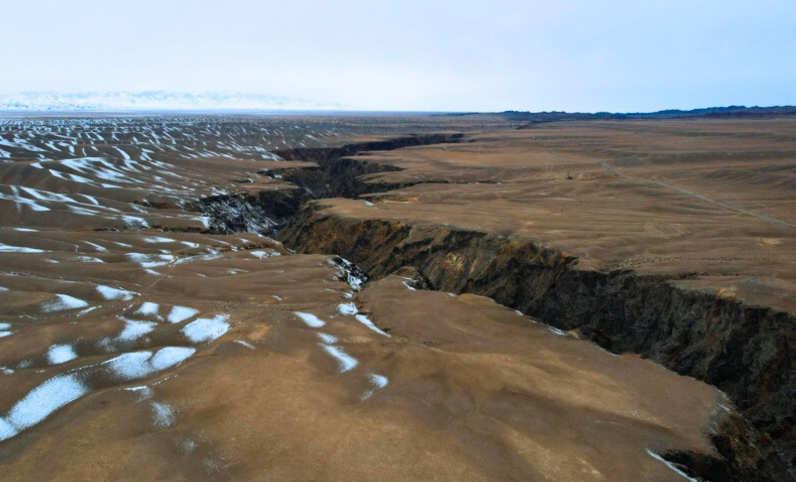
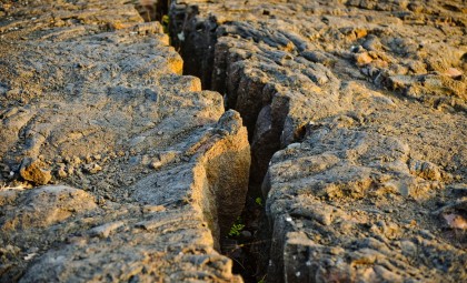
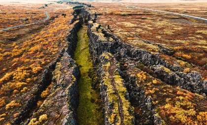
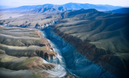
Beneath the dry plains near Lake Tuz in central Turkey, an unexpected geological transformation is occurring. Instead of shifting sideways as once believed, the fault here is gradually pulling the crust apart, millimeter by millimeter.
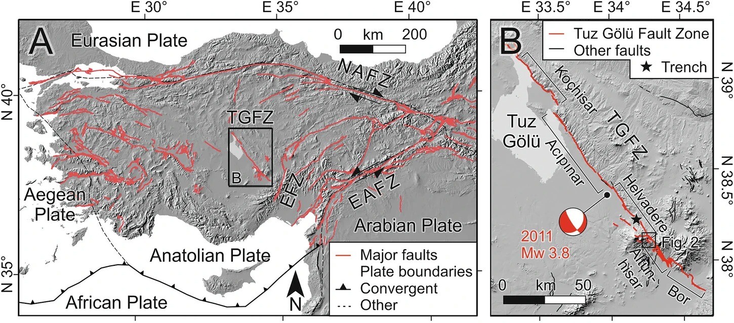
The Tuz Gölü Fault Zone stretches across almost 200 kilometers at a key tectonic intersection involving the Eurasian, Arabian, and African plates. Historically, scientists regarded it as a strike-slip fault, linked to the horizontal motions typical of Turkey’s seismic zones. New findings now challenge this long-standing assumption.
A fresh investigation published in Nature’s Communications Earth & Environment reveals that the fault exhibits vertical extension rather than lateral sliding. Instead of moving past each other, crustal fragments are being pulled apart, redefining the geological perspective of the region.

An Unseen Rift in Turkey’s Tectonic Landscape
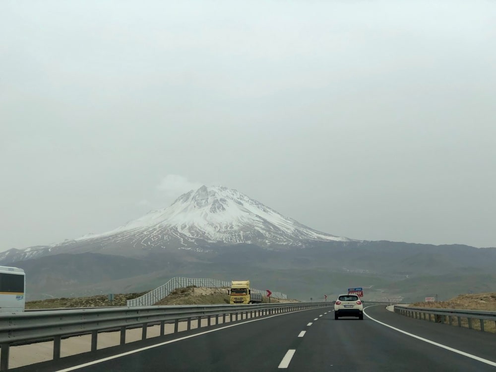
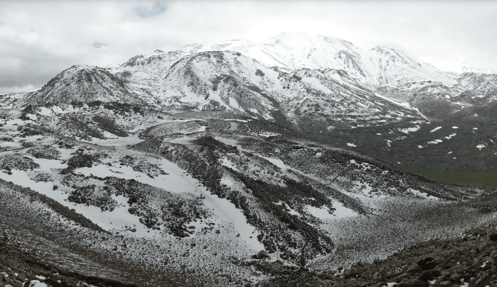
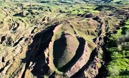
This breakthrough stems from detailed field studies around Hasandağ, a dormant stratovolcano at the fault’s core. Led by Axel Schmitt from Curtin University, the research team analyzed ancient Pleistocene lava flows disrupted by the fault to determine its deformation history.
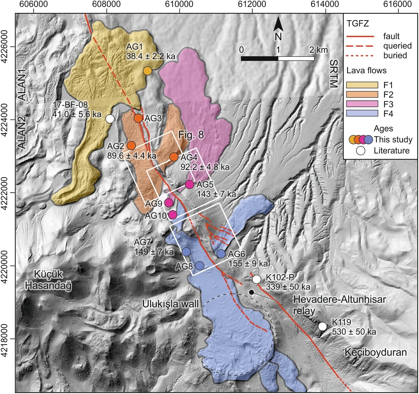
Employing zircon double-dating (ZDD)—a precise technique combining uranium-thorium and helium isotope measurements—they dated four lava flows aged between 151,000 and 38,800 years. These layers, once continuous, now exhibit vertical fractures yet remain aligned horizontally, showing minimal sideways displacement.
The team estimated vertical slip rates ranging from 0.90 to 1.23 millimeters annually, consistent across the sampled flows. Crucially, lateral strike-slip motion thought to dominate was found to be insignificant, contradicting earlier geodetic estimations that suggested right-lateral movement up to 4.7 mm/year.
As noted in Techno-Science’s article, zircon crystals served as reliable timekeepers, enabling researchers to precisely date eruptions and subsequent tectonic activity.
Confronting Models with Field Evidence
Tectonic models for Turkey have heavily relied on satellite data and GPS measurements, which forecasted significant sidewise slip along the Tuz Gölü Fault, aligning with the dominant theory of tectonic escape—the Anatolian Plate squeezed westward amid colliding continental plates.
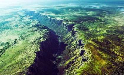
However, field data tell a different story. The consistent vertical offsets apparent in four distinct lava flows—particularly the well-preserved F3 flow—indicate that the fault is dominated by dip-slip movement with minimal horizontal displacement.
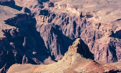
This contradicts earlier views that considered the fault part of a conjugate strike-slip fault system working alongside the Ecemiş Fault Zone. Instead, the Tuz Gölü Fault appears to accommodate east-west crustal stretching, not lateral escape.
Because satellite models lack the long-term sensitivity to slow vertical shifts spanning thousands of years, the geological restoration of lava flows over more than 100,000 years offers a vital perspective unattainable by modern geodesy.
Uncovering Silent Deformation in a Neglected Fault
Unlike the highly active North Anatolian Fault, which frequently generates major earthquakes, the Tuz Gölü Fault has been relatively calm both seismically and in scientific attention. Yet this quietness masks ongoing, gradual restructuring underground.
Vertical fault motion is most prominent near Hasandağ, where tectonic forces intersect with ancient volcanic structures. Despite the lack of significant earthquakes there, the landscape is reshaping slowly but persistently.
Along its entire length, the fault’s linear features lack evidence of switching into a lateral sliding regime. Characteristics like fault scarps, slope reconstructions, and zircon-based offset measurements consistently point towards uniform normal faulting.
This undermines prior beliefs attributing the extension to localized stress anomalies. Instead, a comprehensive revision of its fundamental behavior is necessary—not only for this fault but for similar intraplate structures worldwide.
Rethinking Tectonic Frameworks
These insights challenge how scientists interpret faults whose dynamics do not match surface data or short observational records. Many active faults lie in areas with sparse instrumentation, where GPS and remote sensing can miss slow, vertical crustal deformation occurring over geological cycles.
The Tuz Gölü investigation highlights the importance of morphological reconstruction—the study of altered ancient landforms—to uncover subtle, persistent movements beneath the Earth’s surface. In this instance, preserved lava flows convey information spanning millennia, outpacing short-term sensor data.
As factors like climate change, urban expansion, and population increases amplify risks near seismic zones, integrating long-term geological records into hazard assessments becomes crucial. This study reveals that the Alpine-Himalayan seismic belt, including Turkey at its core, is more structurally intricate than previously recognized.
- Categories:
- Science


0 comments
Sign in to Comment