
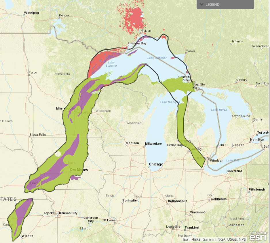
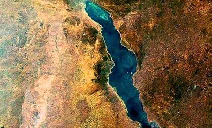
Over a billion years ago, a colossal geological fracture known as the Midcontinent Rift began to develop beneath the current U.S. Midwest region. This vast rift extends around 2,000 kilometers (about 1,900 miles) in a horseshoe pattern, stretching from Kansas northward to Lake Superior, then curving southward toward Michigan. Although the rift had the potential to cleave North America into two separate landmasses, the process unexpectedly ceased after roughly 100,000 years, leaving a mostly sediment-covered scar beneath the surface.
An Ancient Rift Filled With Volcanic Basalt
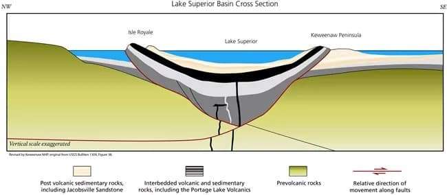
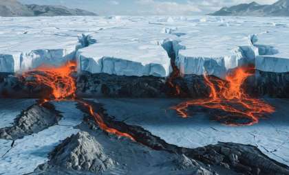
The Midcontinent Rift originated as tectonic plates pulled the Earth's crust apart in opposite directions, creating a vast fracture beneath the continent. Magma surged up from deep within the Earth, filling this rift and solidifying into an extensive layer of basalt, a dark volcanic rock formed from rapidly cooled lava.
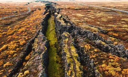
Today, visible basalt formations remain, particularly around Lake Superior on Michigan’s Keweenaw Peninsula. This area gave the rift its alternate name, the Keweenaw Rift. At its peak, the rift's basin rivaled the width of today’s Red Sea.

The Unexpected Halt: A Geological Puzzle
Despite the immense size and the potential of the rift to fracture the continent and form a new ocean, the rifting process ceased abruptly after about 100,000 years. Scientists continue to debate the reasons behind this sudden stop.
Live Science reports that G. Randy Keller, professor emeritus of geophysics at the University of Oklahoma and former Oklahoma Geological Survey director, described the event as a “spectacular failure.” He remarked, “It’s remarkable that an event of this scale could reshape Earth’s crust near Lake Superior without successfully splitting the continental landmass.”
Some hypotheses connect the rift’s halt to a mountain-building event along North America’s Atlantic margin. Others argue the rifting ended with the formation of a sea between the ancient landmasses of Laurentia and Amazonia, precursors to North and South America. This scientific debate has persisted for over ten years without a clear consensus.
Concealed Beneath Sediments, Uncovered by Ice Age Glaciers
Following the end of rifting, thick sediment layers gradually filled the valley, burying the structure deeper within the Earth’s crust. Later geological compression lifted sections of volcanic and sedimentary rock upward, exposing parts of the rift. Multiple glaciers advancing and retreating over the past 2.5 million years eroded sediment layers, revealing exposed segments of the rift valley.
The most prominent basalt and copper-enriched rock formations are found near Lake Superior, especially on Michigan’s Keweenaw Peninsula. For at least 8,000 years, humans have mined copper in this region, with activity continuing until the late 20th century and recently experiencing renewed interest. The National Park Service highlights these formations as “unique, born of an exceptional geological event.”
Contemporary Studies and Practical Uses
Sections of the Midcontinent Rift, particularly in Kansas, are attracting interest from resource exploration industries. Through chemical reactions with water, basalt rock can produce hydrogen, a promising clean energy carrier essential for various industrial applications. This adds to the rift’s significance beyond its geological history.
The Midcontinent Rift stands as an extraordinary geological event—an enormous tectonic rupture that reshaped a vast area but ultimately failed to split the continent. Spanning roughly 3,000 kilometers (1,900 miles), this rift created a basin comparable in size to the Red Sea. Its volcanic rock outcrops near Lake Superior and valuable copper deposits serve as enduring evidence of this billion-year-old chapter in North America’s dynamic geologic evolution.
- Categories:
- Science


0 comments
Sign in to Comment