
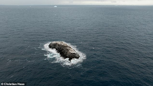
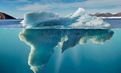
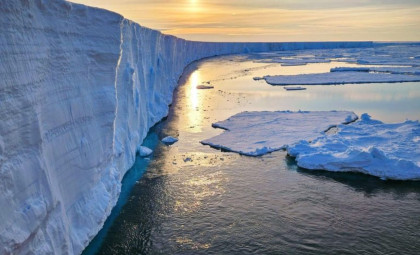
An unusual object spotted in the Weddell Sea initially looked like a dirty iceberg but proved to be a stationary, rocky landmass missing from all current maps. When the German research icebreaker Polarstern approached, researchers realized it was an previously uncharted island.
This discovery occurred during a 2026 Antarctic voyage led by the Alfred Wegener Institute, Helmholtz Centre for Polar and Marine Research. According to an official AWI announcement, a multinational team of 93 scientists had been studying the northwestern Weddell Sea since early February 2026. Unfavorable weather conditions compelled the ship to halt its research and seek refuge around Joinville Island.
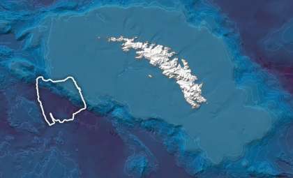
This change in course brought Polarstern into proximity with an area marked on maps not as land, but as a danger zone, indicating potential risks without specifying their nature.

Storm Diversion Guides Polarstern to Uncharted Ground
The original purpose of the Polarstern mission was not to identify new landmasses. The expedition focused on studying the ice and water flows from the Larsen Ice Shelf as well as patterns in the receding sea ice linked to global ocean circulation systems.
However, severe weather prompted the vessel to find shelter on the leeward side of Joinville Island, bringing the team close to the nautical chart's hazard zone.
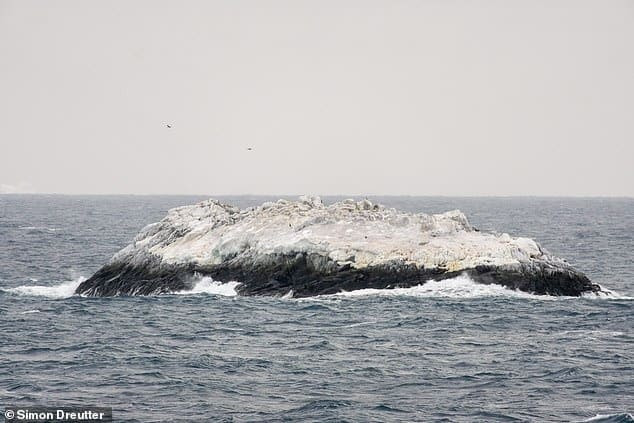
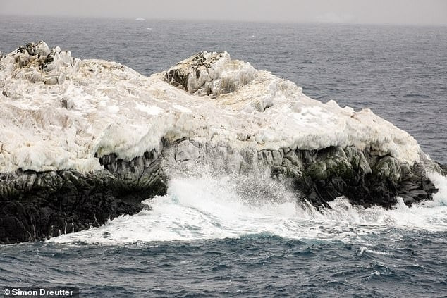
Simon Dreutter, an AWI expert in bathymetry, explained that the charts identified “navigation risks of unknown origin,” without clarity on what dangers were present or their source. Initial observations from the bridge suggested the object was a grimy iceberg, but a closer look revealed a rocky structure.
The ship adjusted its heading towards the feature and confirmed the presence of an island.
Surveying the Island Using Sonar and Drone Technology
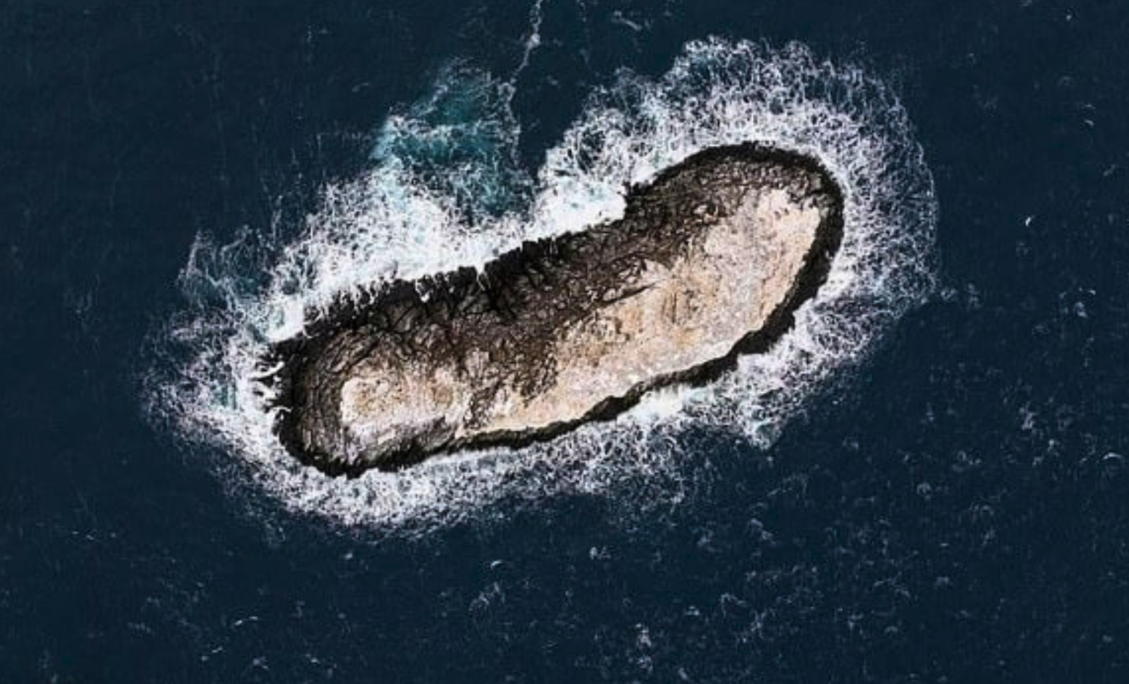
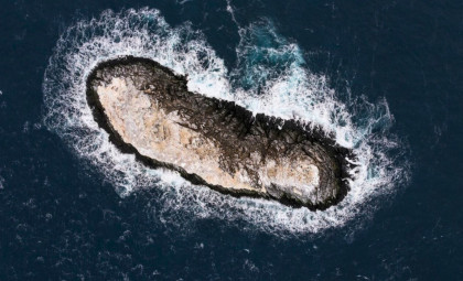
The AWI team exercised caution, ensuring the vessel maintained at least 50 meters depth beneath its keel. Polarstern approached within approximately 150 meters, circumnavigated the island, and scanned the seabed using a multibeam echo sounder.
In addition, a drone captured aerial images which were processed with photogrammetry techniques, combining overlapping photos to measure the terrain and create a detailed elevation model along with georeferenced coastal imagery.
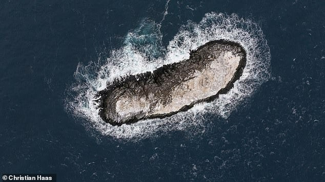
This marked the first comprehensive survey of the island. Findings indicate it is roughly 130 meters long, about 50 meters wide, and rises around 16 meters above sea level.
This makes it slightly longer than the Polarstern itself, which measures 118 meters in length, and roughly twice its width. While not revolutionary in rewriting Antarctica's geography, the island is significant enough to impact shipping in an area where weather, sea ice, and sparse mapping complicate navigation.
Why the Island Was Hidden From Satellite and Other Maps
The curiosity lies not only in the island’s existence but in why it was listed as a danger without being represented as land on various maps and datasets.
The AWI team remains uncertain about why the island only appeared as a danger zone on nautical charts, why it was absent as coastline elsewhere, and why its charted location was about one nautical mile off from its actual position.
Satellite imagery failed to clarify due to the island’s ice cover blending it with nearby drifting icebergs. In the Antarctic environment, a white or gray form surrounded by ice does not easily distinguish solid land from floating ice formations.
This nuance highlights that although no vast unknown parts of Antarctica remain, small, ice-blanketed coastal features can evade detection in areas with limited on-site measurements.
The discovery also emphasizes the challenges of Antarctic seafloor and shoreline mapping. AWI noted that including this island's data is critical for bathymetric mapping projects like the International Bathymetric Chart of the Southern Ocean, where sparse data and interpolation can cause such features to be omitted.
This broader mapping difficulty is echoed in U.S. Geological Survey reports on Antarctic mapping data, highlighting the necessity of coordinated scientific efforts to understand Antarctica and its adjacent Southern Ocean.
Next Steps: Official Recognition and Chart Updates
The island has yet to be officially named internationally. AWI explained that the team will initiate the formal naming procedures required for discoveries of this nature.
Following official recognition, researchers intend to publish the island’s precise coordinates and ensure it is integrated into nautical charts and relevant databases. Accurate charting is crucial for safe navigation in polar waters where unseen hazards pose serious risks.
Additionally, the expedition documented variations in sea ice thickness and surface melt signs in the northwestern Weddell Sea. AWI mentioned that further data analysis and modeling are planned in the expedition’s aftermath.
- Categories:
- Science


0 comments
Sign in to Comment