
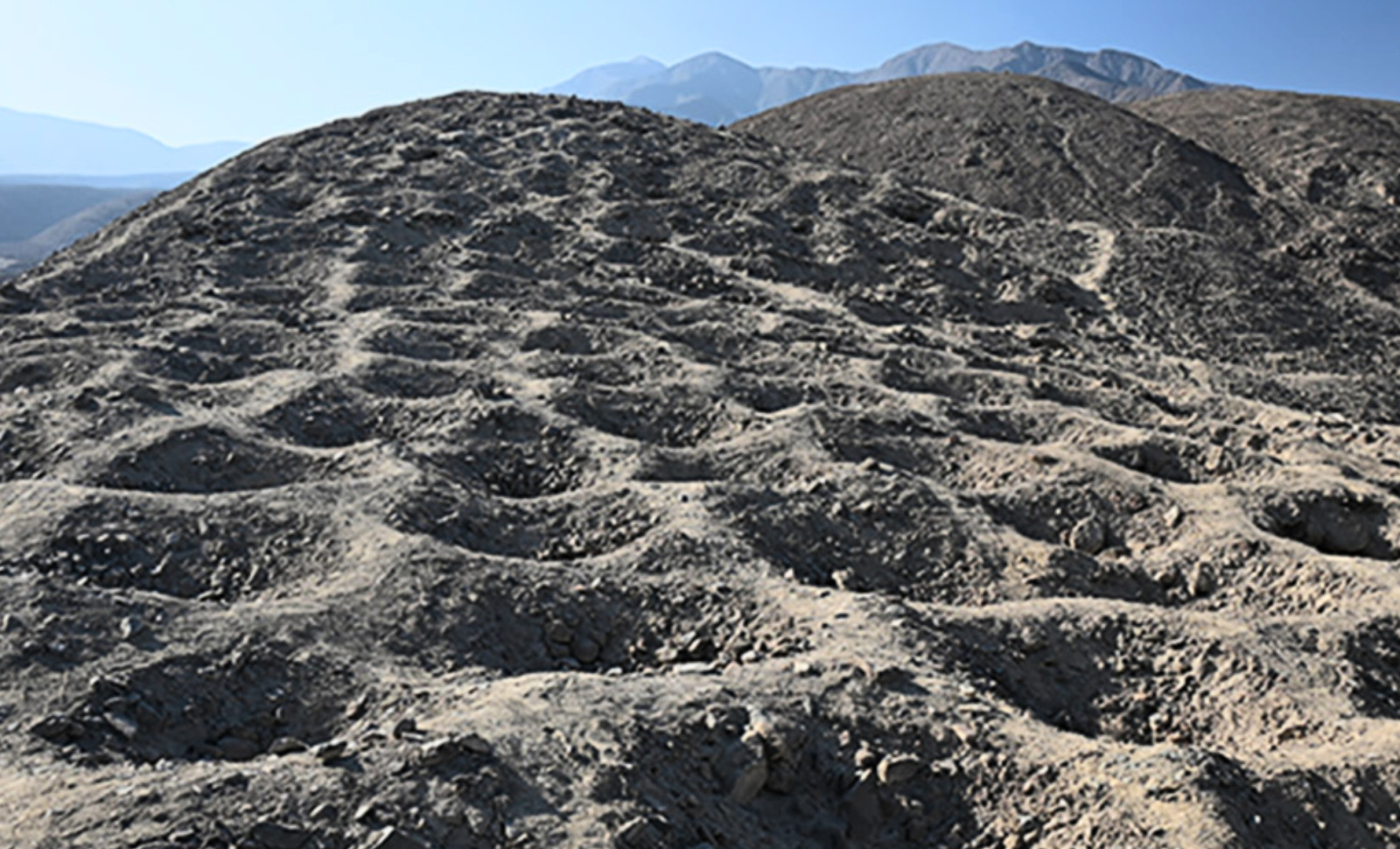
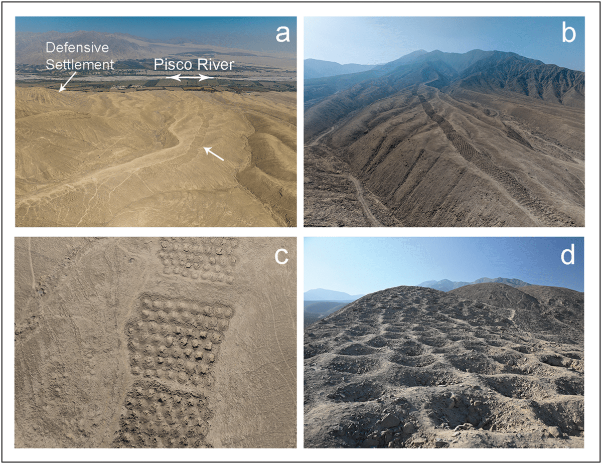
On a stark mountain ridge within Peru’s Pisco Valley, an enigmatic arrangement of pits extends across the terrain. When viewed from above, this pattern resembles a vast serrated ridge etched into the earth. From ground level, it consists of thousands of dug-out holes, each approximately one meter in diameter and depth.
The site, known locally as Monte Sierpe, has been recognized by both inhabitants and researchers for decades, yet its purpose remained elusive. Earlier speculations ranged from defensive fortifications to burial grounds, and even to alien landing markers.
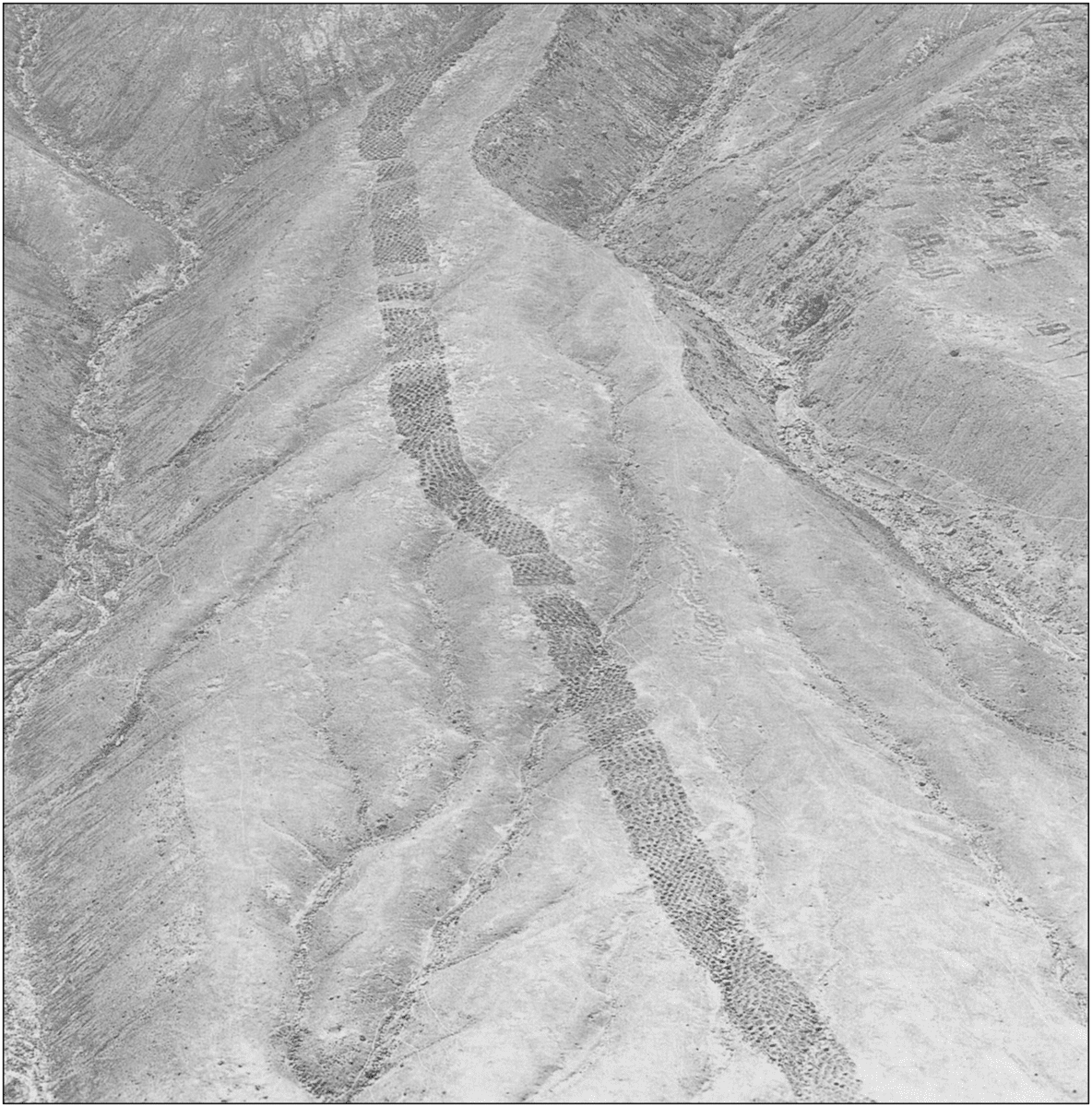
To grasp the enormity of this archaeological feature requires a broad vantage. The site consists of roughly 5,200 pits arranged along a roughly 20-meter-wide band that ascends nearly 1.5 kilometers up the mountain with remarkable precision. The systematic layout implies the involvement of an organized labor force during its construction.

New investigations have shed light on the function behind this impressive feat. A collaborative study led by Charles Stanish from the University of South Florida and Henry Tantaleán of the Universidad Nacional Mayor de San Marcos offers strong evidence that the site functioned neither as a cemetery nor fortification. Instead, it was an expansive accounting mechanism implemented by the Inca Empire.
An Ancient Mechanism for Tracking Tribute
Employing drone technology, researchers mapped the excavation patterns in detail, revealing that the pits were grouped into distinct sections, each with varying numbers of holes. These groupings correspond to the resource and labor management practices of the Inca civilization.
During its peak from the early 1400s until the Spanish conquest in 1532, the Inca society operated without a currency system. Instead, they used the mit’a labor system, where tributary obligations involved providing goods or services such as farming produce, textiles, or manual labor.
While the Inca famously used the quipu—a system of knotted cords for record-keeping—the Monte Sierpe site appears to have functioned as a monumental, open-air ledger visible to multiple observers. This allowed the empire to monitor and validate the amount of tribute arriving at the valley from various regions.
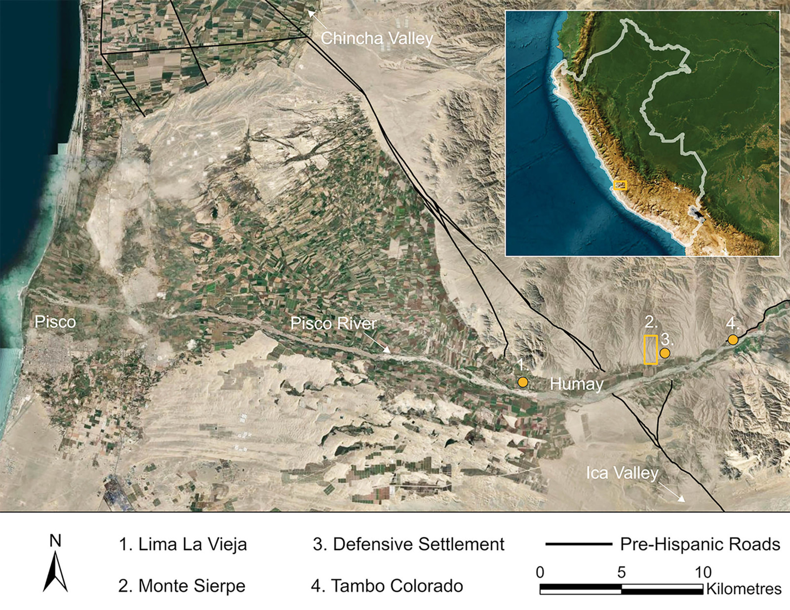
Prime Placement Adjacent to the Royal Road
Monte Sierpe’s location provides crucial insight. Situated just above major storage facilities and beside the Camino Real, the empire’s principal road, it overlooked vital transit routes for goods, personnel, and military movements. Any caravan traveling through the Pisco Valley would pass under the watchful presence of the Band of Holes.
This position near the storage warehouses enabled officials to utilize the pits as a tangible inventory system. Arriving caravans’ loads of grain, textiles, or other supplies could be quantified by assigning each pit as a representation of standard units like baskets or sacks.
This large-scale accounting system would have been essential in a pre-written language society managing extensive resources. By situating the pits on an incline visible from below, the Inca provided a transparent way for the public to observe and confirm recorded contributions.
Coordinated Effort and Construction Techniques
Creating over 5,000 uniformly shaped pits in hard, mountainous soil demanded meticulous organization reflective of the Incan state’s engineering prowess. Evidence suggests the holes were dug with traditional Incan implements like the chakitaklla, a foot plow designed to break tough ground.
Analyses of soil samples and carbon dating from organic material confirm the pits date to the Incan period, supported by cooperation from global institutions, including the University of Sydney.
This study also discounted earlier claims that the site was a burial area. While some human bones have surfaced nearby, the pits themselves contain no skeletal remains or funerary objects, reinforcing their practical, administrative function.
The Inca Empire’s Administrative Genius
The findings at Monte Sierpe highlight the advanced bureaucratic capabilities of the Inca. Governing a vast territory stretching nearly 4,000 kilometers of the Andes demanded precise record-keeping beyond military might.
Although the quipu is the best-known Incan data tool, Monte Sierpe illustrates a complementary, large-scale accounting system. These earthworks served as a physical means for inventory verification and resource tracking, reflecting the complexities of managing wealth in a society without money.
Today, the Band of Holes endures as a striking landmark in Peru’s arid landscape, symbolizing the intricate social and economic networks that flourished long before European contact.
- Categories:
- Science


0 comments
Sign in to Comment