
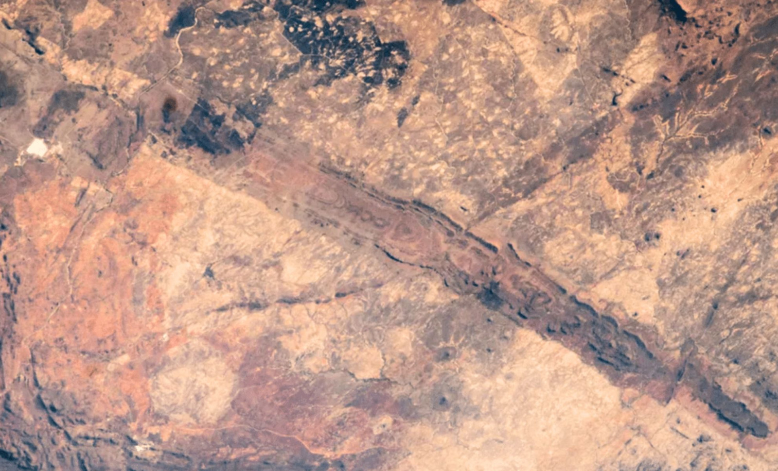
From the vantage point of space, a strikingly straight, dark band slices through central Zimbabwe. This feature is known as the Great Dyke of Zimbabwe, an igneous rock formation dating back approximately 2.5 billion years. Stretching for hundreds of miles, it contains some of the region’s most valuable metal-rich minerals.
Visible from orbit, this lengthy geological feature runs diagonally from northeast to southwest across Zimbabwe’s terrain. Astronauts aboard the International Space Station photographed the formation on September 30, 2010. Later, the NASA Earth Observatory highlighted the image as a compelling perspective of one of southern Africa’s most iconic ancient rock structures.
An Ancient Igneous Monolith Extending 342 Miles
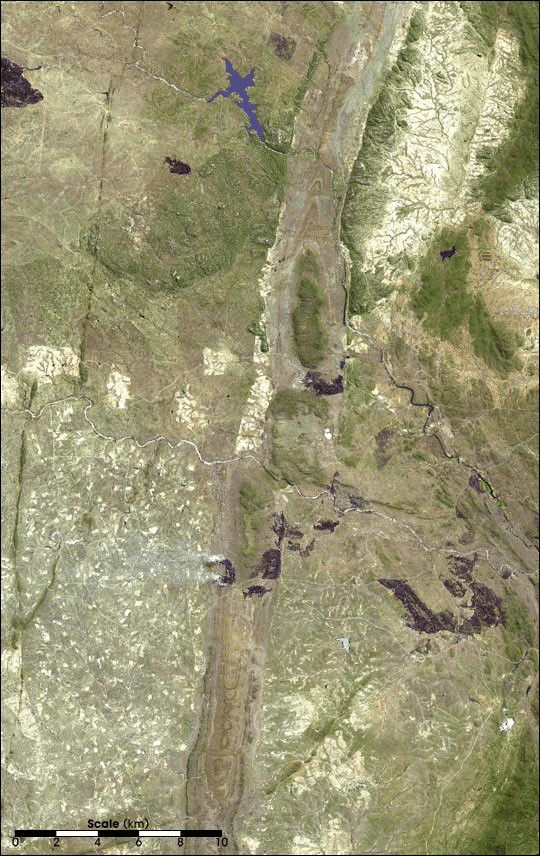
Spanning over 550 kilometers (about 342 miles), the Great Dyke is a narrow but prominent geological feature across Zimbabwe, typically between 3 and 12 kilometers wide. Its elongated shape makes it distinctly visible in satellite and orbital images.

Originally formed far beneath the Earth’s surface, this formation emerged when molten magma intruded into preexisting rock layers and solidified. NASA classifies it as a layered mafic intrusion, meaning a dark, iron- and magnesium-rich igneous rock that developed in layers underground before being uncovered through erosion over billions of years.
This remarkable dyke cuts across the older rocks of the African craton, the ancient, stable foundation beneath much of the continent. Its cross-section resembles a triangular or keel shape, indicative of magma rising through fractures while the Earth’s crust was extending.
Insight from the Astronaut Photo
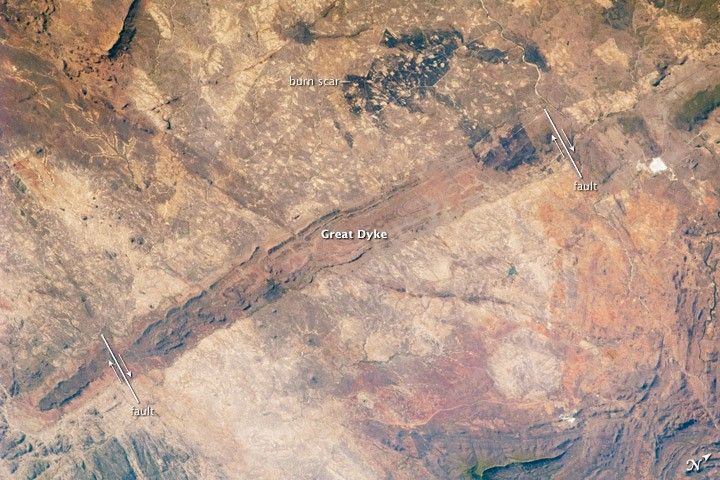
The NASA shot zooms in on the southern segment of the Great Dyke, presenting it as a clear, dark stripe contrasted against the surrounding landscape. Its distinct color and form make it easy to pick out from orbit.
Captured by Expedition 25 astronauts with a Nikon D2Xs camera paired with a 180 mm lens, the image was later enhanced and cropped by NASA Earth Observatory. Adjustments removed lens distortion to sharpen visibility of the terrain's features.
This single frame captures Earth's multi-era story: two large burn scars are visible near the image’s center-top, while younger fault lines disrupt sections of the dyke. Together, these elements showcase ancient geology, tectonic activity, and recent surface changes coexisting in one view.
Why the Great Dyke Is a Mineral Treasure Trove
Layered mafic intrusions are critically important for geologists and mining industries because they create zones where valuable metals accumulate. As molten rock cools, mineral separation occurs, causing specific metals to concentrate within stratified layers.
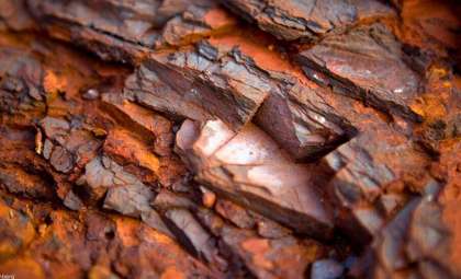
The Great Dyke houses a range of metals such as chromium, nickel, copper, platinum, titanium, iron, vanadium, and tin. Among them, chromium found in chromite and platinum are especially abundant and economically significant.
This mineral wealth has made the Great Dyke more than a geological curiosity — it’s a prime resource hub that has attracted extensive mining, particularly targeting chromite and platinum deposits.
Dynamic Transformations Across Geologic Time
Although the Great Dyke initially formed as a continuous magma intrusion, it has since been altered by geological processes. Faults visible in NASA’s image (marked with arrows) reveal younger movements that have displaced segments of the structure, highlighting changes it endured after solidification.
These tectonic motions explain why the Great Dyke is no longer a perfectly intact line of rock. Instead, it reveals a history of fracturing, offsetting, and erosion spanning billions of years.
Seen from space, the Great Dyke transforms deep geological time into a visible imprint on Earth’s surface: a 2.5-billion-year-old igneous formation traversing Zimbabwe for over 550 kilometers, rich in chromium-laden chromite and platinum, and shaped by fire, faulting, and erosion.
- Categories:
- Science









0 comments
Sign in to Comment