
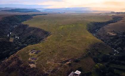
Researchers have uncovered an enormous fortress dating back 3,000 years nestled in the remote highlands of the South Caucasus. This archaeological marvel was revealed through drone technology that captured nearly 11,000 aerial images, assembled into detailed topographic representations. The findings, published in Antiquity, are transforming our understanding of settlement organization during the Late Bronze Age and Early Iron Age.
Drone Imaging Reveals Hidden Extent Beyond Initial Surveys
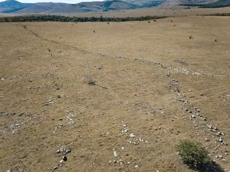
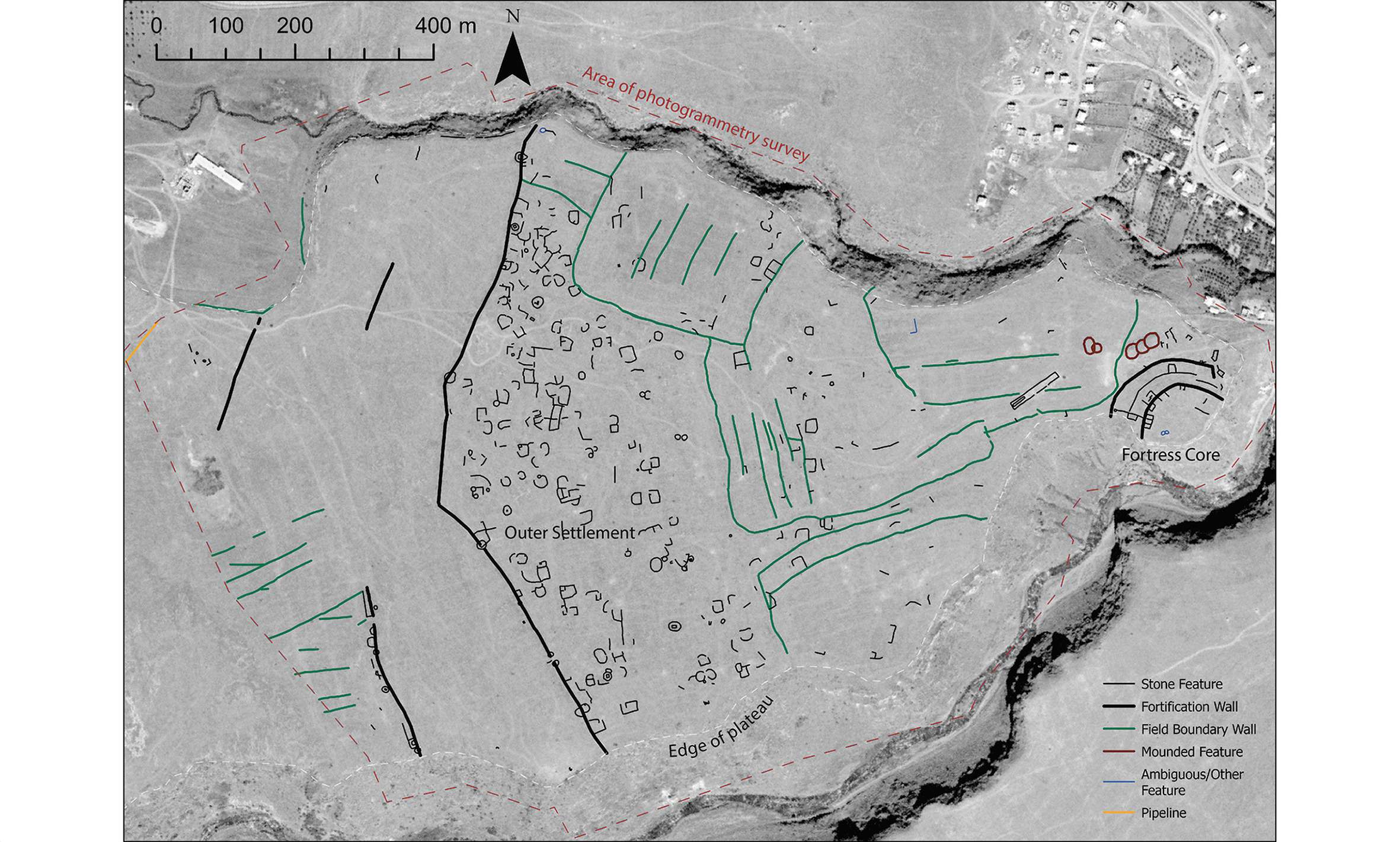
During initial on-site investigations in 2018, archaeologists underestimated the complexity and scale of the site, only detecting scattered remains. However, extensive drone surveys generated thousands of overlapping photographs, which were processed into digital elevation maps and highly accurate orthophotographs that captured every stone wall and burial from an aerial viewpoint.
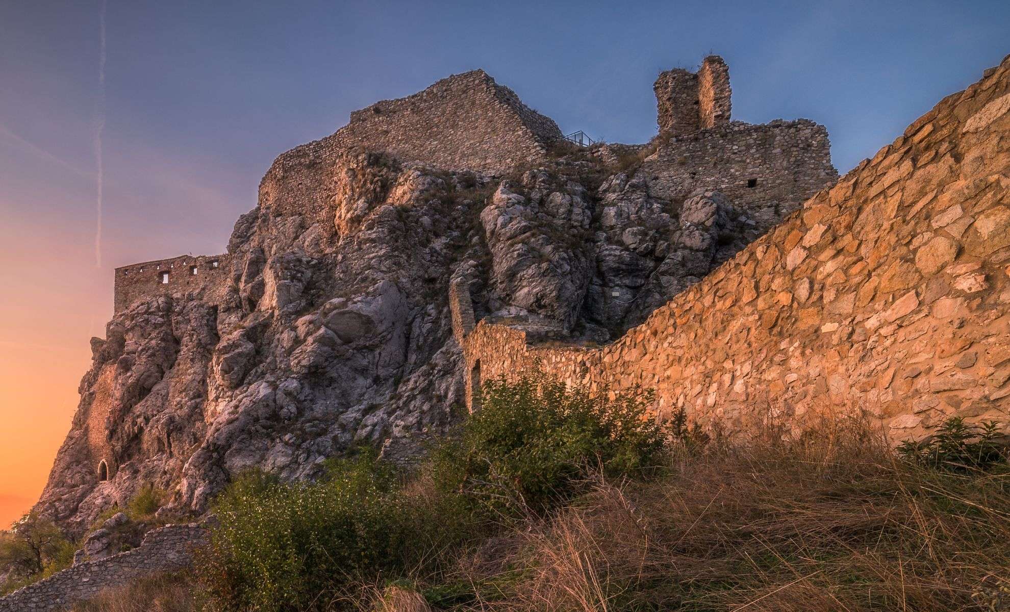
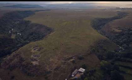
The fortress proved to be more than 40 times larger than first estimated. Positioned on a natural ridge flanked by two deep ravines, the complex features both inner and outer defensive walls alongside the footprints of various stone structures. The outer rampart extends for over half a mile, enclosing one of the largest ancient fortifications documented in this geographical area.

An Ancient Defensive Complex Rediscovered
Located at a strategic junction between Europe and Asia, this fortress likely functioned as a significant center of activity. Its inner and outer walls, approximately six feet thick, consist of rough-hewn boulders bonded with mortar, providing formidable protection.
Evidence suggests both defensive zones were occupied simultaneously. Interestingly, the expansive outer enclosure yielded fewer material remains, suggesting it might have served seasonal inhabitants—perhaps groups leading livestock who visited certain times annually.
Drone surveys also revealed intricate remains of agricultural terraces, burial grounds, and subtle traces of past human activity that would have been difficult to detect from the ground level.
Cold War Spy Satellites Illuminate Landscape Changes
To better understand temporal changes, researchers consulted unexpected Cold War-era spy satellite images, declassified in 2013. These historic aerial photographs offered a unique lens to examine alterations in the settlement’s terrain and structural layout over the decades.
Integrating these vintage satellite photos with modern drone data created a comprehensive picture of the site's development, demonstrating how combining old and new technologies is revolutionizing archaeological research.
“The use of drones has allowed us to understand the significance of the site and document it in a way that simply wouldn’t be possible on the ground,” said Nathaniel Erb-Satullo, a senior lecturer in architectural science at the Cranfield Forensic Institute.
Thousands of Artifacts Await Excavation
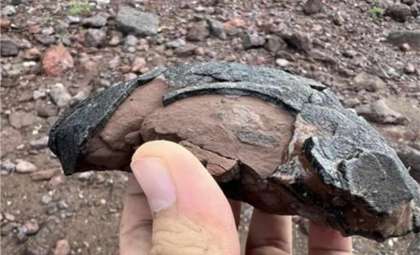
The Dmanisis Gora site remains in the early phase of excavation, with expectations to uncover tens of thousands of objects, such as ceramic fragments, animal remains, and other artifacts reflecting ancient daily routines. These discoveries will provide insight into agricultural practices, herd movements, and demographic organization.
Researchers aim to decipher whether this expansive settlement originated from coordinated urban planning or evolved through the gradual amalgamation of smaller communities. Its impressive scale and intricacy “introduce new perspectives on population clustering in Eurasia and beyond.”
- Categories:
- News


0 comments
Sign in to Comment