
Researchers have detected a new category of gamma-ray emission originating from storm clouds, offering fresh perspectives on the intricate dynamics of thunderstorms. Utilizing cutting-edge sensors aboard NASA aircraft, the team captured bursts of gamma radiation emitted by tropical storm systems, enhancing our understanding of these high-energy atmospheric events.
Discovery of Unique Gamma-ray Emission Types
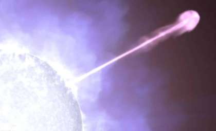
Gamma rays, the most energetic type of electromagnetic radiation, are usually linked to powerful cosmic occurrences such as supernovae and the environments around black holes. Since the 1990s, however, scientists have found that Earth’s atmosphere itself produces gamma rays during certain weather events. In particular, terrestrial gamma-ray flashes (TGFs)—intense and brief radiation bursts lasting only microseconds—have been observed in association with lightning. Until now, the diversity of gamma-ray emissions from storm clouds remained poorly understood.
NASA’s latest research has revealed an intermediate form of gamma-ray emission dubbed “flickering gamma-ray flashes,” which persist for 50 to 200 milliseconds. This duration is longer than typical TGFs but shorter than the steady gamma-ray glows detected previously. Physicist Martino Marisaldi highlighted the challenge of observing these signals remotely: “They’re almost impossible to detect from space, but when you are flying at 20 kilometers [12.5 miles] high, you’re so close that you will see them.”

These flickering flashes provide unprecedented insight into storm cloud behavior, unavailable via earlier measurement techniques. Their detection promises to deepen our comprehension of how thunderstorms generate radiation, especially concerning lightning initiation. As physicist Joseph Dwyer from the University of New Hampshire stated, “They’re telling us something about how thunderstorms work, which is really important because thunderstorms produce lightning that hurts and kills a lot of people.”
High-Altitude Flights Reveal Extensive Gamma-ray Activity
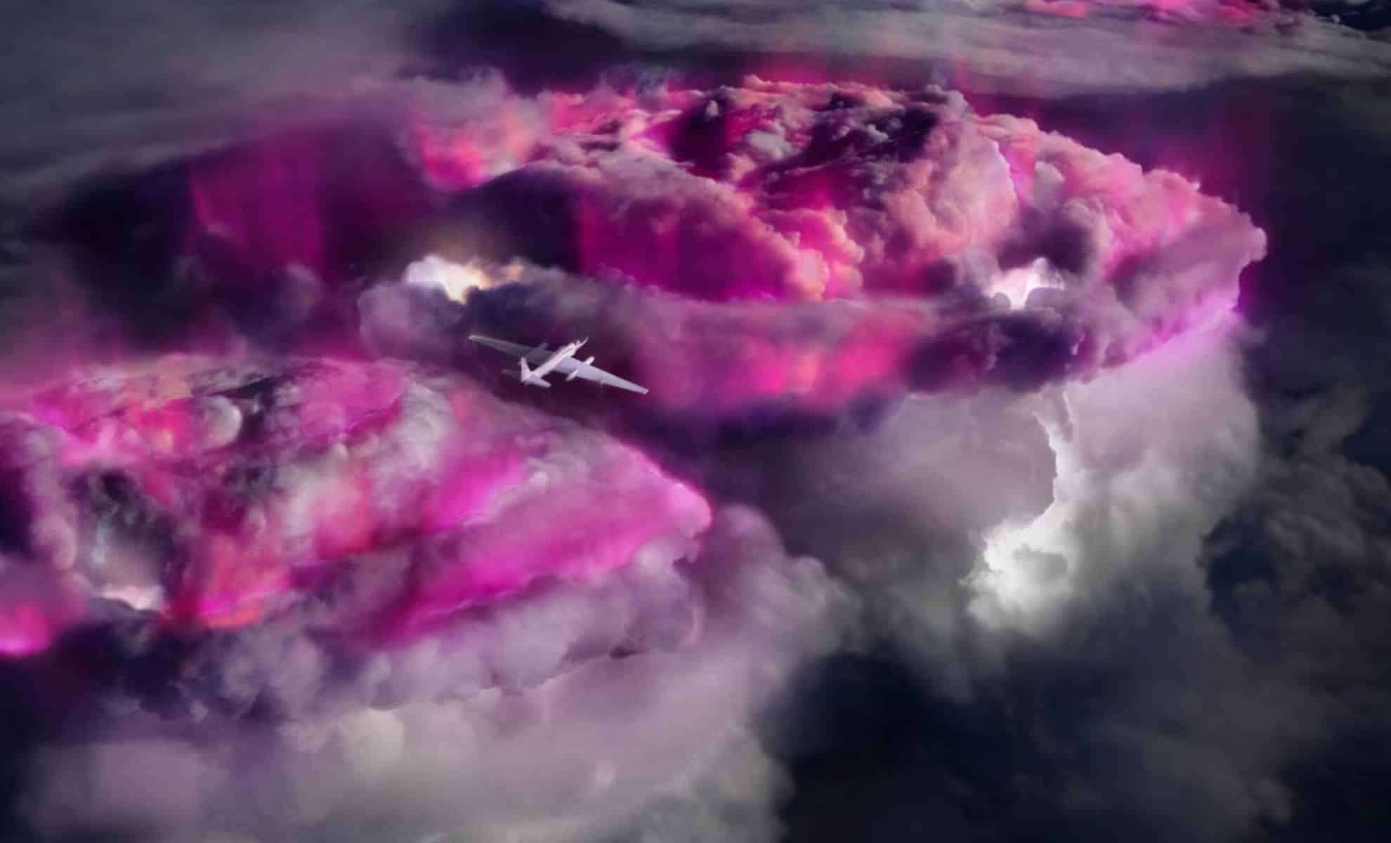
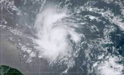
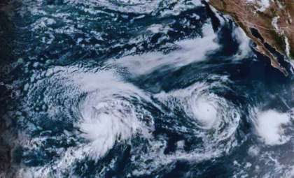
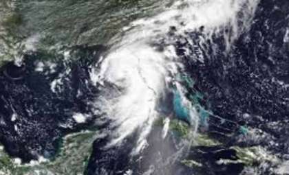
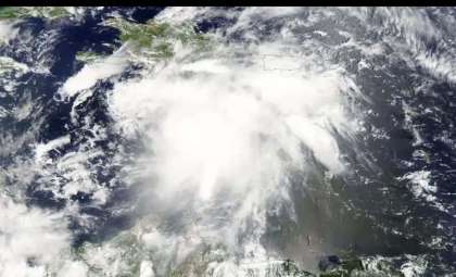
This advancement stemmed from NASA’s ALOFT (Airborne Lightning Observatory for Fly’s Eye Geostationary Lightning Mapper Simulator and Terrestrial Gamma-ray Flashes) project, which deployed the ER-2 High-Altitude Aircraft. This specialized plane, a modified U2 spy plane, operated at an altitude of 20 kilometers (12.5 miles), allowing close-range observations just above thundercloud tops. During 10 flights throughout July 2023, the ER-2 surveyed storms over the Caribbean and Central America, collecting a trove of data on gamma-ray emissions.
While expecting only a few terrestrial gamma-ray flashes, the mission recorded over 130 such events—surpassing all predictions. Lead researcher Nikolai Østgaard from the University of Bergen recalled, “I went to a meeting just before the ALOFT campaign. And they asked me: ‘How many TGFs are you going to see?’ I said: ‘Either we’ll see zero, or we’ll see a lot.’ And then we happened to see 130.”
This wealth of data, coupled with the identification of flickering gamma-ray flashes, represents a major leap forward in decoding the energetic phenomena within thunderstorms. These results challenge prior assumptions regarding the frequency and characteristics of gamma-ray emissions during storms and pave the way for future storm science. As NASA’s project scientist Timothy Lang observed, “If we had gotten one flash, we would have been ecstatic — and we got well over 100.”
Enhancing Our Understanding of Lightning and Storm Behavior
The identification of flickering gamma-ray flashes along with the abundant TGFs observed underscores the complexity of storm electrification. Thunderstorms generate a spectrum of gamma radiation, ranging from rapid bursts to sustained glows. This radiation stems from the intense electric fields inside storm clouds—comparable to stacking 100 million AA batteries—which accelerate electrons to velocities sufficient to trigger nuclear reactions producing gamma rays.
Notably, these flickering bursts may reveal key early-stage lightning processes since they seem to occur independently from visible lightning strikes. Physicist Steve Cummer of Duke University commented, “There is way more going on in thunderstorms than we ever imagined.”
The new knowledge could improve lightning hazard predictions, enhancing safety for aviation, space operations, and populations on the ground. With lightning posing serious risks annually, understanding the genesis of both gamma rays and lightning paves the way for better forecasting and protective strategies.
Distinctive Gamma-ray Characteristics of Tropical Storms
Further analysis illuminated how tropical thunderstorms differ considerably from those in higher latitudes regarding their gamma-ray output. According to lead researcher Martino Marisaldi, the emissions from tropical storms resemble a “boiling pot,” where gamma radiation bursts erupt continuously across the storm rather than remaining static as observed in other cloud types.
Because tropical storms are larger and more intense, the team estimates that over half of such storms produce gamma radiation to varying degrees. This persistent emission might serve as a safety mechanism, releasing energy that could otherwise trigger more extreme events like intense lightning or TGFs.
These findings offer crucial insights into meteorological and atmospheric sciences, expanding understanding of the electrical activity within storm systems and challenging long-held views on storm functioning. They open new research pathways exploring the interaction between radiation, lightning, and storm processes.
Advancing the Frontier in Thunderstorm Research
The identification of flickering gamma-ray flashes combined with comprehensive observations of tropical storms marks a pivotal moment in unraveling thunderstorm physics. These revelations illustrate the profound energy and complexity underlying lightning generation and gamma radiation production.
Ongoing analysis of data from the ALOFT mission, enabled by advanced airborne technology and the unique vantage of the ER-2, promises further breakthroughs. Scientists now have an unparalleled window into storm cloud interiors, unveiling the sophisticated mechanisms driving some of Earth’s most powerful weather events.


0 comments
Sign in to Comment